Curated OER
LA CENERENTOLA (Cinderella)
Learners work in groups to create a map key. The map key represents the diversity of each of the Cinderella stories previously read. They explore the cultural dimensions and contributions of the arts.
Curated OER
Park Brochures
Sixth graders investigate natural environments by researching national parks. In this brochure making instructional activity, 6th graders explore a specific national park and research it's information by utilizing the web. Students...
Curated OER
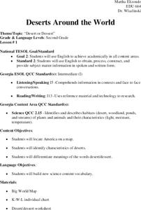
Deserts Around the World
Second graders explore the deserts around the world. They use a map and locate America on the map. Students discuss and identify the characteristics of deserts and differentiate the meanings of the word desert and dessert. Students...
Curated OER
Canada's Landform Regions
High schoolers identify and describe the processes that created the landform regions in Canada. They map the regions and research one region to discover more about it. They present their findings to the class.
Curated OER
Discovering Your Community
Pupils focus on the origins of the families that make up their community by exploring their family's origins through themselves, parents, and grandparents. Students create a map marked with family origins for the class.
Curated OER
Temperature and Daily Life: Mexico City and Indianapolis
Students compare the effect of temperature on daily life of a citizen in Mexico City, Mexico with that of a citizen of Indianapolis, Indiana.
Curated OER
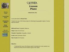
Animals from Afar
Young scholars visualize the scope of the Roman empire by illustrating the geographic origins of various imported animals. They study how exotic animals were imported into Rome from the farthest regions of the empire.
Curated OER
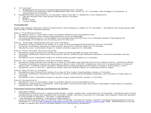
Where Do Canadians Live?
Students investigate Canadian people by researching the geography of the country. In this world geography instructional activity, students identify locations within Canada with large populations based on their access to waterways....
Curated OER
Voyage to the New World
Students examine the exploration of the New World. They write a descriptive account of the first encounter between Europeans and Native Americans, analyze and label maps, plot Columbus's journey on a map, and write a chapter summary.
Curated OER
Women's Rights Historic Sites
Students use maps, readings, floor plans, photos and cartoons to research the conditions of upstate New York in the first half of the 19th century, examine the issues that led to Women's Rights Convention of 1848 and consider current...
Curated OER
A Canadian Inventory: The Way We Are!
Pupils, in groups, explore major thematic sections of the Atlas of Canada. They use their findings to produce a wall display, consider and incorporate the issue of sustainability into their material and deliver a presentation to the class.
Curated OER
Louisiana Parishes
Students research a parish in Louisiana. They research things such as: what makes that parish different from others, major cities, what is the land like there, are there any bodies of water, what is the population, are their any colleges...
Curated OER
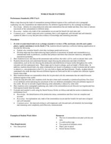
Economics: World Trade Patterns
Students examine world trade patterns and discover the role of commodities in trade. While explaining the benefits of trade, they create maps and flowcharts depicting the patterns of goods and people movement. Also, students write...
Curated OER
Earth's Energy Balance Performance Standard
Students examine how Earth-Sun relationships affect Earth's energy balance and the pattern of world temperatures. Students study a Surface Temperature Regions map and write a paragraph describing the temperature pattern from the Equator...
Curated OER
Who's Range is it?
Students investigate the habits of panthers by analyzing radio transmitted data. In this animal life lesson plan, students utilize computers to view the range of different statistics dealing with Florida panthers. Students complete a...
Curated OER
Executive Branch of the U.S. Government
Fourth graders create a K-W-L chart of what they know about the executive branch of government. They access the Internet to research a specific level of government. They create a PowerPoint presentation with a minimum of eight slides.
Curated OER
The Silk Road, An Ancient Internet
Students examine how goods and ideas moved along an ancient trade route between China and Europe. They make charts of items, ideas, etc. that were transported along the Silk Route.
Curated OER
The Mysteries of El Nino: How Much do We Really Know?
Seventh graders investigate the causes and effects of El Nino and explore its global impact on weather related occurrences through this series of activities.
Curated OER
Developing, Developing, Developed!
Learners differentiate among and explain various levels of economic development around the world. They see that levels of economic development vary greatly in different countries according to many different measures.
Curated OER
Population Density
Students examine world population density and population distribution. They create pie charts showing population distribution and analyze population patterns in the United States and major regions of the world. They identify...
Alabama Learning Exchange
The Sun and the Earth
Third graders study and diagram the positions of the Earth and sun during the four seasons. They predict weather for cities in the northern and southern hemispheres.
Curated OER
Whose Buffalo?
Seventh graders examine how the Plains Indians vied with white commercial buffalo hunters for the millions of Great Plains buffalo. They create an illustrated broadside supporting the interests of either the Indians or the commercial...
Curated OER
Geography of the Study of the Spanish-speaking People of Texas
Young scholars identify the physical features, demographic characteristics, and history of the four Texas towns featured in Russell Lee's photo essay, "The Spanish-Speaking People of Texas." They conduct Internet research, and create a...
Curated OER
Winter Wonderland: Internet Literature Project
Young scholars, using the Internet, communicate with peers around the world about winter-themed books. They study authors, write book reviews, re-write endings, interview book characters, create scene dioramas, paint murals, and write...
Other popular searches
- Maps Skills Thematic Unit
- World Religion Thematic Maps
- Using Thematic Maps
- Map Thematic Unit
- Creating Thematic Maps
- Thematic Map Information
- Geography Thematic Maps
- Reading Thematic Maps
- Use Thematic Map
- Thematic Map Skills


