Curated OER
Avalanche And Landslide Hazards in Canada
Learners explore where the natural disasters, avalanche and landslides, are most frequent in Canada and investigate their associated causes and effects. They navigate the Atlas of Canada Web site for natural hazards.
Curated OER
Canada's Natural Regions and Their Varied Characteristics
Students examine Canada's six natural regions, with all their underlying human and economic activities, identify specific characteristics of each region, discover economic and human riches of natural regions and, create presentations to...
Curated OER
Canada's Landform Regions
Students use a atlas to identify and describe Canada's Landform region. Using the information they collect, they create a thematic map of the region and describe all of the physiographic regions and the processes that formed them. They...
Curated OER
Canada's Geographic Position
Ninth graders investigate the characteristics of the geographic position of Quebec and Canada in the World. They study Canada's land and water boundaries, surface area and time zones.
Curated OER
Canada's Landform Regions
High schoolers identify and describe the processes that created the landform regions in Canada. They map the regions and research one region to discover more about it. They present their findings to the class.
Curated OER
Canada...a Visual Journey
Students, in groups, research Canada's six natural regions (ecozones). They create a visual representation of each region on a large wall map of Canada and present it to the rest of the class.
Curated OER
Canadian Conoe Trip
Sixth graders research Canadian geography - the land and the bodies of water. They then plan an imaginary canoe trip through six major water bodies in Canada. They conclude the unit of study with a creative story.
Curated OER
Canada's Natural Regions and Their Varied Characteristics
Pupils study Canada's six natural regions, including both the human and economic activities of each. In groups, they create a display representing one of the six regions.
Curated OER
Geography: Intro to Canada
Students investigate the geography of Canada by analyzing a map of the country. In this North American geography lesson, students identify the 13 provinces of Canada and their locations by examining a Canadian map. Students may use...
Curated OER
A Canadian Inventory: The Way We Are!
Pupils, in groups, explore major thematic sections of the Atlas of Canada. They use their findings to produce a wall display, consider and incorporate the issue of sustainability into their material and deliver a presentation to the class.
Curated OER
Some Like it Cold: Canada's Northern Communities
Fifth graders examine cultures close to the arctic circle. In this geography lesson, 5th graders consider the impact of climate on cultural development of arctic communities. Students research a given community and present their findings...
Curated OER
Max Knows Mexicao, United States and Canada
Students utilize their map skills to explore the regions of North America. They explore the physical characteristics and climates of the regions. Students label their map and prepare a presentation of their findings.
Curated OER
Discovering Dinosaurs: Planning your Summer Vacation
Students use the online Atlas of Canada to gather information about places in Canada.
Curated OER
Historical Indian Treaties and Aboriginal Population
Sixth graders navigate an online atlas of Canada and compare the land area of of historical Aboriginal peoples in Manitoba to present-day figures.
Curated OER
Cod Calamity
Learners research the history and aims of sustainable cod fishing in Canada. They read articles, conduct online research, complete worksheets and present their findings to the class. They also complete self and peer evaluations using a...
Curated OER
Treasure of the Tar
Students, using an atlas, locate the region known as the "Tar Sands" in the Central Plains of Canada. They hypothesize about the future economic potential of this natural resource. They create a poster about the Tar Sands industry in...
Curated OER
Understanding Canadian Weather Extremes
Students research and analyze the causes and sources of Canada's extreme weather conditions. They conduct an experiment, complete a worksheet and predict the most likely locations for extreme weather conditions.
Curated OER
Polar Day: Canada's Arctic Barometer
Students study Polar Day. For this climate change lesson, students use specific Internet sources to complete a webquest regarding Canada's Northern Region and how it acts a barometer.
Curated OER
Historical Research on Explorers of Canada
Eighth graders navigate an online Atlas of Canada to research an explorer. They examine the areas that were explored.
Curated OER
Historical Research on Explorers of Canada
Eighth graders study an online atlas of Canada to research an early explorer.
Curated OER
Exploring Canadian Cities - a Day To Remember
Students research information on the geographical features, climate, and cultural activities of a Canadian city. They plan a day in the city with a schedule of activities. They synthesize information and create a large poster about the...
Curated OER
Names and Places
Students explore where jobs are done. In this careers and geography lesson, students locate places in Canada on a map and list jobs that are done in their area of Canada. Lesson includes extension and differentiation ideas.
Curated OER
The Rivers and Lakes of Alberta
Students are introduced to the online Atlas of Canada and they identify the lakes and major rivers of Alberta.
Curated OER
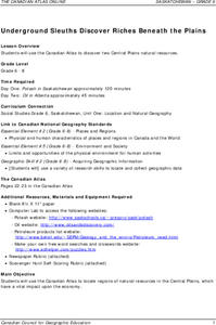
Underground Sleuths Discover Riches Beneath the Plains
Students identify Alberta, Saskatchewan, and Manitoba on map, and use Canadian Atlas to locate regions of natural resources in Central Plains, which have vital impact upon the economy. Students then complete scavenger hunt worksheet.


