Curated OER
The Great Military: Map of Texas
The battle at the Alamo may be one of the most famous military campaigns in Texas history, but it is by no means the only one. As part of their study of the military history of Texas, class members research less-well-known sites, locate...
Curated OER
Texas Commemorative Maps: Honoring Our Past
To celebrate Texas, groups plan and create a commemorative map for a topic or theme in Texas history. The richly detailed plan and the approach could easily be adapted to any state. Samples are included.
Curated OER
Tools of the Trade: The Use of Geographic Tools
Students examine the tools of demographic analysis and apply them to real-world situations. They analyze maps, define terminology, and write an information paper for the appropriate government agency to recommend an action or policy change.
Curated OER
Mapping Your Community
Students define the boundaries of their community by comparing the community's official boundaries with other historical, political, physical, and perceived boundaries of the area and create a community map.
Curated OER
The Landscape of a Novel
Students, after reading a novel, utilize geographic skills to map out the places described in the novel. They collect data, envision spatial features and then design a map to work off of to complete their assignment. Each student also...
University of Wisconsin
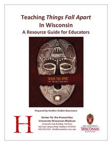
Teaching Things Fall Apart in Wisconsin: A Resource Guide for Educators
“There is no story that is not true, . . .” And uncovering the truths in Things Fall Apart is the focus of a 68-page resource packet designed to provide instructors with a wealth of materials that enhance understanding of Chinua Achebe’s...
Curated OER
African Safari Adventure
Students conduct Internet research on the different safaris available. They locate and label safari sites on the continent of Africa. They create a PowerPoint presentation for the class to persuade the class why they should vote for...
Curated OER
LA CENERENTOLA (Cinderella)
Learners work in groups to create a map key. The map key represents the diversity of each of the Cinderella stories previously read. They explore the cultural dimensions and contributions of the arts.
Curated OER
Interactive Atlas
Second graders examine the different ways people move from place to place in a neighborhood. Using the interactive online atlas MapQuest, they identify the various ways people move around their own neighborhood by creating a map and...
Curated OER
Discovering Your Community
Pupils focus on the origins of the families that make up their community by exploring their family's origins through themselves, parents, and grandparents. Students create a map marked with family origins for the class.
Curated OER
Winter Wonderland: Internet Literature Project
Young scholars, using the Internet, communicate with peers around the world about winter-themed books. They study authors, write book reviews, re-write endings, interview book characters, create scene dioramas, paint murals, and write...
Curated OER
Geography: African Floor Maps
Students explore the African continent and identify the various countries there. They examine the history, geography, environment, and inhabitants of the countries. Students create maps of Africa using a variety of materials.
Curated OER
Wow! You're Eating Geography
Learners examine patterns of food producing areas, and identify foods that are grown locally, in the U.S., and around the world. They map and graph the major food crops of their local area, the U.S., and other countries, and discuss the...
Curated OER
Canada's Landform Regions
High schoolers use a atlas to identify and describe Canada's Landform region. Using the information they collect, they create a thematic map of the region and describe all of the physiographic regions and the processes that formed them....
Population Connection
The Human-Made Landscape
Agriculture, deforestation, and urbanization. How have human's changed the planet and how might we mitigate the effects of human activity on the planet? To answer these questions class members research the changes in human land use from...
Curated OER
A Visit to China
Sixth graders study the history of China. They explore the Chinese people, the Great Wall of China, religions, government and Dynasties. In groups, 6th graders collect information on China. They write a report on their findings and...
Curated OER
Tallahassee Project
Sixth graders gather information from technological sources such as TV, radio, and Internet as well as from newspapers and maps and produce a final printed report. They use the data to create a spreadsheet and read a Florida state...
Curated OER
Population Density
Students examine world population density and population distribution. They create pie charts showing population distribution and analyze population patterns in the United States and major regions of the world. They identify...
Curated OER
Geography of the Study of the Spanish-speaking People of Texas
Young scholars identify the physical features, demographic characteristics, and history of the four Texas towns featured in Russell Lee's photo essay, "The Spanish-Speaking People of Texas." They conduct Internet research, and create a...
Curated OER
Executive Branch of the U.S. Government
Fourth graders create a K-W-L chart of what they know about the executive branch of government. They access the Internet to research a specific level of government. They create a PowerPoint presentation with a minimum of eight slides.
Curated OER
Beary O'Mometer Learns About Careers In Meteorology
Students explore the field of meteorology. In this meteorology lesson, students explore weather-related careers as they research the field of study as well as various weather concepts. Students interview meteorologists, write business...
Curated OER
Mapping Lab and Lead Poisoning
High schoolers are introduced to GIS and its uses. They make predictions before viewing the actual lead poisoning cases by location of Dade County. Pupils use actual Miami-Dade County spatial data to explore basic principals. Students
Curated OER
Whose Buffalo?
Seventh graders examine how the Plains Indians vied with white commercial buffalo hunters for the millions of Great Plains buffalo. They create an illustrated broadside supporting the interests of either the Indians or the commercial...
Curated OER
Park Brochures
Sixth graders investigate natural environments by researching national parks. In this brochure making instructional activity, 6th graders explore a specific national park and research it's information by utilizing the web. Students...


