Curated OER
The Mother Culture of Mexico: The Olmecs
Sixth graders study the Olmec civilization. They develop a map of Mexico and a map of the area of the Olmec civilization. They research Olmec art, religion, and architecture. They construct Olmec symbols including giant heads, altars,...
NOAA
I Can't Breathe!
The Gulf of Mexico dead zone, an area of low oxygen that kills marine life, costs the United States $82 million every year. Young scientists research anoxic ocean environments then come up with a hypothesis for the cause of the Gulf of...
Curated OER
The First North Americans
Students identify and interpret the different North American Indian groups, by region, and the type and impact of their interaction with Europeans.
Then they complete an overview of one main Native American group during the age of...
Curated OER
Max Knows Mexicao, United States and Canada
Students utilize their map skills to explore the regions of North America. They explore the physical characteristics and climates of the regions. Students label their map and prepare a presentation of their findings.
Curated OER
Latin America: Places and Regions
Seventh graders create a Latin American portfolio in the form of a country presentation using PowerPoint software. They use their knowledge of geographic concepts to interpret maps, globes, charts, diagrams, and timelines.
Curated OER
Drought Threatens Huge Man-Made Lake
Students locate Lake Mead, then read a news article about Lake Mead drying up and how that would effect water and power supplies to the region. In this current events lesson, the teacher introduces the article with a map and vocabulary...
Curated OER
East to West: Africa's Influence on Mexico
Your historians and social anthropologists study the relationship between peoples of ancient Africa and ancient Mesoamerica. They relate in written or verbal form the African presence in the ancient Americas. They create their own...
Curated OER
Living Swamps, Bayous and Forests
Third graders explore interesting environments by exploring Louisiana. In this wetland lesson, 3rd graders utilize the web to research the State of Louisiana, the bayous in the area, and the Gulf of Mexico. Students write a journal entry...
Curated OER
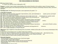
THE MESOAMERICAN MYSTIQUE
Students research, archeology, historical videos, and travel highlights in the northern region of Central America. They identify the various archaeological / historical sites along with a date of probable existence and the title of the...
Curated OER
Esperanza Rising - Anticipation Guide
Learn about Mexican culture while simultaneously strengthening reading, writing and computer skills. In order to get the most out of Esperanza Rising, pupils should have prior knowledge of Mexican culture. Therefore, there are links to a...
Curated OER
Teaching Spanish Heritage in the Context of the Ancient Mediterranean
Students identify and interpret Spanish heritage, including the Mediterranean culture, language, history, trade, and migration. Following, they began an in-depth study of Egypt, the Middle East, Greece, and Rome and were able to make...
Curated OER
World Oil Reserves and Trade Routes
Students analyze the global distribution of natural resources to determine the relationship of resource availability to international problems and issues. They explain how the uneven distribution of resources can result in global...
Curated OER
From Sea to Shining Sea
Students study the geography of the United States of America. Students write letters, create travel brochures, make maps, graph population numbers, read fiction and nonfiction selections, complete KWL charts, and watch films.
Curated OER
Moving West with the Forts: Using an Interactive Map
Students discern a map of Texas and it's forts in the early to mid-1800's. From this map they analyze movement from the moment Texas became a state to its involvement in the Civil War.


