Curated OER
Orienteering: Map Skills
Students use a map to locate six specific landmarks on a course using a map. They identify how maps can help us and write a paragraph describing how to get from one landmark to another on the map.
Curated OER
Going, Going, Ghost
Third graders research ghost towns. In this geography instructional activity, 3rd graders locate ghost towns on a map and choose one location to research. Students construct a research paper and present it to the class.
Curated OER
Map It!
Fourth graders demonstrate map making skills by using the computer to create maps of the geographic features, regions, and economy for their state.
Curated OER
Drake's West Indian Voyage 1588-1589
Middle schoolers investigate several maps detailing Sir Francis Drake's voyages. In this geography lesson, students practice reading maps and locating the precise locations of where Sir Francis Drake visited. Middle schoolers...
Curated OER
How Did This Happen?
Students use websites and discussion to investigate the 2004 Asian Tsunami. Students identify the Indian Ocean coastline's physical, political and human geography features and consider how they affected loss of life and property in those...
Curated OER
Migrating to Texas
Fourth graders explore the migration to Texas from other parts of the United States. Through journal entries they write about the trip as if they were the settlers coming to a new and foreign country. Working in small groups, 4th graders...
Curated OER
Stories That Really Add Up
Students, in groups, develop math lessons for younger students that each stems from a popular student story. Group members individually develop lessons for other subject areas based on their group's story, creating interdisciplinary units.
Curated OER
Chinese Inventions
Students identify inventions as coming from China. In this Chinese inventions lesson, students are given a list of common items such as cast iron, a wheelbarrow, and the decimal system, then conduct research to identify where they were...
Curated OER
Ecotourism in National Parks and Wilderness
Students develop a plan for ecotourism after researching a nearby national park or wild area.
Curated OER
Digital Values: Internet Safety
Students explore digital communication by participating in a critical thinking activity. For this Internet safety lesson, students discuss ways to protect their identity on the Internet as well as preserving friendships. Students...
Curated OER
War in the News
Young scholars consider the portrayal of war in the news. In this lesson on Journalistic perspectives, students will work in groups to critically examine news articles written during war times throughout history.
Curated OER
Map It!
Fourth graders collect and explore different maps and their uses before using the program Pixie to create maps of geographic features, political features, and economic information for the state in which they live.
Curated OER
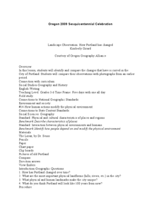
Landscape Observation: How Portland Has Changed
Students read The Lorax and discuss how populations change the environment. Using given photos, students use a Venn Diagram to compare and contrast the Portland of yesterday to present day Portland. They write a comparison paper and...
Curated OER
Our State Road Trip
Students take a virtual tour of the country of China instead of a state. Using the Internet, they examine the differences between a political and physical map and use latitude and longitude to locate specific places. They also research...


