Curated OER
Latitude and Longitude
Students find latitude and longitude on a map or atlas. They create maps with a cruise route. They practice plotting locations given latitiude and longitude.
K12 Reader
Where On Earth Are You?
What do we use to determine the exact locations on the earth? Your kids can learn all about compass roses and latitude and longitude. Test understanding with the five reading comprehension questions included on the page.
Curated OER
Walking on Maps
Students are introduced to the various types of maps and their functions. As a class, they play a game similar to twister to review map concepts. They answer questions about the map and use the internet to view larger maps of the world.
K12 Reader
Absolute Location
Where in the world are we? As a reading comprehension exercise, kids read a short passage about navigation using latitude and longitude, and then respond to a series of questions based on the article.
Curated OER
Maps: Latitude and Longitude
Students visit interactive sites focusing on latitude and longitude. They participate in activities about the prime meridian, time zones, and equator. They view the coordinates of states and cities.
Science Matters
Ring of Fire
Over a period of 35 years, earthquakes and volcanoes combined only accounted for 1.5 percent of the deaths from natural disasters in the United States. The 15th lesson in a 20-part series connects the locations of earthquakes and...
Curated OER
Map Coordinate Bingo
Students play a bingo-type game to locate cities by coordinates. They explain the use of orientation on a map and identify cities in the western hemisphere. They compare road maps, shutttle images, and a CIR image and obtain an...
Curated OER
Latitude on World Maps
Sixth graders examine the purposes of maps. For this Geography lesson, 6th graders practice using latitude and longitude on a map.
Curated OER
Finding Longitude and Latitude on Pennsylvania Maps
Students draw the lines of longitude and latitude on a map. Students look at a topographical maps to see how topography relates to land use.
Curated OER
The Global Grid System-World Map Activity
Students demonstrate how to use the global grid system. In this map skills activity, students use a world map to locate various locations. Students identify locations based on the global grid system. Students complete a worksheet as an...
Curated OER
Can You Find Me Now?
Students locate points using longitude and latitude coordinates. They locate their home using longitude and latitude, explore the uses of GPS, and accurately use a GPS.
Curated OER
Earth Matters
Students identify Earth's equator, prime meridian, lines of latitude, lines of longitude, parallels, and meridians.
Curated OER
It's Happening, Where? Find the Absolute and Relative Location of News Articles
Students read newspaper articles. For this social studies lesson, students locate the latitude and longitude of the location where the news article takes place. Students write a summary of the news article.
Curated OER
Post Roads
Students locate the major cities in the colonies during the Revolutionary War. For this map skills lesson, students use a globe to locate cities such as Charleston and Boston using latitude and longitude coordinates.
Curated OER
Civil War Naval Strategy
Students apply critical thinking skills to war strategy. In this Civil War map lesson, students use their knowledge of latitude and longitude as well as scale to respond to questions regarding Civil War battle strategies.
Curated OER
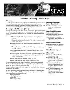
Reading Contour Maps
Students examine contour maps and bathymetry maps and discover how to interpret a contour map of the East Pacific Rise. Students look at a map as a class and answer questions together before working independently on a map of the East...
Curated OER
Of Compasses, Sextants and Chronometers
Students identify longitude and latitude and how they were, and are, determined, and discuss the rudiments of navigation in the eighteenth century.
Curated OER
Principles of Flight: Where are We?
Students explore the concept of topographical maps. For this topographical map lesson, students discuss how airplanes know where to fly. Students use topographical maps to simulate a field trip on the computer.
NOAA
Understanding El Niño Using Data in the Classroom
Are weather troubles caused by El Nino? An installment of a larger series presents a five-part lesson on El Nino. First, scholars learn to read sea surface temperature maps. Then, they compare them to data on graphs before determining if...
Curated OER
Where in The World Am I?
Young scholars explore the concept of absolution location. In this geography skills lesson, students discuss how to identify and locate latitude and longitude. Young scholars play a game to reinforce the skills.
Curated OER
Message in a Bottle
Sixth graders write a short story about being stranded on a deserted island. After a brief geography review of locations at various latitudes and longitudes, 6th graders draft their story about being stranded. They use sensory and...
Curated OER
Globe Skills Lesson 6 The Louisiana Purchase
Middle schoolers explore the Louisiana Purchase territory. In this geography skills lesson, students use map skills in order to plot and note latitude and longitude, measure scale distance, and locate landforms that were part of the...
Curated OER
Globe Skills Lesson 4 The Colonial Period
Students practice their map skills. In this Colonial geography lesson, students complete an activity that requires them to locate English colonial locations using latitude and longitude coordinates.
Curated OER
Globe Skills Lesson 11The Vietnam War
Learners develop their globe and map skills, In this geography lesson, students examine the Vietnam War as they complete an activity that requires them to plot latitude and longitude.
Other popular searches
- Latitude and Longitude Maps
- Maps, Longitude and Latitude
- Longitude & Latitude Maps
- Longitude Latitude Maps
- Maps, Longitude Latitude


