Curated OER
Drake's West Indian Voyage 1588-1589
Middle schoolers investigate several maps detailing Sir Francis Drake's voyages. In this geography lesson, students practice reading maps and locating the precise locations of where Sir Francis Drake visited. Middle schoolers...
Curated OER
Map Readng And Giving Directions
Students read a story to create the context for the lesson plan. Then they are given or create a community map. Then students use the scenario of being lost in order to role play giving directions to a partner to find a destination. The...
Curated OER
Chart Making for Navigators
Students discuss the importance and function of nautical maps for sailors. They, in groups, take soundings of a simulated bay in a shoebox and develop a nautical chart that enable them to navigate the shoebox safely.
Curated OER
An Encounter of Former Foes
Students examine a timeline on the internet showing the relationship between the American Government and the Nez Perce in the 19th Century. After looking at the timeline and included map, students answer questions.
Curated OER
U.S. Geography: The Northeast
Students investigate U.S. Geography by creating a map in class. In this natural resource instructional activity, students create a map of the United States and research the Northeast based on their resources and recyclable...
Curated OER
The Faithful Friend
Learners work in co-op groups to create a Reader's Theater production of the story. Students create a flow map that sequences the major events in the story. Learners research the island of Martinique and create a travel brochure...
Curated OER
Interviews with the American People "Days of Infamy"
Students compare and contrast statements made by people in "Man on the Streets." They are interviewing them on the current war in Iraq and how they felt on Sept. 11th. These interviews are tape recorded. To see what kinds of questions to...
Curated OER
Boston Massacre Trial
Students participate in trial simulation following the Boston Massacre in which they use core map A to help present their evidence and testimony.
Curated OER
Around the World in 5 Days
Learners explore continents, draw map, discuss cultures, use research to learn geography, and investigate cultures.
Curated OER
Romans in Britain, or Classical Colonialism
Students identify the extent of the Roman Empire on a map of Europe and North Africa. They discuss the reasons behind Roman expansion and occupation. They read Cymbeline and write about the attitudes of 3 characters. Groups stage the scene.
Rainforest Alliance
How Do Jaguars and Howler Monkeys in Belize Depend on Us?
How does weather play a role in the lives of land and sea creatures? Find out with a lesson plan focused on habitats and the ways animals from different homes are connected. Here, learners explore how the life of a jaguar and...
Curated OER
Revolutionary Boston
Students annotate core maps to explain either the political or the military situation in the British North American colonies, using Boston as a case study. They explain the British military strategy for suppressing the rebellion in Boston.
Curated OER
A Place Called Nepal
Students investigate maps of Nepal and then create their own to disover how human activity is influenced by terrain and climate. Students participate in a trek across Nepal simulation to imagine the challenges people have to face...
Curated OER
Filling Up Florida
Students study factors controlling Florida's population growth and related environmental impacts. They research natural community types and construct maps (including a large-sized map of Florida) to be used for a simulation activity.
Curated OER
My Neighborhood:
Learners act as tour guides for their communities after conducting research about their neighborhoods. After conducting research, students write stories and create maps of their communities to share with classmates and community members.
Curated OER
Townsite Era
Students learn about the Townsite Era and are able to explore who they were and how they lived at that time. In this Townsite Era students create their own map of the Loma Linda are, design their own community and use a computer...
Curated OER
Exploring Indiana's Natural Resources
Fourth graders complete a variety of activities as they study the European exploration of the Midwest, focusing on Indiana. They map the path explorers took, comparing the British with the French. They research why the explorers stopped...
Curated OER
Shackleton's Antarctic Adventure
Learners research the exploration of Antarctica by the explorer Sir Ernest Shackelton. In this Antarctic exploration lesson, students watch a movie about Sir Ernest Shackelton and his ship the Endurance. Learners study a map of...
Curated OER
Prepare for a Field Trip
Students write a journal exercise that relates to preparing for a trip. They make a visual map to generate ideas about things to see, do and learn during the field trip. They assign roles for different tasks that need to be performed...
Curated OER
Making A New Nation
Eighth graders read standard road maps and topographical maps, and examine the lives of pathfinders who opened the trails to the West. They develop Living History presentations, role-playing a character from the past.
Curated OER
World Geography: Who am I?
Students are able to provide a basic description of one country that has arsenic in its water supply. They are able to locate these countries on a map. Students explore the majors countries that have been affected by arsenic...
Curated OER
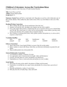
Sarah Plain and Tall
Students read the story, dividing it into chapters per day until complete. They respond to the ad, just as Sarah, Plain and Tall did and use the correct parts of a letter used including a return address, greeting, body, closing and...
Curated OER
Philadelphia and the Constitutional Convention "Heat Up"
Students explore the Constitutional Convention of 1787. In this U.S. Constitution lesson, students role play the parts of delegates in a simulation of the convention.
Curated OER
Introduction to Canada
Ninth graders investigate the country of Canada by examining their media in this geography instructional activity. They use the Internet to research Canadian newspapers and analyze a topic covered by both US and Canadian media sources....


