Curated OER
Geography of Canada
All about Canada! Learners explore the geography and providences of Canada by watching videos, studying maps and conducting internet research. By the end of this lesson, your class should be able to locate major areas and compare and...
Other
Office of the Prime Minister: Capital Scramble
Drag the provinces and territories to their locations on the map of Canada in this interactive game. Then unscramble the letters to identify the capital cities of each of the provinces. A paper pencil version may be printed.
University of Texas at Austin
University of Texas: Perry Castaneda Library: Canada Maps
The University of Texas at Austin provides an extensive collection of maps relating to Canada. Links are given for maps of Canada on many other web sites.
Houghton Mifflin Harcourt
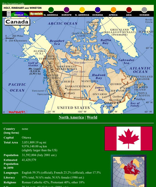
Holt, Rinehart and Winston: World Atlas: Canada
A detailed map showing the provinces and territories of Canada. You can enlarge the details by clicking on any area or name on the map.


