Hi, what do you want to do?
NASA
Landsat 9 At Work
Landsat 9, which NASA is launching in September 2021, will collect the highest quality data ever recorded by a Landsat satellite, while still ensuring that these new measurements can be compared to those taken by previous generations of...
NASA
NASA | Landsat Looks to the Moon
Every full moon, Landsat 8 turns its back on Earth. As the satellite's orbit takes it to the nighttime side of the planet, Landsat 8 pivots to point at the moon. It scans the distant lunar surface multiple times, then flips back around...
NASA
NASA | Landsat's Global Perspective
On July 23rd, 1972, the first Landsat spacecraft launched into orbit. At the time, it was called "Earth Resources Technology Satellite," or ERTS, and was the first satellite to use a scanning spectrophotometer. Previous satellites relied...
NASA
NASA | Landsat: Making a Difference, One User At A Time
The Landsat Data Continuity Mission will continue and improve upon the 40-year-old Landsat program. This video examines two uses of Landsat data to monitor agriculture. Both wineries and timber companies rely on Landsat data to check...
NASA
Landsat 9 Data Available!
The data from Landsat 9 is available for anyone to download. With both Landsat 9 and Landsat 8 in orbit, there will be high-quality, medium-resolution images of Earth’s landscapes and coastal regions every eight days. Landsat 9 was...
NASA
Landsat's Global View of Ice Velocity
Ice from glaciers constantly flows into the ocean, but the speed the ice moves at changes. Landsat 8 provides near-real-time mapping of ice speed in nearly all the world’s frozen regions. Information like ice speed helps scientists study...
NASA
Landsat 9, part 3: More Than Just A Pretty Picture
It’s not enough just to record data with a satellite; you also need to analyze it here on Earth. Episode 3 shows the efforts of the USGS to downlink and archive the five decades of Landsat data we’ve collected, as well as make it...
NASA
NASA | Landsat - From the Archives
The Landsat program is the longest continuous global record of Earth observations from space -- ever. On July 23, 1972 NASA launched the first satellite in this program, then known as ERTS, the Earth Resources Technology Satellite and...
Curated Video
USGS confirms 2 minor earthquakes in Morris County
The U.S. Geological Survey confirms two minor earthquakes early yesterday.
Getty Images
Satellite dishes operate in a field at the USGS in Bozeman, Montana.
Satellite dishes operate in a field at the USGS in Bozeman, Montana.
Curated Video
2 Girls Rescued From Rubble After Turkey Earthquake
The overall death toll in Friday's quake reached 87 on Monday after teams found more bodies amid toppled buildings.
Curated Video
7.5 Magnitude Earthquake Prompts Tsunami Warning For Alaska
The warning was later downgraded and eventually lifted Monday night.
Curated Video
1 Dead In Powerful Mexico Earthquake
The Pacific Tsunami Warning Center later said the threat of potential waves had passed.
US Geological Survey
U.s. Geological Survey: Earthquakes: Great Circles
An animated illustration explains, in simple terms, the concept of measuring distance using great circles around the Earth.
US Geological Survey
U.s. Geological Survey: Earthquakes: Thrust Fault
Quick, full color animation of a thrust fault, or a high-angle reverse fault.
US Geological Survey
U.s. Geological Survey: Earthquakes: Wavefront
A quick animation of the instantaneous boundary between seismic waves inside the earth.
Other
U.s. Geological Survey: Multimedia Gallery: Video: Grizzly Bear Charges Wolf
An exciting scene plays out as a mother grizzly and her two cubs challenge and charge a wolf in competition for food. [4:30]
US Geological Survey
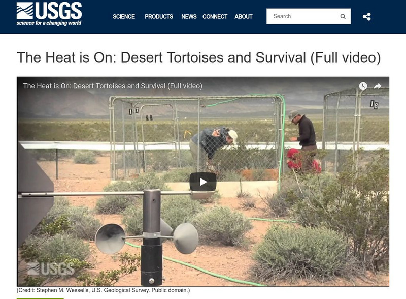
U.s. Geological Survey: Multimedia Gallery: Video: Desert Tortoises and Survival
A four-part series featuring the endangered Mojave Desert Tortoise and investigating the population decline of this species. [0:30]
US Geological Survey
Usgs: Earthquakes: Amplification
An animation of amplification caused by ground shaking across a portion of Earth where viewers will view the difference in soft sediment versus hard rock.
US Geological Survey
U.s. Geological Survey: Earthquakes: Blind Thrust Fault
A quick, animated illustration showing a blind thrust fault that does not rupture all the way up to Earth's surface.
US Geological Survey
U.s. Geological Survey: Earthquakes: Directivity
A quick animation showing directivity, the directional movement of the seismic energy between two stations.
US Geological Survey
U.s. Geological Survey: Earthquakes: Foreshocks, Mainshocks, Aftershocks
Animated illustration shows the top and cross-section views of foreshocks that precede an earthquake, the mainshocks, and the aftershocks that follow the quake.
US Geological Survey
U.s. Geological Survey: Earthquakes: Horst & Graben
Brief animated illustration demonstrating the movement of a horst and graben fault during an earthquake.
US Geological Survey
U.s. Geological Survey: Earthquakes: Normal Fault
Animated illustration demonstrates a normal fault, which is a dip-slip fault where the rock mass above the fault moves down.


