Curated OER
The Growth of the United States
In this westward expansion worksheet, students fill out a graphic organizer of predictions and short answers of how land was acquired in the United States. Students do this for 6 land territories.
Curated OER
The Lewis and Clark Expedition
Students study westward expansion. In this US history lesson, students describe the adventures and hardships faced by the explorers known as Meriwether Lewis and William Clark. Students write a report to the President about the...
Curated OER
Families, holidays, and the United States
In this families, holidays, and the United States learning exercise, students fill in the blanks to sentences about families, holidays, and the United States. Students complete 10 multiple choice questions.
Curated OER
Why is rice important?
Second graders examine why rice is so important to the world. In this agriculture lesson, 2nd graders discover the origins of rice farming. Students study how many countries depend on rice for survival. Students research countries and...
Curated OER
A Comparison of Immigrant Language Policies (Canada and the United States)
Students explore the linguistic backgrounds that have shaped the cultural perspectives of Canada and the United States. In this cultural comparison lesson, students create a class presentation that reflects the similarities and...
Curated OER
The States and Capitals- Part Two
Students complete a activity. In this states lesson, students write the name of each capital beside its respective state.
Curated OER
Democracies in North America: Canada, the United States, and Mexico
Pupils examine democratic values. In this democracy lesson, students research the political systems of Canada, Mexico, and the United States in order to compare and contrast them. Pupils also discuss domestic and international events...
Curated OER
Mapping the United States
In this map of the United States worksheet, students label mountains, surrounding countries, oceans, and more. Students complete 12 tasks.
Curated OER
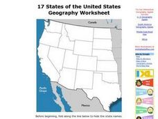
17 states
In this states worksheet, students label states in the United States that are on the west side of the country. Students label 17 states.
Curated OER
Statue of Liberty
Students make their own Statue of Liberty. In this Statue of Liberty lesson plan, students research the symbol of the United States, create a KWL chart for it, and cut and paste their own Statue of Liberty.
Curated OER
The National Motto
Second graders examine the meaning of the national motto, "In God We Trust." In this national motto lesson, 2nd graders explain some of the reasons why people selected the motto for the nation after viewing and discussing a coins and a...
Curated OER
USA States, Capitals Print Worksheet
In this United States worksheet, students read a list of all of the states and their capitals. Students write the abbreviations for each state. Students are given 50 states and 50 capitals.
Curated OER
Memorable Maps
Students draw an assigned map from memory about the United States or any other region they are studying. In this maps lesson plan, students draw a map from their memory at the beginning of the year, and do the same assignment at the end...
Curated OER
General Knowledge Quiz About the USA
In this facts about America worksheet, learners complete a 14 question multiple choice on-line interactive quiz about the U.S.A. Included are historical facts, famous people, and landmarks.
Curated OER
New Mexico
In this New Mexico worksheet, students read a two page text about the history of the state of New Mexico. Students answer ten true and false questions.
Curated OER
Massachusetts
In this Massachusetts activity, students read a two page text about the history of the state of Massachusetts. Students answer 10 true and false questions.
Curated OER
Missouri
In this Missouri worksheet, students read a detailed 2 page history of the state. Students answer ten true and false questions about the passage.
Curated OER
Fifty States
In this 50 states worksheet, students do research to answer 10 questions about the states, their location and special facts.
Curated OER
United States Regions
In this United States political map worksheet, students examine regional census boundaries of the US. State boundaries are also included.
Curated OER
United States Map
In this United States political map worksheet, learners examine national and state boundaries. The map also highlights the location of each of the state capitals and the national capital.
Curated OER
USA Capitals Map
For this United States political map worksheet, students examine state boundaries and locations of each of the state capitals.
Curated OER
States: United States Map
In this United States political map worksheet, students examine state boundaries. The map is labeled with the names of each of the 50 states.
Curated OER
U.S. States - The Midwest States
In this geography and math worksheet, students complete the simple addition equations and match the sums to the colors. Students then color the Midwest States by the color code.
Curated OER
United States Presidents
In this presidential worksheet, students color a picture of a United States President. There are pictures of each president from George Washington through George W. Bush. Each picture takes up one page. The name and dates of service...


