Curated OER
US: Western Region Map
In this U. S. Western Region outline map worksheet, students examine boundaries of each of the states and the placement of the capital cities. This map is not labeled.
Curated OER
Unit 6 Arithmetic: Multiplication of Decimals
In this multiplication of decimals worksheet, students begin by reviewing whole number multiplication skills. They multiply whole numbers by decimals. One problem asks students to determine the decimal placement when numbers with like...
Curated OER
History of Our Solar System Time Line
Ninth graders explore the concept of ratios. In this ratio lesson, 9th graders construct a to scale time line that starts at the beginning of time. Students determine the correct placement of big events in time such as when the dinosaurs...
Curated OER
Thanksgiving Feast
Use the Tool Factory Workshop to have your class create a list of people to invite to their Thanksgiving Feast.They will take pictures related to the fall season and create invitations using Tool Factory Database. Students make a grocery...
Curated OER
Alabama Outline Map
In this Alabama outline map learning exercise, students examine political boundaries of the state and the placement its capital city as well as its major cities. This map is not labeled.
Curated OER
Alaska Outline Map
In this Alaska outline map learning exercise, students examine political boundaries of the state and the placement its capital city as well as its major cities. This map is not labeled.
Curated OER
Arizona Outline Map
In this Arizona outline map instructional activity, students examine political boundaries of the state and the placement its capital city as well as its major cities. This map is not labeled.
Curated OER
Arkansas Outline Map
In this Arkansas outline map worksheet, students examine political boundaries of the state and the placement its capital city as well as its major cities. This map is not labeled.
Curated OER
California Outline Map
In this California outline map worksheet, students examine political boundaries of the state and the placement its capital city as well as its major cities. This map is not labeled.
Curated OER
Colorado Outline Map
In this Colorado outline map worksheet, learners examine political boundaries of the state and the placement its capital city as well as its major cities. This map is not labeled.
Curated OER
Delaware Outline Map
In this Delaware outline map activity, learners examine political boundaries of the state and the placement its capital city as well as its major cities. This map is not labeled.
Curated OER
Florida Outline Map
In this Florida outline map worksheet, students examine political boundaries of the state and the placement its capital city as well as its major cities. This map is not labeled.
Curated OER
Georgia Outline Map
In this Georgia outline map instructional activity, students examine political boundaries of the state and the placement its capital city as well as its major cities. This map is not labeled.
Curated OER
Idaho Outline Map
In this Idaho outline map worksheet, students examine political boundaries of the state and the placement its capital city as well as its major cities. This map is not labeled.
Curated OER
Illinois Outline Map
In this Illinois outline map activity, students examine political boundaries of the state and the placement its capital city as well as its major cities. This map is not labeled.
Curated OER
Indiana Map
In this Indiana outline map activity, students examine political boundaries of the state and the placement its capital city as well as its major cities. This map is not labeled.
Curated OER
Iowa Outline Map
In this Iowa outline map worksheet, students examine political boundaries of the state and the placement its capital city as well as its major cities. This map is not labeled.
Curated OER
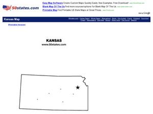
Kansas Outline Map
In this Kansas outline map worksheet, students examine political boundaries of the state and the placement its capital city as well as its major cities. This map is not labeled.
Curated OER
Kentucky Outline Map
In this Kentucky outline map instructional activity, students examine political boundaries of the state and the placement its capital city as well as its major cities. This map is not labeled.
Curated OER
Louisiana Outline Map
In this Louisiana outline map activity, students examine political boundaries of the state and the placement its capital city as well as its major cities. This map is not labeled.
Curated OER
Maryland Outline Map
In this Maryland outline map worksheet, students examine political boundaries of the state and the placement its capital city as well as its major cities. This map is not labeled.
Curated OER
Massachusetts Outline Map
In this Massachusetts outline map worksheet, students examine political boundaries of the state and the placement its capital city as well as its major cities. This map is not labeled.
Curated OER
Michigan Outline Map
In this Michigan outline map worksheet, students examine political boundaries of the state and the placement its capital city as well as its major cities. This map is not labeled.
Curated OER
Missouri Outline Map
In this Missouri outline map worksheet, students examine political boundaries of the state and the placement its capital city as well as its major cities. This map is not labeled.
Other popular searches
- Comma Placement
- Hand Placement
- Product Placement
- Furniture Placement
- Decimal Placement
- Adjective Placement
- Advanced Placement
- Feature Placement
- College Math Placement
- Advanced Placement Physics
- Advanced Placement English
- Adjective/noun Placement


