Curated OER
How Much is There to Eat?
High schoolers examine food production related to population density. In this interdisciplinary lesson, students gather data regarding food production in the American South and in India. High schoolers follow the outlined steps to...
Curated OER
Principles of Flight: Where are We?
Students explore the concept of topographical maps. For this topographical map lesson, students discuss how airplanes know where to fly. Students use topographical maps to simulate a field trip on the computer.
Curated OER
Plotting the Ocean Floor
Fourth graders plot points on a graph, connect the dots to make the ocean floor profile and label the topographical features. They utilize a worksheet and a website imbedded in this plan to plot the ocean floor.
Curated OER
Grid it, Map it
Students participate in designing a city layout using grids and coordinates. They work on a city space and create a grid on a life size layout on the gym floor.
Curated OER
Elevation at its Peak
Students pretend they are hiking up a mountain. They practice making calculations on angles and elevation. They use topographic maps to estimate distances and trigonometric ratio methods.
Curated OER
TE Activity: Choosing a Pyramid Site
Students determine how engineers decide on choices for final designs and sites for construction. They look at a surveyor's report while they evaluate sites where a pyramid could be build. They consider the distance the pyramid would be...
Curated OER
Math 53 - Midterm 1 Review
For this math worksheet, students eliminate the parameter to find a Cartesian equation of the curve given by the parametric equations.
Curated OER
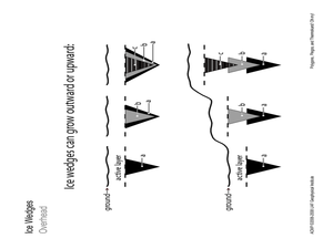
Polygons, Pingos, and Themokarst! Oh MY!
Students complete activities to learn about the common land features in Alaska. In this land study lesson, students study an overhead for permafrost features. Students define ice wedge polygons, thermokarst, and pingos. Students also...
Curated OER
Risk Assessment and Geometry
Tenth graders study the concept of risk analysis as it relates to geometry. In this spatial relationship lesson plan, 10th graders are provided a set of coordinates to analyze a piece of land described. Students write a description that...
Curated OER
Relative Humidity of Your School
Students predict the location where the relative humidity the highest and lowest in and around their school. They use a sling psychrometer to measure the relative humidity of the various locations.
Curated OER
Landfills and the Potential for Groundwater Contamination
Students examine how a sanitary landfill is constructed, how it functions, and how waste and leachate affects the areas around the landfill. After a discussion about landfills and leachates, students construct a Sanitary Landfill Model...
Curated OER
Physics: Visualization of Hydrogen Wave Functions
Students explore various methods for visualizing the results of hydrogen wave function. They observe trends using a polar plot tool and make plots for the first three energy levels of the radial wave function for hydrogen. Students apply...
Other popular searches
- Ocean Topography
- Map Key Topography
- Topography Maps
- Sea Floor Topography
- Contour Map Exercise
- Contour Maps Topography
- Bottom Topography
- Costa Rican Topography
- Aluminum Foil Contour Map
- Topography and Contour Map
- Map Topography
- Contour Map Face


