Curated OER
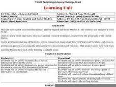
States Research Project
Eighth graders create an in-depth research report on a state. They conduct Internet research, write a comparison essay about New York State and their assigned state, create a 3-dimensional map, and develop a Powerpoint presentation.
Curated OER
Modeling Shadows
Students demonstrate understanding of shadows by creating a physical model of concepts taught.
Curated OER
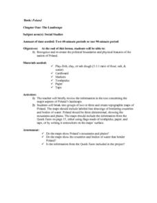
The Landscape of Poland
Students recognize and re-create the political boundaries and physical features of the nation of Poland. They create three dimensional topographic maps of Poland. In addition, they compose two journal entries written in two different...
Curated OER
Design an Island
Young scholars make a map of an imaginary island using the topographic symbols provided from a worksheet. Students place lakes, dwellins, reefs, etc. in areas where they would logically be located from understanding how the topography...
Curated OER
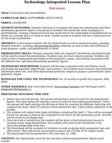
Polygons And Polyhedra
Students recognize and name two-dimensional and three-dimensional geometric figures. One group of students will extend the study of polygons to quadrilaterals while another group of students will extend the study of polygons to...
Curated OER
Houses
Third graders use a number of problem solving strategies in this unit of lessons. They determine how to draw and model three-dimensional objects, use co-ordinate systems, determine probability of events, and identify paths of simple...
Curated OER
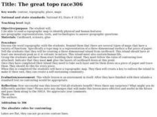
The Great Topo Race
Students create a three dimensional island out of cardboard to examine how to read and use a topographical map. They make sure that their island can sustain life and that it has one volcanic mountain peak. They trace the parts of their...
Curated OER
Building a Trading Post: How to Choose a Site
Students brainstorm what kinds considerations might have to be made when building a trading post. They create an artistic representation of what their trading post would look like (two- or three- dimensional).
Curated OER
Book: Spain
Young scholars, after reading Chapter One in the book, "Spain," design and re-create the political boundaries as well as the physical features of nation of Spain. They utilize play-doh or salt dough to illustrate and create their three...
Curated OER
World Projections
Students identify map projections and examine polar maps. In this map skills lesson, students use a flat world map to identify various projections and calculate the distances between locations by using a map scale.
Curated OER
Pictures of Data
In this data worksheet, students look at maps and charts and answer multiple choice questions about them. Students complete 10 questions.
Curated OER
Flat Earth Society
Students explore map distortion. In this geography instructional activity, students compare Mercator projection maps to globes in order to understand the strengths and weaknesses of projection maps.
Curated OER
Where is Flat Stanley?
Learners create a story map of the basic elements and significant events of the book Flat Stanley. Students brainstorm places they would like to visit if they had been flattened and then, write about an imagined experience. Learners...
Cornell University
Constructing and Visualizing Topographic Profiles
Militaries throughout history have used topography information to plan strategies, yet many pupils today don't understand it. Scholars use Legos and a contour gauge to understand how to construct and visualize topographic profiles. This...
Curated OER
Mapping Deep-Sea Habitat
Students create a two-dimensional topographic map and a 3-D model of landforms. In this creative lesson plan students create 2 and 3-D objects and learn how to interpret the data from these things.
Curated OER
The Solar Neighborhood within 17 Light Years!
In this distance between stars worksheet, students plot the distance between the sun and 11 other stars on a 2 dimensional grid using a protractor and a ruler. They determine the distances between various stars and they find the shortest...
Curated OER
Washington D.C.
Students research monuments in Washington, D.C. In this geography lesson plan, students research one monument and use the Internet to gather information. Students create a three-dimensional model of their monument.
Curated OER
World Continents
Students identify the continents of the world. In groups, students create a three-dimensional clay representation of their assigned continent. Using KidPix software, they draw and color their continent. Students research their continent...
Curated OER
Mapping Seamounts in the Gulf of Alaska
Students describe major topographic features on the Patton Seamount, and interpret two-dimensional topographic data. They create three-dimensional models of landforms from two-dimensional topographic data.
Curated OER
Three D Constellations
Pupils are introduced to both celestial coordinates and to the first rung on the distance determination ladder. They convert spherical coordinates to Cartesian coordinates to construct a three dimensional model of a constellation which...
Curated OER
The Rocks Under Illinois
The goal of this fine geology lesson is to have learners create a map that shows how the rock layers are arranged far underground where they can't be seen. The ambitious lesson plan requires high schoolers to learn the law of...
Curated OER
Down on the Farm
Students are introduced to a map of an Illinois farm. They determine whether the map is of the past, present, or future by looking at features on the map. They also use the map to make a three-dimensional model.
Curated OER
Three Dimensional Geology
Students use rocks and fossils to interpret the geology of an area. They use prior knowledge and make recommendations about where to build a subdivision based on the rocks.
Curated OER
The Landscape
Students recognize and recreate the political boundaries and physical features of the nation of Slovakia. They create topographic maps of Slovakia. The maps should include labeled line drawings of bordering countries. Slovakia should be...
Other popular searches
- Three Dimensional Story Maps
- Three Dimensional Map
- Three Dimensional Physical Map
- Three Dimensional Map


