Curated OER
Utah: State History
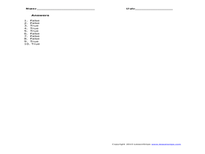
For this Utah state history worksheet, students read two and a half pages of information about Utah and complete 10 true and false questions.
Curated OER
States in the USA Quiz
For this online interactive geography quiz worksheet, students respond to 50 identification questions about the states in the United States of America. Students have 4 minutes to complete the quiz.
Curated OER
United States of America: 1860
In this United States historical map worksheet, students examine the boundaries of the labeled states and territories of the nation in 1860.
Curated OER
United States of America: 1860
In this United States historical map worksheet, students examine the boundaries of the states and territories of the nation in 1860. This map is unlabeled.
Curated OER
Mystery State # 41
Kids use their deductive reasoning skills, state knowledge, and five clues to determine mystery state #41. They'll follow the clues to locate the mystery state on a US map. Note: This is a warm-up activity, so it includes two short...
Curated OER
Name the States Worksheet 4
In this name the states instructional activity, students examine 6 state map outlines and identify each of them by writing the state names and postal abbreviations.
Curated OER
Name the States Worksheet 2
In this name the states worksheet, students examine 6 state map outlines and identify each of them by writing the state names and postal abbreviations.
Curated OER
Name the States Worksheet 1
In this name the states worksheet, learners examine 6 state map outlines and identify each of them by writing the state names and postal abbreviations.
Curated OER
Name the States Worksheet 5
In this name the states worksheet, students examine 6 state map outlines and identify each of them by writing the state names and postal abbreviations.
Curated OER
Blank Map: The United States of America
In this map worksheet, students use the blank outline map of the United States to label the 50 states or for any other study purpose. Each state boundary is shown with no name labels.
Curated OER
Illinois State Map
In this Illinois geography worksheet, students color and label a map of Illinois. Students study the location of the capital and where Illinois is situated in the United States. There is a black line map of the state with a grey US map...
Curated OER
Virginia State Map
In this geography of Virginia worksheet, students color the map and label major cities and physical features. Students also study a second map showing the location of the state of Virginia in the United States.
Curated OER
Georgia State Map
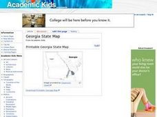
In this geography of Georgia worksheet, students color the map and label major cities and physical features. Students also study a second map showing the location of the state of Georgia in the United States.
Curated OER
Florida State Map
In this geography of Florida learning exercise, students color the map and label major cities and physical features. Students also study a second map showing the location of the state of Florida in the United States.
Curated OER
Midwestern States
In this United States geography worksheet, students study the image of the Midwestern states. Student then label the states with the following choices: Missouri, Iowa, South Dakota, Minnesota, Nebraska, Illinois, North Dakota, Kansas,...
Curated OER
Mystery State #38
In this United States mystery learning exercise, students determine which state is described by the 5 clues listed on the sheet and then mark it on the outline map of the United States.
Curated OER
Blank US Map
In this blank outline map worksheet, students study the physical boundaries of the 50 states that make the United States. This outline map may be used for a variety of geographic activities.
Curated OER
United States Prepositions
In this prepositions worksheet, students use the clues to help them locate the positions of the state according to the prepositions given in each sentence.
Curated OER
States and Capitals - Lesson 4 - U.S. Political Map
In this U.S. state capitals worksheet, students identify the capital cities of the 50 states using the latitude and longitude coordinates provided.
Curated OER
Name The States Worksheet 3
In this states worksheet, students analyze the shape of 5 US states. Students identify each state and write the name of the state and its postal abbreviation.
Curated OER
Angles, Bearings and Maps
In this angles, bearings and maps worksheet, students measure angles and classify, calculate the size of unknown angles, and complete related multiple choice and word problems.
Curated OER
Mystery State #18
In this mystery state instructional activity, students answer five clues to identify the state in question. They then locate that state on a map.
Curated OER
Mystery State #51
For this mystery state worksheet, young scholars answer five clues to identify the state in question. They then locate that state on a map.
Curated OER
United States of America: Name That State!
In this states worksheet, students write the names of all 50 states, matching numbers on a map of the US with their correct state names.


