Curated OER
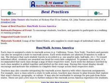
Run/Walk Across America
Walk, jog, or run across America. Maps of individual states, visual progress, competition, and rewards, seem to be great motivational ideas. Make sure that the distances that each class has to walk or run are the same, because getting...
C-SPAN
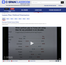
Political Polarization
Dive into the political breach with pupils and explore the reasons for political polarization. Using clips from C-SPAN that include discussions from reporters and scholars, class members consider what is causing the political fault lines...
Curated OER
Metropolitan Areas in the USA
Fifth graders explore why people live in certain regions of the United States. They investigate information on specific metropolitan areas such as temperature, population, natural resources, precipitation and landforms. In groups, 5th...
Curated OER
Using Our Natural Resources Wisely
Middle schoolers understand how ground water can be recycled to maximize its usage and begin to think about ways conservation can help Kansas preserve its natural resources in other areas - soil, minerals, and clean air.
Curated OER
Litter Garden
Young scholars discuss what man-made and natural materials are visible in litter. Using a sample of litter, they review the concept of decomposition between the two types of materials. They examine the two samples once and a while and...
Curated OER
Fish Food for Thought
Students examine the role of the US Environmental Protection Agency and the Federal Clean Water Act of 1970 after reading Lynne Cherry's, A River Ran Wild. They decide if the goals of the act were met and create a fish cartoon that...
Curated OER
Making a Globe
Students examine the mercator projection or nautical chart and observe how global maps do not have the same distance as flat maps. They design handmade globes using the meridians and equator as guides to draw in the land. They paint and...
Curated OER
Asian Studies Unit Korea
Students conduct research about different Asian countries. The research is done in order to compare and contrast the different land areas and cultures. Students complete a writing assessment related to it.
Curated OER
Scrambled States
Students read or are read the story "Scrambled States". Using a map, they identify their states and time zones. They predict their states representation in the book and discuss it after the book is finished. They discvor the differences...
Curated OER
Students Become Mapmakers
Students practice making a map of a continent and correctly plotting five cities on that map. They place latitude and longitude lines on a map, determine the need for various map projections and explain why map scales are necessary.
Curated OER
Moose Traveler
Students collaborate and write a story about a Moose that travels across country. The adventure would take place in their state and each chapter would include information about the state. Other schools across the states could participate...
Curated OER
Write a Harry Potter Script
Examine the technique of writing a script and complete a worksheet in which young writers summarize a favorite chapter in a Harry Potter book. They practice public speaking by acting out the summarization scenes for classmates. Handouts...
Curated OER
Podcasting and the News
Students participate in a class discussion about pod casting. They access a podcast and practice using such features as pause, rewind, and fast-forward. They listen to a news podcast and complete a graphic organizer about what they have...
Curated OER
Map Skills
Do you need to practice map skills? Children with a range of abilities will complete a KWL chart about maps, practice important map vocabulary and then read a few pages from their textbook. They will use their vocabulary words and...
Curated OER
First You Take an Ecumene
Although this was written regarding Canadian agriculture, it can be used in any agriculture or environmental science class. Learners evaluate agricultural and economic activity maps and consider land use competition. Activities that get...
Curated OER
Race and Ethnicity in the United States
Students explore race and ethnicity as it is defined by the U. S. Census Bureau. They compare data from 1900, 1950, and 2000 and identify settlement patterns and changes in population. In groups, they map these changes and discuss...
Curated OER
Circling Ethiopia: A Novel Approach to Introducing a Region
Students read a novel to gain insight into a different region of the world. Using a graphic organizer, they share the information they have already gathered about Ethiopia. They draw an outline map of Africa and read the opening pages of...
Curated OER
Martin Luther King, Jr.: Civil Rights Leader
Students investigate and read about the life and contributions of Martin Luther King, Jr. They listen to a biography and take notes, complete a pictorial story, and complete a writing assignment in response to questions about civil...
Curated OER
Mexico
Third graders become culturally aware of the differences all over the world. They explore a different culture, and recognize and appreciate the similarities and differences with their own.
Curated OER
Mapping India
Students participate in an activity in which they place placards listing geographic features, landmarks, etc. in the correct place on a large fabric map of a given country. They also examine artifacts, photos, sounds/music, etc. from...
Curated OER
Map of Town
Third graders draw a map of the town given different sites to locate on the map by the teacher. They explain that latitude and longitude are used to locate places on maps and globes, identify the distinctive physical and cultural...
Curated OER
Mapping the Middle East
Students examine how the countries of the Middle East were created. They explore the influence of various political and geographic factors in their creation. They list the things they should consider in deciding how to draw new borders...
Curated OER
Around the World Calendar
Students examine world landmarks and monuments. They create a 12 month calendar featuring a significant site for 12 different countries.
