Curated OER
Four Main Directions
Students describe directions using a globe for north, east, south and west. In this mapping lesson plan students identify the north and south pole. Students understand the importance of the equator and the Prime Meridian. Students...
Curated OER
Direction of River Flow
Students determine the direction the river flows. They use a US map with rivers listed, colored pencils and a compass or transparency with directions marked. Students use a color key to determine which direction the river is flowing...
Curated OER
Globe Lesson 4 - The Compass
Learners study compass' and their use in navigation. In this compass lesson, students use a compass and a globe to answer the questions about navigation.
Curated OER
TE Activity: Northward Ho!
Young scholars design a simple compass. They examine how the Earth's magnetic field has both horizontal and vertical components. They determine how a compass works and work with cardinal directions.
Curated OER
Topo Map Mania!
Students read and use topographical maps. They also use a compass to find bearing to an object on a map and in the classroom. Ask your students how they might travel to somewhere they have never been to befo
Curated OER
Google Earth
Young scholars explore cardinal directions and the compass rose using Google Earth. In this cardinal directions and compass rose instructional activity, students use Google Earth to visit Disney World. Young scholars choose which...
Curated OER
Magnetism: What is a Magnetic Field?
Students make a compass. In this magnetism lesson, students use the Internet to research magnetic fields and perform an experiment to find the magnetic fields around different magnets. Students use the Internet to research...
Curated OER
School Sleuths Treasure Map
Students are explained how a grid and compass work. They are also explained that archaeologists use grids as a record of the exact location of artifacts. Students define the term datum as a point of reference on grids from which all...
Curated OER
Magnets
Students explore how the earth is a magnet and that magnets have two "poles". In this magnetic instructional activity students complete an activity by designing their own compass.
Curated OER
Mapping the News
Students explore cartography. In this map skills and map making lesson, Students work in groups to create wall size world maps including legends, compass roses, latitude and longitude, and physical features. Students collect...
Math Mammoth
Construct Line Segments and Angles
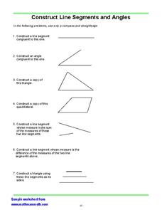
In this math worksheet, learners are asked to used a compass and straight edge to construct copies of shapes, angles and line segments.
Curated OER
North, South, East, and West
A basic lesson on the teaching of the cardinal directions awaits your class. They are directed to go to different parts of the playground and where they attempt to describe their location in relation to each other by using the cardinal...
Curated OER
Reviewing Azimuth
Combine angles and the compass rose in this labelling worksheet. Geographers begin by labeling the cardinal directions on a compass template, along with the degrees corresponding to each. They then add the azimuthal directions, labeling...
Curated OER
Astrolabe Lab
In this astrolabe worksheet, students use a compass rose and an astrolabe to measure altitude and azimuth of five objects in the room and 5 objects outside the room. They answer questions about these two types of measurements.
Math Mammoth
Construct Line Segments and Angles
In this construction instructional activity, students use a compass and a straightedge to construct line segments, angles, and copy polygons. This one-page instructional activity contains 7 constructions.
Curated OER
All About the Animals
Whose footprints are those? After reading Janet Halfmann's book, Little Skink's Tail, young scholars use footprints to determine where on a gridded map certain animals have been spotted. They use the map to answer 3 questions, one...
Curated OER
Compass Rose: Dance and Quilt
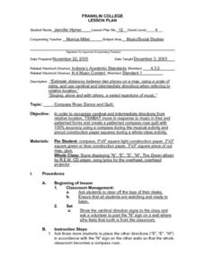
Fourth graders identify the cardinal directions by listening to a song entitled, "Stand," and by reviewing the lyrics to that song. They notice the cardinal directions that are posted around the classroom. They perform the motions as...
Curated OER
Getting to the Point
Students determine location by using the technique of triangulation. They imagine that they are out in the wilderness and have come to the top of a ridge. How can one identify the ridge on the topo map? How can one figure out where you...
Curated OER
Identifying Angles
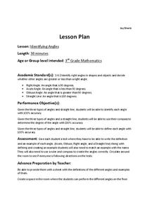
Third graders analyze angles and determine if they are acute, right, or obtuse. In this angles lesson, 3rd graders study the definition and characteristics of each angle. Students then do a worksheet to identify the name of the angle.
Curated OER
Cave Activity: Mapping Fractures
Students tour a cave and observe fractures in the cave's ceiling. They record characteristics of the fracture. They locate three major passages in the cave and ten major fractures.
Curated OER
The Top 5 Ancient Chinese Inventions
In this top five ancient Chinese inventions worksheet, students investigate each Chinese invention in detail along with the top five British inventions of all time. Students then answer five comprehension questions while writing an essay...
Curated OER
Mapping It Out: Social Studies Online
A great way to introduce 2nd graders to map skills would be to use this presentation. The visuals are inviting and the layout is easy to understand. This would be a terrific way to cover the basics on how to read a map. There is also a...
Curated OER
Magnetism
This set of seven activities attracts physical science stars to concepts concerning magnetism. Pupils play with a lodestone, magnets, needles, and iron filings to understand magnetic forces, fields, and applications. If you are new to...
Curated OER
Stellar Navigation Curriculum
Middle schoolers investigate the concept of star mapping and how it is used in space navigation. They conduct various activities to see the effect of mapping. Also the teacher uses models and demonstrations in order to communicate the...


