Curated OER
Magnets are Attractive!!!
Students experiment with magnets. For this magnet lesson, students listen to the story What Makes a Magnet? by Franklin M. Branley. They explore different magnets to see what they attract and repulse and view their effect on...
Curated OER
In Mr. Lincoln's Shoes
Students demonstrate basic map skills. In this US history lesson, students review cardinal directions and use a compass rose while at the same time discuss what life was like for Abraham Lincoln.
Curated OER
The Circle Graph
In this circle graph worksheet, students complete problems involving many circle graphs including a compass rose, degrees, and more. Students complete 7 activities.
Curated OER
Circle Graphs
Sixth graders interpret, create, and display data in a circle graph. In this circle graph lesson plan, 6th graders use a compass, protractors, pizza boxes, and more to create a circle graph and analyze the data they put into it.
Curated OER
Orienteering I
Students are introduced to compass work. They name the parts of a compass. Students describe how the parts of a compass are used. They are shown the proper way to hold a compass. Students are shown that-a-way arrow and its purpose.
Curated OER
Orienteering II
Students name the parts of a compass and comprehend the function of each part. They define paces and tallies and use them in a real world situation. Students are shown the proper use of radio terminology. They use a map and compass to...
Curated OER
Location, Location
Third graders draw and interpret simple scale maps, use maps to move around efficiently or plans to propose actions. They use of a compass to specify and find directions. They display and discuss a map of the local region.
Curated OER
MAPPING THE SCHOOL FOREST
Pupils measure distances and directions using paces and a compass. They determine their own pace, explore how to read a compass bearing, and how to take bearings on given sites.
Curated OER
Modified Orienteering
Students participate in activities using compass settings. They find north and notate the bearings of objects that have been set up in the school yard. They find marks that both visible and hidden behind and under things like trees, and...
Space Awareness
How To Travel On Earth Without Getting Lost
Have you ever wanted to travel the world? Take a virtual trip with a geography lesson that uses longitude and latitude, the position of the sun, an astronomy app, and a classroom globe.
Curated OER
Where is Here?
Learners are shown the very basics of navigation. The concepts of relative and absolute location, latitude, longitude and cardinal directions are discussed, as well as the use and principles of a map and compass.
Curated OER
TE Lesson: GPS on the Move
Students participate in a scavenger hunt and a drawing activity to examine the use of Global Positioning Systems including a handheld GPS receiver for personal navigation. They practice using the GPS receivers while collecting data from...
Curated OER
TE Activity: The Trouble with Topos
Pupils study the uses of topographical maps including the many forms that they take. They discover that the map features show its intended use such as city maps, wilderness maps, and state maps. They complete a worksheet in which they...
Curated OER
Of Compasses, Sextants and Chronometers
Students identify longitude and latitude and how they were, and are, determined, and discuss the rudiments of navigation in the eighteenth century.
Curated OER
Orienteering - Lesson 3 - Topographical Maps and Contour Lines
Learn how to read a topographical map and understand what the contour lines mean. Explore longitude and latitude. Find a cliff, a valley, a mountain peak, and more. This is just one of the ten lessons in this unit on oreinteering....
Curated OER
Direction and Angle: Positions and Directions
This is an interesting mix of concepts. Half of this presentation provides double-digit addition and subtraction practice and the other half has students discuss cardinal directions and right angles. Use these together, or use them on...
GoSoftWorks
GoSkyWatch Planetarium for iPad - The Astronomy Star Guide
Digital compass alignment enables navigation of the skies with true orientation at any time. Just point to the sky or "aim for the stars!" This application acts as a virtual telescope, allowing you to zoom in on any object that is...
Curated OER
Direction Skills
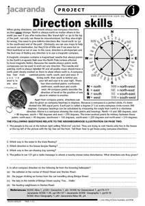
In this geography worksheet, students read an excerpt on what directions tell someone. They respond to 6 short answer questions related to the neighborhood illustration found on the second page of the worksheet.
Curated OER
Map It Out
Third graders create obstacle course maps. They lay out their course on the playground, using symbols for trees, fences, etc, Students, in groups, exchange maps and then follow the courses.
Curated OER
Lesson on GPS
Students investigate global positioning systems. In this technology and mapping lesson, students view a PowerPoint presentation in which they identify the features of a GPS, state its uses, and follow steps to find a waypoint.
Curated OER
Mapping My World
First graders make two maps. In this developing and reading maps lesson, 1st graders read Mapping Penny's World, discuss the parts of a map, create a map of their classroom, and create a list of directions of how to get to various...
Curated OER
Forest Fun
Students explore orienteering and how to use a compass. They explore the importance of forests and identify some of the trees in a local forest.
Curated OER
Follow the Light
Here is another in the interesting series of lessons that use the special State Quarters as a learning tool. During this instructional activity, pupils learn about lighthouses, maps, the cardinal directions on a compass, and U.S....
Curated OER
Age of Exploration
Students work individually or in a group researching a box compass using historical information on the uses of the compass as well as the scientific theories of the compass. They create a box compass and a water compass which are...

