Curated OER
Angles Activities
A series of geometry worksheets have mathematicians constructing, dissecting, overlapping, and measuring as they analyze angles in various contexts. Learners use symmetry and reflections in a compass rose to write instructions on...
Curated OER
Reviewing Azimuth
Combine angles and the compass rose in this labelling instructional activity. Geographers begin by labeling the cardinal directions on a compass template, along with the degrees corresponding to each. They then add the azimuthal...
Curated OER
The Circle Graph
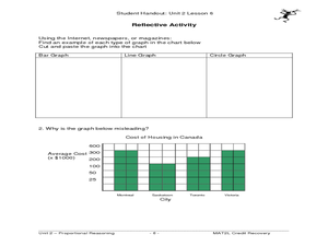
In this circle graph instructional activity, students complete problems involving many circle graphs including a compass rose, degrees, and more. Students complete 7 activities.
Curated OER
Ticky Goes to Jr. Map School
Second graders explore the compass rose and North - East - South - West.
CK-12 Foundation
Right Triangles, Bearings, and Other Applications: Sailing Race
Help your class get their bearings when it comes to right triangles. Pupils determine distances traveled or components given the bearing of a sailboat using an interactive. The scholars develop a sense of finding the bearings of a given...
Curated OER
Angles and Turns
In this angles instructional activity, students solve 24 problems in which angles and measurements on a compass are calculated. There are also some map problems to solve. The page is intended for online use but can be done on paper.
Curated OER
Basic Mapping Skills
Establish and study the parts of a map with your class and, then they will work in small groups to create their own detailed map, including a legend. There are specific instructions to follow on what needs to be included.
Curated OER
Geography: Japan Project Online Lesson, Part 2
Students, in small groups, create and exchange map questions and share them with students in Japan. After examining the maps, they compare and contrast the two maps on the county Web Board. Students use a rubric to evaluate their answers.
Curated OER
Cartography Project
A lesson involving mapping, the use of a compass, writing and following directions, and exploring the first two themes of geography is here for you. Learners create original maps that show the routes they take through their own...
Curated OER
Space Science:Wherever You Go, There You Are
Students explore navigation principles by observing, measuring, and interpreting data to determine locations. Using a compass, compass rose, and a transit, they plot courses and discover the workings of the Global Positioning System...
Curated OER
Cartography
Students research about cartography and how to be a cartographer. In this math instructional activity, students draw a map of their classroom. They use a robot to explore navigation using a compass rose.
Curated OER
Map Making/Floor Plans/Map Reading
Learners apply their knowledge of scale when mapping the classroom. They determine the use of a map legend and orient a map using a compass. They create the classroom maps using transfer graph paper.
Curated OER
Radial Design Mandala
Students design original radial art designs.In this radial design lesson, students use compasses and a nature inspired idea to create radial art. Students understand the use of symmetry, balance and design shapes in continual patterns....
Curated OER
Flight Path
Young mathematicians investigate that things move in a directional path. They construct a paper airplane and measure an airplane's length of flight. Everyone constructs a map with a key showing their airplane's flight path
Curated OER
Plot Your Course
Students determine distance and direction on a nautical chart. In this nautical lesson, students identify obstacles and characteristics of common aid to navigation on a nautical chart.
Curated OER
A Class Census
Students recognize that data represents specific pieces of information about real-world activities, such as the census. In this census lesson, students take a class and school-wide census and construct tally charts and bar graphs to...
Curated OER
Touring Delmarva
Students plan a trip. In this trip planning lesson, students use a map to find where they would like to visit with a pretend family of 4. They get a specific amount of money and time and need to decide where they will stay and what they...
Mathed Up!
Addition and Subtraction
After watching a brief video on addition and subtraction, young mathematicians are put to the test. Including 12 problems, individuals solve word problems to find the least number, total amount, and difference of numbers.
Curated OER
Tooling Around Arizona: Measuring Distances
In this measurement worksheet, student measure the distances between Arizona cities by using a the scale on an Arizona Cities map. Students complete 15 problems.
Curated OER
Calculating Distance On Maps
Fourth graders determine the mileage from the local community to various scenic attractions in the Four-Corners-Region. They receive direct instruction and carry out activities in cooperative group settings.
Curated OER
Are We There Yet?
Students discover how to use maps and why they are important when using a map. They calculate distance using a map scale and time using travel speed and a map scale.
Curated OER
Mapping Central Park
Learners use the mapping skills to explore New York's Central Park. They examine a map of Central Park to discover its features. After discussing the characteristics of the park, students design their own dream park and draw it to scale.
Curated OER
How Healthy is the Wetland?
Learners explore wetlands. In this ecology lesson plan, students visit a wetland site and collect data about the wetland functions. Learners record their results and use the data recorded to rate the wetland site on its function.
Curated OER
Diagon Alley in Toronto
In this Harry Potter worksheet, students draw a diagram of Toronto's wizarding quarter. Students make the map as colorful and accurate as possible.
Other popular searches
- Compass Rose Worksheet
- Compass Rose Art Lessons
- Compass Rose Lesson Plans
- Using a Compass Rose
- Creating a Compass Rose
- Making a Compass Rose
- History of Compass Rose
- Using the Compass Rose
- Compass Rose Lesson
- Using Compass Rose
- Compass Rose for Directions
- Making Compass Rose


