PBS
Pbs Learning Media: Visualizing Topography
Explore the topography of a hill, a valley, and a cliff in this interactive activity featuring visualizations of three-dimensional topography in two dimensions. Adapted from Stephen Reynolds' "Visualizing Topography."
NASA
Nasa: Shuttle Radar Topography Mission
The Shuttle Radar Topography Mission, a project to collect the most accurate topographic database for the Earth, is documented at this site.
Country Studies US
Country Studies: Cambodia: Topography
Read a great description of the topography of Cambodia which takes you from the heights of the mountains to the Gulf of Thailand. From the Country Studies section of the Library of Congress.
National Geographic
National Geographic: Energy Solutions: Tapping Into Topography of Lake Turkana
In this lesson, students read and analyze articles about the alkaline water in Lake Turkana in Kenya, and about a wind energy project near Lake Turkana. They then examine the many factors that must be considered when undertaking this...
Science Buddies
Science Buddies: Career Profile: Geographer
Learn about the career of a geographer, a social scientist that uses knowledge of climate, culture, and topography to address a whole host of problems the world faces. Find out the educational requirements and what the job entails in...
American Geosciences Institute
American Geosciences Institute: Earth Science Week: Predict the Flow
Using a common modeling compound, students form a "volcano" and examine its topography to predict which way lava will flow down its slopes.
Geographypods
Geographypods: Map Skills
A collection of highly engaging learning modules on various topics within mapping skills. Covers map symbols, how to use four- and six-figure grid references, cardinal directions, distance, contour mapping, and drawing cross-sections....
NOAA
Noaa: Ngdc: Images, Visualizing Data
The National Geophysical Data Center has transformed extensive ocean research into colorful video, 3D maps, charts posters and more! This site starts off with a film clip of a dive into the Marianas trench and then lead you to other...
NASA
Nasa: Oceanography
Join NASA in its study of oceanography and learn about the Earth system, the physical ocean, and life in the ocean. Try out the Giovanni: Earth Data Visualization Tool and access satellite-derived data to enhance the learning experience.
Science Education Resource Center at Carleton College
Serc: Exploring Air Quality in Aura No2 Data
This activity illustrates how data can be imported into Google Earth for visualization and interpretation. Students are introduced to air quality as it relates to population density and topography.
Other
Topo Zone: Free Usgs Topo Maps for the Entire United States
A huge collection of topographic maps for each of the US states. Scroll down to see a map of the United States and click on the state you are interested in. From there, you can search for a particular location, choose a featured map, or...
Geographic
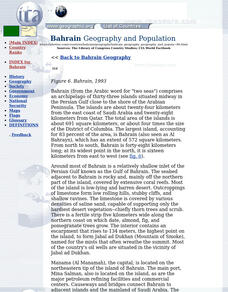
Photius: Bahrain Geography and Population
Read about Bahrain's topography. Made up of several islands, you can find out how the country is connected by causeways from one island to the next.
Country Studies US
Country Studies: Afghanistan: Mountains
An interesting discussion of the mountain ranges in Afghanistan. There is information about the meanings of the names, the various roads and passes through the mountains, and some mention of vegetation in the mountains. From Library of...
Other popular searches
- Contour Maps
- Contour Maps and Elevation
- Contour Maps Topography
- Contour Lines Maps
- Contour Lines on Maps
- Contour Lines Map Reading
- Reading Contour Maps
- Contour Interval Map Scale
- Worksheets Contour Maps
- Geography Contour Maps
- Isolines and Contour Maps
- Music Contour Maps


