Curated OER
Cross Section and Slope
Students draw cross sections of given contour maps. In this math lesson, students interpret the different symbols used in the map. They determine slope and steepness through direct measurement.
Curated OER
TOPSY TURVY MAPS
Eighth graders use the data analyzer and motion detector to collect data and measure distances. They create topographic maps drawn to scale of a given setup and relate the concepts to the creation of historical ocean maps.
Curated OER
Glaciers of Canada
Students examine photos, a poster, maps and an article series by National Geographic to determine characteristics of glaciers and the process of glaciation. They both answer guided questions and develop their own questions about the...
Curated OER
Another World: Yesterday and Today
Young scholars identify ways families, groups, and community influence daily life and personal choices, one hundred years ago and today. The recognize how topographic features influence settlement and daily life. They create a list of...
Curated OER
Using Maps to Learn About Antarctic Topography
Pupils explore maps and familiarize themselves with features of Antarctica. They utilize a topographical map to create a three-dimensional model of Antarctica. They identify and describe the different regions of Antarctic ice.
Curated OER
Project Map: Scale Worksheet
In this map reading worksheet, learners determine the distance from a plotted treasure on a topographic map. They must adjust for magnetic declination.
Curated OER
Our Country's Environment
In this environment worksheet, students complete a crossword puzzle using the word bank and definitions for terms about the land and its water.
Curated OER
What Do Maps Show?: Lesson 4 How to Read a Topographic Map
Learners examine the use of topographic maps as two dimensional representations that show elevations and slopes with contour lines. They read maps of the Salt Lake City, Utah area and complete the associated worksheets that show map...
Curated OER
All About Antarctica
Learners research the continent of Antarctica to find important facts about its topography, resources, climate, industry, agriculture, and wildlife. They identify Antarctica's animal life and learn what special needs and habitats these...
Curated OER
Build the Great Wall Lesson Plan
Students study the history and significance of the Great Wall of China. They examine the topography of the Chinese landscape before building a model of the Wall. Over the course of the school year, they use art supplies to build a wall...
Curated OER
Contour and Cross-Section Skills
In this geography worksheet, learners identify the Wolf Creek Crater and how it was formed. They examine a contour map given of how the crater would look from above. Then, pupils use a ruler to draw lines as on the graph to the side....
Curated OER
Mountains
An informative and well-designed presentation on mountains awaits your geographers. Excellent photographs from mountain ranges around the world are includedin this terrific PowerPoint. The last slide effectively sums up what pupils have...
Curated OER
Laura Ingalls Wilder and Pioneer Life
Fourth graders complete a three-week unit about Laura Ingalls Wilder and pioneer life. They research the topography of Michigan in the 1870's, conduct Internet research, write journal entries, participate in polka and waltz dancing, and...
Curated OER
Physical Geography of Africa
Fifth graders investigate the topography of Africa. In this physical geography lesson, 5th graders research the six regions of Africa and complete a physical map. Students locate various landforms in Africa. Students use their...
Curated OER
Marine Energy
In small groups, energy engineers research and make a topographic map of a marine natural resource. They report to the rest of the class pros and cons of extracting their assigned resource. The two activities may take up to four class...
Alabama Learning Exchange
WATER You Doing to Help?
Auntie Litter is here to educate young scholars about water pollution and environmental stewardship! Although the 15-minute video clip is cheesy, it's an engaging look at the water cycle and conservation. Learners start by illustrating...
Curated OER
African Safari
Sixth graders gain an appreciation for the different cultures that inhabit the Earth by focusing on the people of Africa
Curated OER
The Great Topo Race
Young scholars create a three dimensional island out of cardboard to examine how to read and use a topographical map. They make sure that their island can sustain life and that it has one volcanic mountain peak. They trace the parts of...
Curated OER
Maps
Students investigate three types of maps. In this history lesson, students idenitfy different maps and explore how they relate to the area, while keeping climate and topography in mind. They discuss maps used to navigate land. air and sea.
Curated OER
The Silk Roads Big Map
Students generate oversized rendition of the Silk Roads from Europe to East Asia, apply elements such as political and topographic features, the Silk Roads, products of the regions, and the routes of key travelers.
Curated OER
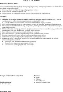
Where In The World?
Pupils review the proper terms for maps and various geographical features. In groups, they create a topographical map and label all geographic features in a given area. They present this material to the class and answer any questions...
Curated OER
Settlement Patterns of the United States
Students examine the conditions that affected the way people settled in the United States. Using maps, they examine the topography and climate of different locations and determine the factors that do and do not allow settlement to occur....
Curated OER
Geography of Japan
Students complete a worksheet that guides them through an overview of Japanese geography. Students research the topography, climate, population and size of Japan and consider how these factors work together to produce Japanese culture.
Curated OER
Louisiana Purchase
Middle schoolers use maps to locate and describe the area purchased by the Louisiana Purchase. In groups, they write a letter to Thomas Jefferson in which they evaluate the topography, climate and geography of the land. They determine...
Other popular searches
- Contour Maps
- Contour Maps and Elevation
- Contour Maps Topography
- Contour Lines Maps
- Contour Lines on Maps
- Contour Lines Map Reading
- Reading Contour Maps
- Contour Interval Map Scale
- Worksheets Contour Maps
- Geography Contour Maps
- Isolines and Contour Maps
- Music Contour Maps


