Curated OER
Contour Map Worksheet #2
Following a contour map of a hill, a stream, and the ocean, are five multiple choice questions. Earth science enthusiasts determine elevation, direction of water flow, distance, and steepness. They also match the map to a selection of...
Curated OER
Geography and Topography, History and Architecture
For this social studies lesson plan, students answer short answer questions about the geography, topography, history, and architecture of the east part of the United States. Students complete 24 questions.
Curated OER
Contour Map Worksheet #4
There are only four questions here. There is a contour map of Cottonwood, Colorado and the creek that crosses it. Earth scientists tell in what direction the creek flows, identify the highest elevation on the map, draw a topographic...
Curated OER
Contour Map Worksheet #3
Earth scientists answer five multiple choice questions about the topographical map atop the worksheet. Use this as a quick assessment of understanding after having taught how to read contour lines and topographic maps.
Curated OER
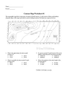
Contour Map Worksheet #1
Being able to read a topographic map is a standard in middle school earth science units and imperative for outdoor enthusiasts. As you introduce learners to this skill, you can assign this as an assessment or reinforcement. Pupils view a...
Wind Wise Education
Where is it Windy?
How is the wind up there? The class builds a topography model using materials available in the classroom, then place wind flags in different locations on the landscape. Using a fan as a wind source, pupils collect data about how wind...
Curated OER
Contour Map
In this contour map worksheet, students create 3 different contour maps by highlighting all the data points with the same value and connecting the dots.
Curated OER
Red River Contours
In this contour map worksheet, students use a given contour map to answer 16 questions about the area shown on the map. Topics include the gradient from one spot to another, the elevation, the direction of the flow of the Red River, the...
Curated OER
Cause and Effect: Light Clusters and Geography
After viewing a map of lights at night over a variety of geographic formations, young topographers connect the location of light clusters to geographic features that encourage human settlement. They list causes and effects of large...
Curated OER
Topographic Maps
In this topographic map worksheet, students learn how to read a topographic map and create a topographic map of their own using clay or Play-Doh. Students include contour lines by layering the clay. Students answer 6 questions about...
Curated OER
Project Map: Scale Worksheet
In this map reading instructional activity, students determine the distance from a plotted treasure on a topographic map. They must adjust for magnetic declination.
Curated OER
Our Country's Environment
In this environment worksheet, students complete a crossword puzzle using the word bank and definitions for terms about the land and its water.
Curated OER
Contour and Cross-Section Skills
In this geography worksheet, learners identify the Wolf Creek Crater and how it was formed. They examine a contour map given of how the crater would look from above. Then, pupils use a ruler to draw lines as on the graph to the side....
Curated OER
Regents High School Examination: Physical Setting Earth Science 2008
Throughout this earth science exam, high-school geologists complete a series of multiple choice and short answer questions about the solar system, atmosphere, and earth system. This is an amazing test, as are all of the exams developed...
Curated OER
Regents High School Examination: Physical Setting Earth Science 2010
Every topic under the sun is covered in this New York State Regents High School Examination. With the focus of earth science, participants answer 85 quesitons about the solar system, geologic time, rocks and minerals, landforms, and...
Curated OER
Regents High School Examination: Physical Setting Earth Science 2009
Junior geologists address 50 multiple choice questions and 35 short answer questions about the earth system. Plenty of visuals are included for interpretation: diagrams, graphs, maps, photographs, laboratory setups, weather symbols, and...
Curated OER
Regents High School Examination: Physical Setting Earth Science 2006
Test your class on earth science with this extensive resource. This test, created by The University of the State of New York Regents, is made up of 50 multiple choice questions and 32 short answer questions that cover the branches of...
Curated OER
Vocabulary for Dimensions of the Earth
In this Earth dimensions activity, students define 24 terms associated with contour maps, latitude, longitude, and time zones.
Curated OER
Gallery Walk Questions on Rivers
A Gallery Walk is a technique that allows small groups to visit different stations, where they examine and discuss materials about an overarching topic. Questions about rivers and fluvial processes are available in this resource;...
Curated OER
Worksheet 19 - Topographical Maps
For this map worksheet, students use information from given topical maps and locate the maxima and solve one dimensional wave equations. This two-page worksheet contains four problems.
Curated OER
Student Exploration: Building Topographic Maps
In this earthquake exploration worksheet, students complete 2 prior knowledge questions, then use "Building Topographic Maps Gizmo" to conduct several activities, completing short answer questions when finished.
Curated OER
Exploring Earth Through Maps and Technology
In this maps worksheet, students read 3 pages of detailed information about maps, latitude, longitude, topography, satellites and global positioning. Students then answer 10 questions. There is also a research project assignment available.
Curated OER
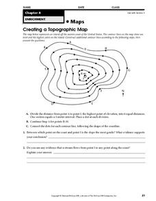
Creating a Topographic Map
In this topographic map instructional activity, students add contour lines to a topographic map using instructions provided. Once topographic map is finished, students complete 2 follow-up short answer questions.
Curated OER
Maps Reinforcement
In this map worksheet, students complete 6 multiple choice questions and 5 short answer questions about 3 different map figures.
Other popular searches
- Contour Maps
- Contour Maps and Elevation
- Contour Maps Topography
- Contour Lines Maps
- Contour Lines on Maps
- Contour Lines Map Reading
- Reading Contour Maps
- Contour Interval Map Scale
- Worksheets Contour Maps
- Geography Contour Maps
- Isolines and Contour Maps
- Music Contour Maps


