Curated OER
Finding Fresh Scenes - Geography With Monet
Fourth graders locate a site in Indiana that has a different look or topography than their hometown. They develop a brochure for this place from the point of view of a publicist who desires artists to come to this area and paint the...
Curated OER
Graphic Geography
Students investigate a foreign language. Then by looking at a map they identify ten major geographic features. Students conduct research to find information. The geographical area is then presented in the foreign language as a project.
Curated OER
World Geography: Who am I?
Students are able to provide a basic description of one country that has arsenic in its water supply. They are able to locate these countries on a map. Students explore the majors countries that have been affected by arsenic...
Curated OER
Combining Geography and Literature by Mapping a Story
Learners listen to or read a story on their own. Using the text, they describe the relative locations of the main events. In groups, they develop two and three dimensional maps of the story. They create a key and a title for their map.
Curated OER
Geography General Space
Pupils work together to explore states and/or countries while designing their movement area for the day.
Curated OER
State Poster Fair: US Geography, Social Science, Art
Pupils research a US state, design and construct a state 'poster' to display important facts about that particular state. They present their work to the class.
Curated OER
Current Events, Geography
Students read the newspaper to become aware of what is happening in their city, state, nation, and world. They summarize, find locations on a map and ask thought-provoking questions.
Curated OER
Utah: Geography
Students research the different geographical regions and landforms in Utah.
Curated OER
Geography of the Wasatch Front
Students identify the three main types of urban environments by learning characteristic land-cover types. They examine and analyze a thermal image of Salt Lake City. Then they predict surface and air temperatures from aerial photos.
Curated OER
A Geopoem About Alaska
Sixth graders conduct Internet research on the physical and human characteristics of Alaska. They compose and write geopoems about the state of Alaska, using a template.
Curated OER
Geography and Ecology of the Inuit
Middle schoolers examine environment and ecology of the Arctic region, and explore history and traditions of the Inuit.
Curated OER
Focused Learning Lesson: World Geography
Students examine the impact that humans have had on the environment and the difficulties the environment can cause. They also examine major physical changes as a result of human action or natural causes.
Curated OER
Geography of Idaho Trees
Young scholars discuss the variety of trees in Idaho and their specific locations. Working in groups, they draw pictures of the tree species and place them on a map of Idaho where they are prevalent.
Curated OER
Geography And Chinese Landscape Painting
Fourth graders label the physical features of China on a map and become familiar with
the content of traditional Chinese landscape paintings in this lesson intended for the forth grade classroom.
Curated OER
Different Perspectives of Oregon's Forest Economic Geography
Learners locate the many forests located in Oregon. In groups, they use the internet to research employment data on wood products made in the state. They discuss how looking at information presented in a different way can change their...
Curated OER
Geography: World Dynamics
Pupils discuss and examine how the world is changing. After reading an article, they discover the immediate changes that have taken place and how they have effected living things. They complete a worksheet identifying the changes as...
Curated OER
Your Neighborhood Geography
Tenth graders use maps and an atlas to observe different climates throughout the world. In groups, they brainstorm what they expect to see in their own neighborhoods and take pictures. They present their pictures to the class and write a...
Curated OER
World Geography: Water: The Indispensable Resource
Students are able to explain why water is an indispensable resource in a written essay and class discussion. They identify at least three examples of where water has been a source of conflict between societies from a reading and...
Curated OER
World Geography: Postcard from the Rim
Students are able to identify the areas of the world that are affected by arsenic contamination of the water supply. They are able to describe the ways in which various societies deal with the problem of arsenic contamination. ...
Curated OER
Business Geography
Tenth graders identify the various types of industry involved in the production of a product. Using various methods and activities, 10th graders working in groups explain the function of each individual industry and their contribution...
Curated OER
Changing Geography
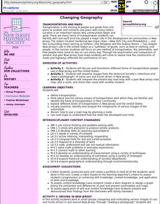
Pupils visually examine, identify and analyze the components of various images of the automobile. They discern how to use a road map by planning a route, then use road maps to explain how the state has developed over time.
Curated OER
Global Geography of Economics: the Indiana Steel Industry
Students research and identify positive and negative effects of imported steel on the Indiana steel industry.
Curated OER
Cultural Anthropology Study Using the Fundamentals of Geography and GPS
Students, in groups, operate the GPS unit, plotting each head stone with accompanying description. Two other students to log in data that corresponds to the given points. One student to note general observations
Other popular searches
- Five Themes of Geography
- U.s. Geography
- China Geography
- Africa Geography
- Mexico Geography
- Canada Geography
- Asia Geography
- France Geography
- Japan Geography
- World Map
- Ireland Geography
- Geography Studies


