Curated OER
Plate Tectonics
In this geology worksheet, learners will cut a map of California along the San Andreas fault line to see how California might change in the future. Then students will compare a world map from 50 million years in the future with a present...
Curated OER
Earthquake Unit
Eighth graders watch the "Earth, the Environment & Beyond" video on earthquakes. Take notes and give an oral summary. They build a working, two dimensional model of a strike-slip, thrust, or normal fault.
Curated OER
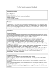
Tic-Tac-Toe for Layers of the Earth
Eighth graders identify the different layers of the earth. In this earth science lesson, 8th graders choose a project to do from a given list according to their learning style. They present their finished project in class.
Curated OER
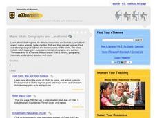
Maps: Utah: Geography and Landforms
Fourth graders research Utah's regions, its climate, resources, and biomes.
Curated OER
Learning About the Basin
Students use watershed maps to explore the Lake Pontchartrain Basin in Louisiana. In this geography lesson plan, students identify important features such as elevation, vegetation, cultural, historical and land use on a map of Lake...
Curated OER
Earthquakes
Sixth graders explain that earthquakes are sudden motions along breaks in the crust called faults. They list the major geologic events including earthquakes, volcanic eruptions and mountain building, which are the result of crustal plate...
Curated OER
What On Earth
Students explore earth science through concept mapping, discussion, and self-discovery.
Curated OER
How Deep is the Ocean
Students predict and then analyze the layout of the tectonic plates that form the ocean's floor using mapping skills and Inquiry based problem solving, They compare the depth of various regions in the ocean with the geologic age to...
Curated OER
Science: Draining the Land - the Mississippi River
Learners use topographic maps to identify parts of rivers. In addition, they discover gradient and predict changes in the channels caused by variations in water flow. Other activities include sketching a river model with a new channel...
Curated OER
Basin & Range Faulting
Students identify that the crust of the earth is constantly moving and that with the exception of faults accompanied by earthquakes, this rate of movement is far too slow to notice. Then they print a copy of cross-section map A and...
Curated OER
Bioregions of California
Students map out the bioregions of California by examining the species and environment in different areas of the state. They use information and pictures from a PowerPoint presentation to complete a map handout and play a trivia game.
Curated OER
The Physical Geography of Australia, Oceania, and Antarctica
Young scholars access information from the United States Geological Survey's Web site This Dynamic Earth to research the Ring of Fire. They answer four questions and then apply what they have learned to create a bulletin board display.
Curated OER
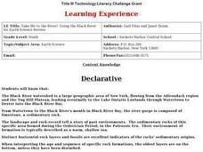
Take Me to the River! Using the Black River for Earth Science Review
Ninth graders use maps to identify landscape regions and drainage patterns producing the Black River. They create PowerPoint presentations pertaining to the Black River watershed, its geologic history and highlighting safe rafting...
Curated OER
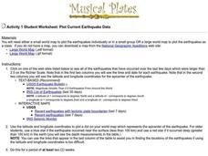
Plot Current Earthquake Data
Students review earthquakes larger than 2.5 that have occurred over a span of several days using a given website reference. In this geology lesson, students plot epicenters on a world map and depth of the quake. All necessary...
Curated OER
GPS Art
Students design their own logo or picture and use a handheld GPS receiver to map it out. They write out a word or graphic on a field or playground, walk the path, and log GPS data. The results display their "art" on their GPS receiver...
Curated OER
Water in the Texas Coastal Basins
Students, after researching a Texas coastal basin, map and graph the information they collect and then translate it into a short report to be presented to their classmates. They brainstorm unique ways to maintain Texas estuaries as well...
Curated OER
The Moving Continents from Pangaea to the Future
Eighth graders examine how the movements of the Earth contribute to fossil distribution. In this fossils lesson students make maps of the placement of the continents.
Curated OER
Earthquakes And Volcanoes
Students investigate the concept of plate tectonics through focusing a research study upon the occurrence of earthquakes and volcanic eruptions. They find information that is used for class discussion. Students complete a mapping of...
Curated OER
Historical Geography Scavenger Hunt
Students are told that Geography is the science that deals with the differentiation of the surface of the earth due to the influence of things like population, vegetation, geology, and land use. They explore the Geography Basics page. ...
Curated OER
Cave Men to Cave Painting
Students explore the Ice Age. In this geology and social studies lesson, students read the book Eyewitness Books Early Humans and create a KWL chart about the Ice Age. Students locate Asia and North America on the World Map and...
Curated OER
Down on the Ocean Floor
Young scholars build a map of the Atlantic Ocean floor and mark the different depths. In this ocean floor lesson students identify parts of the ocean floor that they created and discuss patterns that they see.
Curated OER
A Model of Earth's Tectonic Plates
High schoolers build a model of the Earth showing tectonic plate boundaries. The pattern for the model is provided in the lesson. This is a very useful hands-on component for a lesson about geology or earthquakes.
Curated OER
Volcanoes:How Safe Are They?
Students explore volcanoes, locate them on maps, record general information about volcanoes, and organize information on a fact sheet.
Project SMART
Rocks and Minerals: Touch the Earth
Students complete a unit of lessons on rocks and minerals. They conduct research, write e-mail questions to geologists, write daily journal entries, label maps demonstrating types of rocks/minerals found, and create a web page that...
Other popular searches
- Geologic Mapping Loveland
- Geologic Mapping of Loveland
- Geologic Mapping Love Land
- Creating a Geologic Map
- Geologic Mapping of Love Land


