Curated OER
Planning A Railroad
Students use topographical maps students explain the challenges involved in building the railroad in the Sierra Nevada mountains.
Curated OER
Project Whistlestop:Missouri Vacation Learning Unit
Fourth graders reserach the state of Missouri. In this Missouri History lesson, 4th graders plan a vacation to a region of Missouri. Students work in collaborative groups to determine all aspects of the trip. Students use math skills for...
Curated OER
Of Maps and Worldviews
Young scholars explore Ptolemy's world map as an expression of the Renaissance view of the world.
Curated OER
Map Your State: Regions of Arizona
Fourth graders define vocabulary and locate physical features on maps. In this mapping lesson, 4th graders explore regions of Arizona through landforms found on topographic maps. Students research the history and culture of the...
Curated OER
Waldseemuller's Map: World 1507
Seventh graders analyze various maps. In this Geography lesson plan, 7th graders create a large map as a whole class. Students write a letter to Mr. Waldseemuller.
Curated OER
Maps and Local History
Young scholars study old and current maps of their town. They make connections between the geography of a town and the activities of its inhabitants.
Little 10 Robot
Geography Drive USA™
A trivia-style virtual road trip in which the player's car is moved from state to state as questions are correctly answered. Ideally, a player would learn about different states by reading the simple brochures available in the...
Midwest Institute for Native American Studies
Introduction to Pre-Columbian Lessons
Native peoples established civilizations all over Central and North America. Introduce native civilizations with a unit that promotes discussion, reinforces map skills, enhances reading comprehension, and exposes young historians to the...
Curated OER
Let's Look at Legends: Oregon quarter reverse
Analyzing historical legends is a fun way to develop critical-thinking skills. Pupils will use a graphic organizer to compare and contrast two historical legends relating to volcanoes. While this lesson focuses on the image of Crater...
Curated OER
U.S. and Canada: How are We the Same? How are We Different?
Get high school geographers to compare and contrast Canada and the United States. They begin by drawing a freehand map of North America, then complete readings to gain insight into Canada. The text is not provided; however, another text...
Curated OER
Relationships to Others
Students investigate aspects of a historical map drawn about 1721 by a Native American for presentation to the British governor of South Carolina, and draw maps of the classroom.
Curated OER
Reading the World, Then and Now
Students distinguish geographic features using Ptolemy's map of the world.
Gymnázium Karviná
Australia and New Zealand
Send your learners off on a research adventure with a worksheet on essential facts about Australia and New Zealand. It includes 18 short-answer response questions, as well as a map activity where pupils locate a variety of geographic...
Curated OER
Colonial Vacation Planner
Students plan a family vacation to states that were among the original 13 colonies. The groups determine which state they visit, map their route, calculate the mileage, and determine how much money they spend on gasoline.
Curated OER
Eastern Europe: Passport to Understanding
Seventh graders explore Eastern Europe. They analyze data on select countries. Students prepare a short oral presentation on the country they researched. They locate their country using an interactive map.
Curated OER
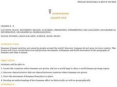
Go Bananas! (Lesson One)
Students research the historical and present movements of bananas. Using maps, they locate the countries in which the fruit is grown and identify common characteristics between the banana-growing countries. They also trace the movement...
Curated OER
Westward Expansion and the Frontier
Students explore U.S. history by researching a historic map. For this westward expansion lesson, students discuss the mystery of the western U.S. in the early 1800's and the impact expansion had on Native Americans and agriculture....
Curated OER
Tooling Around Arizona: Reading Arizona Maps
Students study geography. In this Arizona maps lesson, students develop their map reading skills. They have class discussions and work independently with various copies of Arizona maps to practice those skills. This lesson mentions...
Curated OER
How Far Away
Learners investigate how a historic map drawn in the early days of interstate automobile travel represented distances. They measure distance within their personal space.
Curated OER
TOPSY TURVY MAPS
Eighth graders use the data analyzer and motion detector to collect data and measure distances. They create topographic maps drawn to scale of a given setup and relate the concepts to the creation of historical ocean maps.
Curated OER
Documenting a Historic Climb of Mount Everest
Students create front pages of newspapers that document the historic attempt of a group of Sherpa women to summit Mount Everest.
Curated OER
Africa: Geography Concept Map
For this geography skills worksheet, students complete a graphic organizer where they list African countries and their geographic features, languages spoken, natural resources, and historical facts.
Curated OER
Maps that Teach
Students study maps to locate the states and capital on the US map. Students locate continents, major world physical features and historical monuments. Students locate the provinces and territories of Canada.


