CK-12 Foundation
Ck 12: Earth Science: Maps
[Free Registration/Login may be required to access all resource tools.] How to use topographic, bathymetric, and geologic maps.
Other
Topo Zone: Free Usgs Topo Maps for the Entire United States
A huge collection of topographic maps for each of the US states. Scroll down to see a map of the United States and click on the state you are interested in. From there, you can search for a particular location, choose a featured map, or...
Indiana University
Indiana Univ. Bloomington: Geo Notes: Indiana's Region of Karst Topography [Pdf]
Describes the geological features of the karst topography found in Indiana.
Indiana University
Indiana Univ. Bloomington: Geo Notes: Standing Rocks: Remnants of Erosion [Pdf]
Explains what standing rocks are, how they are formed by erosion, and gives the names of some well-known ones in Indiana.
Other
Southern Kings Consolidated School: Valleys
Beautiful images with a description of what a valley is and how it is formed.
US Geological Survey
Usgs: Erosion of a Sea Stack Over 100 Years
This series of photos dramatically illustrates the process of mechanical weathering known as rock abrasion. Taken over a 100 year span, you can see the effects of rock abrasion on Jump-off Joe, a sea stack at Nye Beach in Oregon. The...
Other
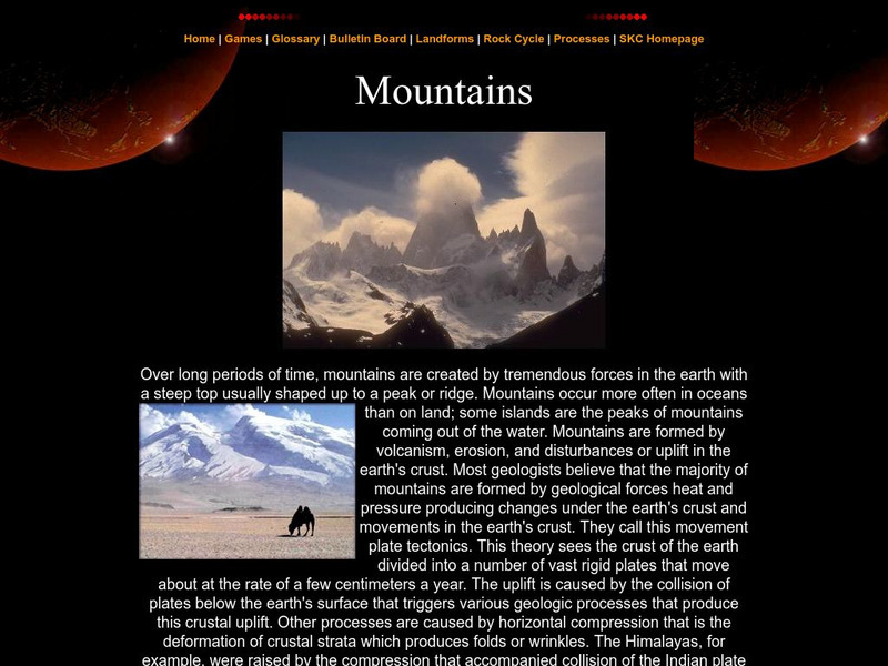
Southern Kings Consolidated School: Mountains
Site from the Southern Kings Consolidated School about mountains. Learn what mountains are and how they form.
Other
Scec: Wallace Creek Interpretive Trail
Go on a geologic adventure in this interactive, online trail guide to the Wallace Creek site on the San Andreas Fault.
Other
Ranges: The Appalachian Mountains
Informative site offering detailed information about the Appalachian Mountains. Click on links to various peaks and view photographs of these beautiful mountains.
Alabama Learning Exchange
Alex: Wearing Away the Mountains
The Tennessee River Gorge outside Chattanooga is recognized as a protected biosphere reserve by the United Nations due to its immense proportion of species to acres. Understanding the formation of the gorge helps explain why so many...
CK-12 Foundation
Ck 12: Earth Science: Chemical Weathering Study Guide
This comprehensive study guide covers the main terms and concepts needed for an earth science unit on chemical weathering. Review questions are included at the bottom of the study guide.
Other
Bscs: Bscs Science Teaching Video Library
Elementary teachers have an urgent need for high-quality science classroom videos. To respond as rapidly as possible, BSCS Science Learning has made some of our best K-12 videos available for free streaming. In this collection, you'll...
Other
Bscs: Student Ideas About Earth's Changing Surface
This list describes common misconceptions children have about the earth's surface and the scientific explanation for those ideas.
Other
Mountains Magnificent: Himalayas
This site from Mountains Magnificent for learning about the culture, trails, and atmosphere of the Himalaya Mountains.
Science Struck
Science Struck: An Explanation of How Waterfalls Are Formed
Describes the processes that cause the formation of waterfalls, examples of waterfalls around the world, and the different types.
Other
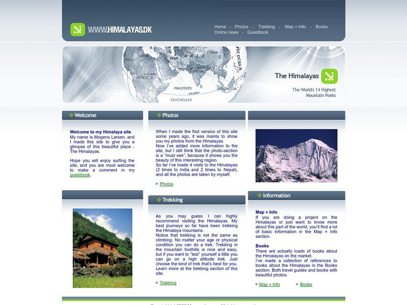
The Himalayas
This site contains helpful information and photos of the Himalayas. Learn valuable information from world traveler Mogens Larsen and journey with him to the enchanting Himalaya Mountains.
Curated OER
Ukraine
This site gives a description of the environment of the Ukraine. Read about landforms, vegetation, animal life, and climate. Also read about the history, and demographics of Ukraine.
Curated OER
Thumbnail Image
Photos, illustrations, 3D graphs and animations are part of this investigation into the geology and landforms of the Grand Canyon. Learn detailed information on the formation of the canyon, the rock layers and prehistoric life that...
Curated OER
Thumbnail Image
Photos, illustrations, 3D graphs and animations are part of this investigation into the geology and landforms of the Grand Canyon. Learn detailed information on the formation of the canyon, the rock layers and prehistoric life that...
Curated OER
Thumbnail Image
Photos, illustrations, 3D graphs and animations are part of this investigation into the geology and landforms of the Grand Canyon. Learn detailed information on the formation of the canyon, the rock layers and prehistoric life that...
Curated OER
Thumbnail Image
Photos, illustrations, 3D graphs and animations are part of this investigation into the geology and landforms of the Grand Canyon. Learn detailed information on the formation of the canyon, the rock layers and prehistoric life that...
Curated OER
Thumbnail Image
Photos, illustrations, 3D graphs and animations are part of this investigation into the geology and landforms of the Grand Canyon. Learn detailed information on the formation of the canyon, the rock layers and prehistoric life that...
Curated OER
Educational Technology Clearinghouse: Maps Etc: Post Wwi Africa, 1920
A map of Africa in 1920 showing colonial possessions of the British, French, Italian, Portuguese, Spanish, and Belgians, including the former German colonies, lost after WWI, per the Treaty of Versailles. This map shows major cities and...
Curated OER
Educational Technology Clearinghouse: Maps Etc: Africa Physical, 1915
Physical map of Africa showing major landforms and waterways, including the Atlas Mountains, Mount Kilimanjaro, the Saharan, Libyan, Arabian, and Kalahari Deserts, The Upper and Lower Guinea Coasts, the Congo Basin, Lake Victoria, and...
Other popular searches
- Landforms and Water Forms
- Canada Geography (Landforms)
- Earths Landforms
- Landforms Lesson Plans
- Landforms of Colombia
- Ocean Floor Landforms
- Definitions of Landforms
- Different Landforms
- Canada Geography Landforms
- Google Earth Landforms
- Geographic Landforms
- Landforms on Neptune


