Curated OER
Westward Expansion
Students locate California and New York on a map and explore available means of travel in the 19th century. Students explore the role of trade in pioneer America and simulate various barter transactions.
Curated OER
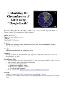
Calculation the Cricumference of Earth using "Google Earth"
Eighth graders investigate properties of circles. In this eight grade mathematics lesson, 8th graders apply proportional reasoning to data gathered with “Google Earth” to calculate equatorial and polar circumference of the Earth.
Curated OER
How High Is That?
Students explore the National Spatial Reference System. In this vertical position lesson, students will discuss the use of vertical position data and solve practical problems involving geographic positioning.
Curated OER
The Librarian Who Measured the Circumference of the Earth
Sixth graders explore angles, triangles, and investigate the circumference of the earth. They participate in a Webquest, access data bases, and communicate with other students through an on-line project site involving the circumference...
Curated OER
Make Your Own "Weather" Map
Learners create their own "weather" map using data from x-ray sources. They analyze and discuss why it is important to organize data in a fashion in which is easy to read. They compare and contrast different x-ray sources using a stellar...
Curated OER
Geography: Snow Cover on the Continents
Students create maps of snow cover for each continent by conducting Internet research. After estimating the percentage of continental snow cover, they present their findings in letters, brochures or Powerpoint presentations.
Curated OER
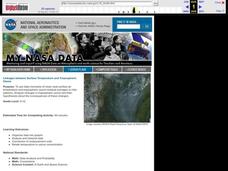
Linkages Between Surface Temperature And Tropospheric Ozone
High schoolers organize and analyze data regarding changes in tropospheric ozone and then hypothesize about the consequences of these changes.
Curated OER
TE Activity: Nidy-Gridy
Students make a grid and coordinate system map of their classroom as they investigate why it is important to have a common map making system. They look at how landmarks are used for navigating an area.
Curated OER
Making a Map of the Classroom
Students create a map of the classroom using the computer programs AppleWorks and iChat in this math-based technology lesson. Lesson extension ideas include a scavenger hunt and maps of other school buildings.
Curated OER
Graphing on a Coordinate Plane
Eighth graders explore the coordinate system. They identify the x and y-axis, parts of the coordinate plane, and discuss the process of plotting points. To emphasize the process of plotting points, 8th graders play an ordered pair...
Curated OER
Measure for Measure: Lengths and Heights
Students explore measuring tools by calculating heights and lengths of random objects. In this distance measurement lesson, students utilize the Internet service MapQuest to measure the distance between their current towns and many other...
Curated OER
Rivers, Maps, and Math
Students use maps to locate and label the major rivers of North and South America. Using the internet, they identify forests, grasslands, mountain ranges and other landforms on the continents as well. They compare and contrast the...
Curated OER
Simple Angles
Third graders identify and construct right, acute and obtuse angles and begin to appreciate the degree and unit of measurement of angle. They know the degree value of angles that are simple fractions of a whole turn know that the angle...
Curated OER
Mapping Natural Disasters
Young scholars use Cartesian coordinates to plot current natural disasters. They relate location of natural disasters to their specific major project countries. Students tie in geometry within this lesson as connected to spatial...
Curated OER
Weather Forecasts
In this weather worksheet, learners view a weekly forecast for Bradford, United Kingdom and answer short answer questions about it. Students complete 7 questions.
Curated OER
Relative Humidity of Your School
Students predict the location where the relative humidity the highest and lowest in and around their school. They use a sling psychrometer to measure the relative humidity of the various locations.
Curated OER
Measuring Angles
Third graders describe an amount of turn from a particular position to another using the 'circular' benchmarks of 0, ++, ++, ++, and full turn. Estimation language such as 'just about', 'between', 'not quite', 'just over', and similar...
Other popular searches
- Longitude and Latitude
- Longitude Latitude
- Latitude and Longitude Games
- Latitude and Longitude Maps
- Longitude & Latitude
- Longitude and Latitude Game
- Longitude and Latitude Math
- Geography Latitude Longitude
- Whaling Latitude Longitude
- Longitude Latitude Minutes
- Longitude and Latitude Lines
- Volcano Latitude Longitude


