Curated OER
Orienteering - Lesson 2 - Topographical Maps
One of the most important skills in orienteering is being able to read a topographical map. Understanding the contour lines and symbols and the scale of the map will make planning your route so much better. In this lesson plan, partners...
Curated OER
Explore Surface Types on a Journey Around Earth
Students explore satellite data. In this technology cross-curriculum math and world geography lesson plan, students locate specific map areas using a microset of satellite data. Students use technology and math skills to determine...
Curated OER
Parallels and Meridians
In this parallels and meridians worksheet, students read about parallels and meridians and answer questions about lines of latitude and longitude. Students complete 8 problems.
Curated OER
Latitude and Longitude
Students identify latitude, longitude, prime meridian, international date line, and equator. They compute the latitude and longitude of different objects.
Curated OER
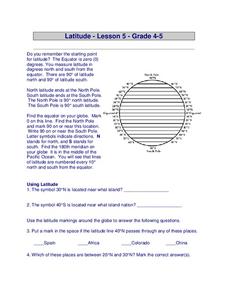
Latitude
In this latitude worksheet, students answer questions about latitude that include absolute locations of countries and coordinates. Students complete 12 questions.
Curated OER
Map Skills
Do you need to practice map skills? Children with a range of abilities will complete a KWL chart about maps, practice important map vocabulary and then read a few pages from their textbook. They will use their vocabulary words and...
Curated OER
A Map as a Tool
Students study the concept of using a map as a tool with the usage of a balloon designed to mimic the features of the Earth with the major features marked and shown on the balloon.
Curated OER
Tracking Satellites Using Latitude and Longitude
Students participate in activities based upon the concepts of latitude and longitude. They apply the fact that technology can be used in our society for a variety of uses. This should help students reflect upon the role of technology.
Curated OER
Google Earth
For this Google Earth worksheet, students access the Google Earth website and find the latitude, longitude, and elevation for their house and school. Then they do the same for a variety of world locations. This worksheet has 10 fill in...
Curated OER
Can You Find Me Now?
Students locate points using longitude and latitude coordinates. They locate their home using longitude and latitude, explore the uses of GPS, and accurately use a GPS.
Curated OER
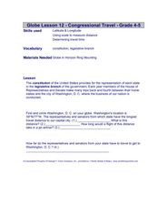
Congressional Travel
Students determine the distances traveled by the members of the legislative branch of the US Government. In this travel distance lesson, students locate Washington, DC on a globe using the longitude and latitude of the city. They...
Polar Trec
The Amazing Antarctic Trek
This resource provides two ways to engage learners in using latitude, longitude, and research skills. In pairs, or on their own, learners will locate several Antarctic regions on a map. They will write the name of the place and a few key...
Curated OER
Finding Longitude and Latitude on Pennsylvania Maps
Students draw the lines of longitude and latitude on a map. Students look at a topographical maps to see how topography relates to land use.
Science Matters
Ring of Fire
Over a period of 35 years, earthquakes and volcanoes combined only accounted for 1.5 percent of the deaths from natural disasters in the United States. The 15th lesson in a 20-part series connects the locations of earthquakes and...
Curated OER
What's Your Temperature?
Learners take a look at the local newspaper and focus on the weather section. They get into small groups, and each one looks at the same map, but of a different part of the country. They must prepare a presentation that shows how...
Curated OER
World War II New Guinea Campaign
Although the big picture for this instructional activity on the New Guidea Campaign of WWII is taking a field trip to the Douglas MacArthur Memorial, you can easily use it as a guide to an independent or group research project as well....
Curated OER
1492: Using Data to Explain a Journey
Students examine how Christopher Columbus made his way across the Atlantic. For this data lesson students use an Internet program to navigate like Columbus.
Curated OER
Earth Matters
Students identify Earth's equator, prime meridian, lines of latitude, lines of longitude, parallels, and meridians.
Curated OER
What in the World?
Eighth graders plot points of longitude and latitude on a world map. In groups, they create a model of the earth's interior and label the parts,
Curated OER
Earth Viewer
Students explore the Earth. In this space lesson, students view the " Earth and Moon Viewer" web site and complete a related worksheet.
Curated OER
The World (With an emphasis on the United States)
Fourth graders recognize the different continents. They are introduced to longitude and latitude and how to find locations using these measurements. This series ends with an emphasis on the fifty states of the United States and their...
Curated OER
Taming the Mighty Dragon
Students incorporate the five themes of geography to study the Yangtze river region. They analyze the possible effects of the three rivers gorge damn project on this area and role play a float the entire length of this dangerous river...
Curated OER
Globe Lesson 9 - Around the World - Grade 6+
In this geography skills worksheet, students read 5-travel scenarios and use their problem solving skills to respond to 9 short answer questions.
Curated OER
An Early American Culture
Students identify the locations of the Hopewell culture. In this map skills lesson, students use a globe to mark several locations of the Hopewell culture.
Other popular searches
- Longitude and Latitude
- Longitude Latitude
- Latitude and Longitude Games
- Latitude and Longitude Maps
- Longitude & Latitude
- Longitude and Latitude Game
- Longitude and Latitude Math
- Geography Latitude Longitude
- Whaling Latitude Longitude
- Longitude Latitude Minutes
- Longitude and Latitude Lines
- Volcano Latitude Longitude


