Curated OER
Pennsylvania State Map
In this geography of Pennsylvania worksheet, students color and label a map of the state. Students also study the location of Pennsylvania on a grey background map of the entire 50 states.
Curated OER
South Carolina State Map
In this map of South Carolina worksheet, learners color and label major cities and physical features in South Carolina. There is also a map showing the location of the state in the U.S.
Curated OER
Utah State Map
In this geography of Utah worksheet, students color and label a map of the state of Utah. Students also study a second map that shows the location of this state in the U.S.
Curated OER
Tennessee State Map
In this Tennessee state geography worksheet, students color and label major cities and physical features on the map. Students also study a second map of the U.S. that shows the location of the state of Tennessee.
Curated OER
Virginia State Map
In this geography of Virginia worksheet, students color the map and label major cities and physical features. Students also study a second map showing the location of the state of Virginia in the United States.
Curated OER
Delaware State Map
In this geography of Delaware worksheet, students color the map and label major cities and physical features. Students also study a second map showing the location of the state of Delaware in the United States.
Curated OER
California State Map
For this geography of California worksheet, students color the map and label major cities and physical features. Students also study a second map showing the location of the state of California in the United States.
Curated OER
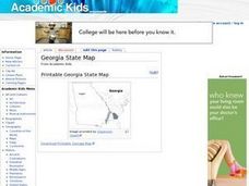
Georgia State Map
In this geography of Georgia worksheet, students color the map and label major cities and physical features. Students also study a second map showing the location of the state of Georgia in the United States.
Curated OER
Florida State Map
In this geography of Florida worksheet, students color the map and label major cities and physical features. Students also study a second map showing the location of the state of Florida in the United States.
Curated OER
Oregon State Map
For this history worksheet, students view and label a map or Oregon its main regions, major cities, important landmarks, compass rose and a legend.
Curated OER
Oklahoma State Map
In this history worksheet, students view and label on a state map of Oklahoma its regions, major cities, important landmarks, compass rose and legend.
Curated OER
United States: Physical Features Fun
In this map worksheet, students color and trace eleven listed features on a map of the United States. Students answer six additional questions about the map. A United States map is not provided. However, websites are provided to find...
Curated OER
North American Biomes
In this Science worksheet, students color a biome map of North America. Students color the map by solving the clues listed on a separate sheet of paper.
Curated OER
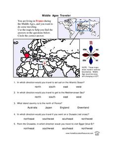
Middle Ages Traveler
In these Middle Ages worksheets, students use the maps to help them find the answers to the questions that help them understand the directions of north, south, east and west. Students also color another map of France according the...
Curated OER
Blank Map: The United States of America
For this map worksheet, students use the blank outline map of the United States to label the 50 states or for any other study purpose. Each state boundary is shown with no name labels.
Curated OER
Map of Africa
In this Africa learning exercise, students analyze a labeled map of Africa. The map shows all the countries and regions as well as the bodies of water. There are no questions to answer.
Curated OER
Blank Map of Canada
In this Canadian geography worksheet, students use a blank map of Canada to color and label important geographical features and cities. Students will need to do their own research before labeling this map.
Curated OER
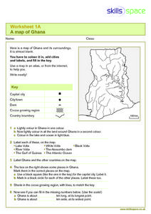
A Map of Ghana
In this Map of Ghana instructional activity, students are given a blank map and key. They are told to label major features and color according to directions.
Curated OER
Map Coloring
In this math worksheet, students create a map using different colors. They use a specific pattern and can use only four colors. This worksheet is a proof of the making of a map using no more than 4 colors. There is an answer key.
Curated OER
Northridge, California Earthquake Map
In this earthquake intensity worksheet, students are given a map labeled with the intensity of shaking for the Northridge area and its surroundings for the earthquake that occurred in 1994. Students color an intensity scale and then...
Curated OER
Outline Map of Japan
In this geography worksheet, students examine a black line outline map of Japan. There is a compass rose on the page. There are no labeled cities.
Curated OER
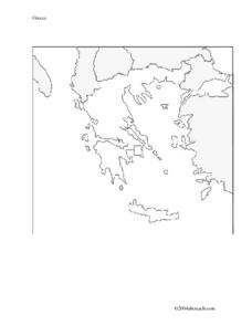
Map And Flag of Greece
For this Greece worksheet, students color and study a Greek flag. Students also color and label a map of Greece. This could be used in writing a report.
Curated OER
Romania
In this blank outline map worksheet, students explore the political boundaries Romania located in Europe. This map may be used in a variety of classroom activities.
Curated OER
Freeform Pennsylvania Map
In this Pennsylvania map worksheet, students research, study and label twenty important cities, physical attributes and the neighbors that surround Pennsylvania on a Pennsylvania map.
Other popular searches
- United States Maps
- Weather Maps
- Topographic Maps
- Story Maps
- Maps and Charts
- Types of Maps
- Maps and Globes
- Middle East Maps
- Maps and Flags
- Historical Maps
- Maps of Europe
- Create Character Maps


