Curated OER
Matching the Globe with the Map
Students examine how to use a globe. In this globe and map comparison lesson plan, students discuss how the globe and map are alike when looking at Africa and Antarctica. Students investigate shapes and sizes of globes versus maps.
Curated OER
Introduction to the United States Map
Students identify a map of the United States. In this United States map instructional activity, students study a map of the United States and find various locations on the map. Students then locate and list the state that touches their...
Curated OER
Introduction to the Globe
Students investigate how to use a globe. In this map skills lesson, students define what a globe is and locate the various continents on the globe. Students are also asked to locate the four oceans on the globe.
Curated OER
Globe Lesson 17 - Alaska and Hawaii - Grade 4-5
Students develop their globe skills. In this geography skills lesson, students explore the area added to the United States when the Alaskan territory was purchased from Russia.
Curated OER
Globe Lesson 4 - Intermediate Directions
Students explore the concept of intermediate directions. In this geography skills lesson, students use map skills in order to identify intermediate directions as they complete a map activity.
Curated OER
Globe Skills Lesson 10 Apollo 11
Students develop their globe skills. In this geography skills instructional activity, students use a globe and a softball to replicate distance between the earth and its moon.
Curated OER
Globe Skills Lesson 8 Dust Bowl Travelers
Students develop their globe and map skills, In this geography lesson, students examine the Dust Bowl as they complete an activity that requires them to plot latitude and longitude.
Curated OER
Globe Skills Lesson 3 Voyage to the New World
Students explore the globe. In this globe skills lesson plan, students use their knowledge of latitude and longitude to respond to questions regarding Christopher Columbus's maiden voyage to the Americas.
Curated OER
Globe Lesson- The Revolutionary War
Students discover using globes. In this geography lesson, students use a globe to outline the original 13 colonies. Students also use a globe to measure the distance from London to New York City and determine how many days it would have...
Curated OER
Globe Skills Lesson 7 The Transcontinental Railroad
Students explore the Transcontinental Railroad. In this geography skills lesson, students use map skills in order to locate legs of the Transcontinental Railroad on globes.
Curated OER
Globe Skills Lesson 6 The Louisiana Purchase
Middle schoolers explore the Louisiana Purchase territory. In this geography skills lesson, students use map skills in order to plot and note latitude and longitude, measure scale distance, and locate landforms that were part of the...
Curated OER
Globe Skills Lesson 4 The Colonial Period
Students practice their map skills. In this Colonial geography lesson, students complete an activity that requires them to locate English colonial locations using latitude and longitude coordinates.
Curated OER
Globe Skills Lesson 11The Vietnam War
Students develop their globe and map skills, In this geography lesson, students examine the Vietnam War as they complete an activity that requires them to plot latitude and longitude.
Curated OER
Globe Skills Lesson 1 Some Early American Cultures
Students apply their knowledge of geography. In this geography skills instructional activity, students read brief selections regarding early Americans. Students respond to the questions included in the self-guided map...
Curated OER
Globe Skills Lesson 5
In this map skills instructional activity, students read a text selection about locations during the American Revolution and then respond to 8 fill in the blank questions.
Curated OER
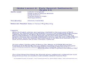
Globe Lesson- Early Spanish Settlements
Students use a globe. In this geography and early settlements lesson, students learn about the settlement of missions and haciendas in New Mexico. Students locate Mexico City and San Francisco on the globe and determine the distance...
Curated OER
Kinds of Maps
In this map worksheet, students match a set of descriptions with the names of different types of maps and answer true/false questions and short answer questions about using maps.
Curated OER
Mapping Community Values
Learners discuss the origin of various maps focusing on the values behind them. Students also explore how human needs and geography influence community settlement patterns. Learners extend learning by creating and mapping their own ideal...
Curated OER
Map Making
Students draw continents and oceans on a handmade globe and transfer their globe onto a flat map. In this maps lesson plan, students use paper and a tennis ball to make their globes.
Curated OER
Thematic Maps of Your School
Learners are able to list the essential elements of a thematic map, understand and use scale effectively to represent a geographic area, use research skills to develop a body of information, plan and draw an accurate thematic map based...
Curated OER
World Map and Globe-Equator, North Pole, and South Pole
Young scholars identify the Equator, North Pole, and South Pole on a map. For this geography lesson, students use a world map and circle the North and South Pole. Young scholars locate the Equator on a globe and use a map marker to...
Curated OER
United States Map- Continent, Country, State
Students identify their continent, country, and state on a globe. In this geography lesson, students use a globe to identify the seven continents, the United States, and the state which they live in. Students define key terms.
Curated OER
Making a Globe
Students participate in a creative project where they construct globes. They label specific places on the globe that helps them learn how to read an actual globe.
Curated OER
A Map Mystery
First graders solve a mystery by following map clues. In this map clues lesson plan, 1st graders follow a computer program called Neighborhood Map Machine. In this program, it gives students directional and spatial clues in order to...
Other popular searches
- Comparing Maps and Globes
- Reading Maps and Globes
- Communities Maps and Globes
- Examining Maps and Globes
- Using Maps and Globes
- Free Maps and Globes
- Maps and Globes Activity
- Maps and Globes Migration
- Globes and Maps
- Maps, Globes and Atlases
- Atlases Maps Globes
- Globes and Maps Continents


