Curated OER
Australia/Oceania Outline Map
For this Australia and Oceania outline map worksheet, students explore the region of the world as they label the 14 countries. The countries are numbered and lines for the answers are provided on the sheet.
Curated OER
Australia and Oceania Map Quiz
In this online interactive geography quiz worksheet, students examine the map that includes 23 countries, territories, and dependencies of Oceania. Students match the names of each to the appropriate locations on the interactive map.
Curated OER
Oceania Map Quiz
In this online interactive geography quiz worksheet, students respond to 14 identification questions about Oceania. Students have 2 minutes to complete the quiz.
Curated OER
Australia and Oceania: Physical Map
In this Australia and Oceania physical map worksheet, learners make note of the major landforms and bodies of water located within this region.
Curated OER
The Cultural Geography of Australia, Oceania, and Antarctica
Young scholars use information from the Australian Department of Immigration and Multicultural Affairs Web site to explore multiculturalism and immigration in Australia. They create graphs and charts from immigration data.
Curated OER
Australia Outline Map
In this Australia and Oceania outline map activity, students make note of the major landforms and bodies of water located within this region.
Curated OER
The Physical Geography of Australia, Oceania, and Antarctica
Pupils access information from the United States Geological Survey's Web site This Dynamic Earth to research the Ring of Fire. They answer four questions and then apply what they have learned to create a bulletin board display.
Curated OER
Australia
First graders are introduced to the country of Australia through books, Internet research, maps and music. They listen to stories, watch videos, decorate cookies and participate in an Australian-themed day of activities.
Curated OER
1984, by George Orwell - Fact or Fantasy?
Students read 1984 by George Orwell. They research a country who has dictators similar to Oceania's leaders and create a outline for a paper. In addition, they create a web page from their information.
National Geographic
Australia, Antarctica, and Oceana
Go on a traveling adventure throughout Australia, Oceana, and Antarctica! This textbook excerpt offers a full unit of study that can easily be supplemented by extra projects or research materials. Learners study maps, read about native...
California Polytechnic State University
Australian Geography Unit
At the heart of this resource is a beautifully detailed PowerPoint presentation (provided in PDF form) on the overall physical geography of Australia, basic facts about the country, Aboriginal history, and Australia culture and lifestyle.
VIF Learning Center
Languages as Reflection of Cultures and Civilizations: French Speaking Countries
Expand your class's vision of the French-speaking world by conducting this research project. Pupils focus on building 21st-century skills while they look up information about a French country and put together presentations.
Curated OER
Australia Map
In this Australia outline map worksheet, students make note of the political divisions of the 5 provinces and territories of the nation.
Curated OER
Australia Map
In this blank outline map instructional activity, students explore the political boundaries of Australia. This map is labeled and may be used in a variety of classroom activities.
Curated OER
Australia Map: Labeled
In this Australia outline map worksheet, students make note of the political divisions of the 5 provinces and territories of the nation. This map is labeled.
Curated OER
Australia Map: Labeled
In this blank outline map worksheet, learners explore the political boundaries of Australia and its provinces and territories. This map is labeled and may be used in a variety of classroom activities.
Curated OER
Population Density
Students examine world population density and population distribution. They create pie charts showing population distribution and analyze population patterns in the United States and major regions of the world. They identify...
Curated OER
The Olympic Rings
In this Olympic Rings research instructional activity, learners observe a picture of the Olympic rings and research their designer. They explore when and where they were first used, what they represent, what are the five major regions in...
Curated OER
Africa Capitals Map Quiz
In this online interactive geography quiz worksheet, students examine the map that includes 53 African countries. Students match the names of the countries to the appropriate locations.
Curated OER
Tallest Waterfalls of the World: Graph It
In this graphing worksheet, 6th graders graph the tallest waterfalls of the world according to which region they are located in. Students then answer questions related to their graph information.
Curated OER
Continents of the World
Second graders participate in a lesson about how people are the same, how people are different and where the continents are located. They go on a trip around the woworld to visit a country in each continent.
Curated OER
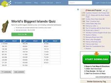
World's Biggest Islands Quiz
In this online interactive geography quiz worksheet, students respond to 20 identification questions about the largest islands in the world. Students have 4 minutes to complete the quiz.
Curated OER
World Education Statistics
Students use a spreadsheet from The Digest of Education Statistics and convert the statistics to percentages, and create a chart of their new data. Students discuss their findings about the disparities in educational spending among...
Curated OER
Continents
For this continents worksheet, students use clues from a song titled "Continents" and match to the correct continent. A link to the song or information for obtaining is not given.
Other popular searches
- Pacific Oceania
- Oceania Economics
- Oceania Culture
- Oceania L Ife
- Australia and Oceania
- Landforms of Oceania
- Pacific Oceania Art
- Australia Oceania
- Geography Oceania
- Region Oceania
- Oceania L Fie
- Pacific Oceania Tourism


