HyperHistory Online
Wold History: World Map: Ottoman Empire
This map shows the Ottoman Empire as part of the world, 1500-1800. Click the buttons to view the world in other historic periods.
HyperHistory Online
Timelines: Ottoman Empire
Compare the timing and happenings of the Ottoman Empire with other world events of the same time period. Click from this page to related sites with maps, biographies, and other information.
Other
Visulistan: Mapping the Empires of History #Infographic
This infographic maps the empires of history including the British Empire, the Mongol Empire, the Russian Empire, the Spanish Empire, the Umayyad Caliphate, the Portuguese Empire, the Achaemenid Empire (First Persian Empire), the Ottoman...
Curated OER
Etc: Division of the Ottoman Empire in Europe, 1912 1913
A map of the Ottoman Empire and the division of its European territories after the two Balkan Wars between 1912 and 1913. The map shows the Turkish territories as the Balkan League (Bulgaria, Greece, Serbia, and Montenegro) intended to...
Other
Islam Project: Maps
A series of historical and near-present-day maps that span Islamic history. Starting with A.D. 750, the maps illustrate both the spread of Islam (from Medina outward to Africa, the Middle East, Europe, and other parts of the world) and...
Metropolitan Museum of Art
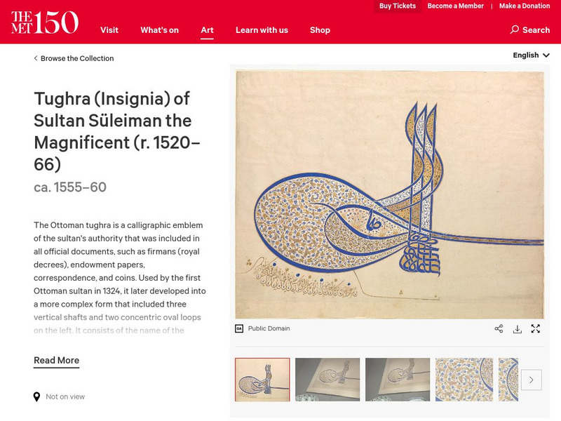
Metropolitan Museum of Art: Tughra of Sultan Suleiman the Magnificent
A tughra is a special calligraphic-style signature used by rulers of the Ottoman empire, often on official decrees. This provides information about the tughra of Suleyman the Magnificent(1494-1566), one of the most famous Ottoman sultans.
Other
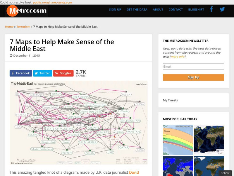
Metrocosm: 7 Maps to Help Make Sense of the Middle East
Keep up to date with the everchanging Middle East Region. The Middle East has been a tangled web of alliances since WWI. These maps attempt to make sense out of the this often confusing area. The 7 maps show the relationships among...
Curated OER
Islam and Islamic History in Arabia and the Middle East: The Ottomans
This site gives a military, political and religious overview of the Ottoman Empire. Includes links to additional Islam and Islamic history sites.
Curated OER
Islam and Islamic History in Arabia and the Middle East: The Ottomans
This site gives a military, political and religious overview of the Ottoman Empire. Includes links to additional Islam and Islamic history sites.
Other
Propaganda Postcards of the Great War: Centrals: Heads of State
Presents some biographical information on the leaders of the Central Powers during WWI - Wilhelm II of the German Empire, Franz Josef I of the Austro-Hungarian Empire, Mehmed Rechad V of the Ottoman Empire (Turkey), and Ferdinand I of...
Library of Congress
Loc: Prints and Photographs: Fenton Crimean War Photographs
Access a documentary record of Crimean War photographs produced by pioneering British photographer Robert Fenton.
Curated OER
Educational Technology Clearinghouse: Maps Etc: Asia, 1903
A map of Asia from 1903 showing country boundaries at the time, major cities, rivers, lakes, terrain, and coastal features. This map shows the extent of the Russian Empire and Turkish Ottoman Empire in Asia, the Empire of Japan and...
Curated OER
Educational Technology Clearinghouse: Maps Etc: Asia, 1912
A map of Asia from 1912 showing country boundaries at the time, foreign possessions, major cities, rivers, lakes, terrain, and coastal features. This map shows the principal railways of the region with connections to Europe. This map...
Curated OER
Educational Technology Clearinghouse: Maps Etc: Political Asia, 1909
A map of Asia from 1910 showing country boundaries at the time, foreign possessions, major cities, rivers, lakes, terrain, and coastal features. This map shows the extent of the Russian Empire and Turkish Ottoman Empire in Asia, the...
Curated OER
Educational Technology Clearinghouse: Maps Etc: Asia, 1904
A map of Asia from 1904 showing country boundaries at the time, major cities, rivers, lakes, deserts, terrain, and coastal features. This map shows the extent of the Russian Empire and Turkish Ottoman Empire in Asia, the Empire of Japan...
Curated OER
Educational Technology Clearinghouse: Maps Etc: Asia, 1899
A map of Asia from 1899 showing country boundaries at the time, foreign possessions, capitals and major cities, rivers, canals, lakes, deserts, terrain, and coastal features. This map shows the principal railways and caravan routes of...
Curated OER
Educational Technology Clearinghouse: Maps Etc: Asia, 1916
A map of Asia from 1916 showing country boundaries at the time, major cities, railroads, rivers, lakes, terrain, and coastal features. The map indicates foreign possessions in the region with British India (which included Myanmar or...
Curated OER
Educational Technology Clearinghouse: Maps Etc: Europe, 1848 1871
A map of Central Europe between 1848 and 1871 showing Prussia, the German Empire, the French gains in Savoy and Nice, and losses in the Alsace-Lorraine territory, the Austria-Hungary Empire, the Kingdom of Italy, and the Ottoman Empire.
Curated OER
Educational Technology Clearinghouse: Maps Etc: Political Map of Asia, 1919
A map from 1919 of Asia showing the political boundaries at the time. This map shows the extent of the Russian and Ottoman empires in Asia, the British possessions of India, Straits Settlements on the Malay Peninsula, northern Borneo,...
Curated OER
Etc: Maps Etc: Europe After the Congress of Vienna, 1815
A color map of Europe after the Congress of Vienna in 1815, which redrew the continent's political boundaries after the French Revolution, Napoleonic Wars, and the dissolution of the Holy Roman Empire. This map is color-coded to show...
Curated OER
Etc: Maps Etc: Europe at the Beginning of the Modern Era, 1792
A map of Europe in 1792 during the French Revolution and the beginning of the Modern Era. This map is color-coded to distinguish between various countries throughout the continent, including Great Britain, France, United Netherlands,...
Curated OER
Yavuz Sultan Selim
Click on a time period on the left of your screen and get great information on what happened within the Ottoman Empire during those years. Custom, culture, military achievements, and more are included.
Curated OER
Kanuni (Lawgiver)
Click on a time period on the left of your screen and get great information on what happened within the Ottoman Empire during those years. Custom, culture, military achievements, and more are included.
Curated OER
Educational Technology Clearinghouse: Maps Etc: The Barbary States, 1802 1805
A map of the Mediterranean Sea region showing the Barbary States and southern Europe at the time of the Tripolitan War (First Barbary War - 1801-1804) between the United States and the North African Ottoman Empire regencies. The map...
Other popular searches
- The Ottoman Empire
- Ottoman Empire Break Up
- Decline Ottoman Empire
- Ottoman Empire Literature
- Ancient Ottoman Empire
- Ottoman Empire L
- Early Ottoman Empire
- Collapse of Ottoman Empire
- Decline of Ottoman Empire
- Rise of Ottoman Empire
- 19th Century Ottoman Empire


