Curated OER
Canada Outline Map: Labeled
In this blank outline map worksheet, learners study the political boundaries of the North American country of Canada as well as those of the provinces located there. This map is labeled.
Curated OER
Canada Outline Map
In this blank outline map instructional activity, students study the political boundaries of the North American country of Canada as well as those of the provinces located there.
Curated OER
Canada Outline Map
For this blank outline map worksheet, students study the political boundaries of the North American country of Canada as well as those of the provinces located there.
Curated OER
South America Outline Map
In this outline map activity, students discover and investigate the continent of South America. No country borders or physical features are depicted. This blank outline map may be used for a variety of classroom activities.
Curated OER
South America Outline Map
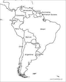
In this blank outline map learning exercise, students explore the political boundaries of South America and the nations there. This map may be used in a variety of classroom activities. The map is labeled with the country names.
Curated OER
South America Outline Map
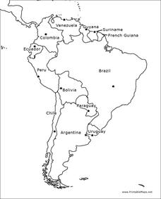
In this blank outline map learning exercise, students explore the political boundaries of South America and the nations there. This map may be used in a variety of classroom activities. The location of the capital cities are...
Curated OER
North America Outline Map
In this blank outline map worksheet, students investigate the political boundaries of the continent. This map may be used for a variety of classroom activities.
Curated OER
Denmark Outline Map
In this blank outline map activity, students explore the political boundaries of Denmark located in Europe. This map may be used in a variety of classroom activities.
Curated OER
Europe Outline Map
In this blank outline map worksheet, students explore the political boundaries of the continent of Europe and those of the countries located there.
Curated OER
Spain Outline Map
For this blank outline map worksheet, students explore the political boundaries of Spain located in Europe. This map may be used in a variety of classroom activities.
Curated OER
Canada Outline Map
In this blank outline map learning exercise, students study the political boundaries of the North American country Canada as well as those of the provinces located there. The capital cities of the provinces are listed.
Curated OER
United States Outline Map
In this United States outline map worksheet, students note the political boundaries of the states that are labeled with state capitals.
Curated OER
South America Outline Map
In this outline map worksheet, students discover and investigate the physical boundaries of the countries in South America. The names of countries and a star to mark the capital city are included.
Curated OER
Blank Europe Outline Map
In this blank outline map worksheet, students explore the political boundaries of the continent of Europe and those of the countries located there. This map may be used in a variety of classroom activities.
Curated OER
Blank Europe Outline Map 2
For this blank outline map worksheet, students explore the political boundaries of the continent of Europe and those of the countries located there. This map may be used in a variety of classroom activities.
Curated OER
Europe Outline Map (Labled)
In this blank outline map learning exercise, students study the political boundaries of the labeled European nations.
Curated OER
Africa Outline Map: Labeled
In this Africa outline map worksheet, students explore the political boundaries of the continent of Africa the countries located there. Each of the nations is labeled on the map.
Curated OER
California Map
In this California blank outline map worksheet, students examine the political boundaries of the state and then mark the state capital, other cities, and other state attractions on the map.
Curated OER
Wyoming Map
In this blank outline map worksheet, students fill in the state capital, major cities, landforms, and other places of interest on this map of Wyoming.
Curated OER
Tennessee Map
In this Tennessee outline map, students examine the political boundaries of the state. Students mark the state capital, major cities, and other state attractions.
Curated OER
Revive Reviews With Student-Created Study Guides
Students work cooperatively in small groups to practice note-taking and outlining skills which are applied as student create unit Study Guides for their classmates. They demonstrate critical thinking skills as they decide the most...
Curated OER
Persuasive Essay
Next time you assign your young historians to write a persuasive essay, use this document as a starting point and support them with a rubric, tips for writing a successful persuasive piece, and a general essay outline.
Curated OER
Missouri Map
In this Missouri blank outline map worksheet, students examine the political boundaries of the state and then mark the state capital, other cities, and other state attractions on the map.
Curated OER
Outlining Transportation#139
Learners examine how people, products, and ideas travel. They create an outline using the proper format after completing a class brainstorming session about means of transportation.
Other popular searches
- Outlining Map
- Outlining Skill Practice
- Outlining Story Maps
- Outlining a Research Paper
- Outlining Lesson Plans
- Outlining Lessons
- Lessons on Outlining
- Creating an Outlining
- Outlining Projects
- Outlining +Handout
- Outlining Handout
- Outlining +"Handout


