Curated OER
Asia Outline Map
In this Asia outline map worksheet, students explore the continent as they label the 47 countries. The countries are numbered and lines for the answers are provided on the sheet.
Curated OER
Australia/Oceania Outline Map
For this Australia and Oceania outline map worksheet, students explore the region of the world as they label the 14 countries. The countries are numbered and lines for the answers are provided on the sheet.
NASA
Outline Maps
Don't miss this gold mine of blank maps for your next geography lesson! Regions include traditional continents such as Asia, Europe, and Africa, as well as other major world areas such as the Pacific Rim and the Middle East.
Lincoln-Sudbury Regional High School
WWII Position Paper
There are some historical events that may warrant greater reflection and more in-depth analysis, and the decision to intern Japanese-Americans in the United States during World War II, as well as to drop the atomic bomb on Hiroshima and...
Curated OER
How To Write a Social Studies Outline
One of the keys to success in school is organization. This resource leads learners through the process of creating an outline for a chapter from a social studies text. In addition, they review facts they have learned in their class...
Scholastic
Organization Outline
Forming a strong organizational outline is important when reading a complex text, writing an informative essay, or analyzing a complicated problem. Use a straightforward organization outline to teach learners about concept mapping.
Curated OER
Canada Outline Map
In this blank outline map learning exercise, students study the political boundaries of the North American country of Canada as well as those of the provinces located there.
Curated OER
South American Outline Map
In this blank outline map worksheet, students study the political boundaries of the continent of North America and those of the countries located there.
Curated OER
Mexico Outline Map 2
In this outline map worksheet, students discover and investigate the North American country of Mexico. This blank outline map may be used for a variety of classroom activities.
Curated OER
Africa Outline Map
In this outline map activity, students discover and investigate the continent of Africa and the political boundaries of its nations. This blank outline map may be used for a variety of classroom activities.
Curated OER
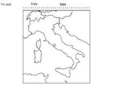
Italy Outline Map
In this outline map learning exercise, students examine the political boundaries of the European nation of Italy. The map may be used in variety of activities that individual teachers create to accompany it.
Curated OER
Kazakhstan Outline Map
In this blank Kazakhstan outline map worksheet, students study the political boundaries of the country. This outline map may be used for a variety of geographic activities.
Curated OER
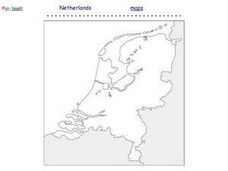
Netherlands Outline Map
In this outline map worksheet, students examine the political boundaries of the European nation of the Netherlands. The map may be used in variety of activities that individual teachers create to accompany it.
Curated OER
North America Outline Map
In this blank North America outline map worksheet, students study the political boundaries of the continent. This outline map may be used for a variety of geographic activities.
Curated OER
Europe Outline Map
In this outline map activity, students examine the political boundaries of the continent of Europe. The map may be used in variety of activities that individual teachers create to accompany it.
Curated OER
Alabama Outline Map
In this Alabama outline map worksheet, students examine political boundaries of the state and the placement its capital city as well as its major cities. This map is not labeled.
Curated OER
Arizona Outline Map
In this Arizona outline map activity, students examine political boundaries of the state and the placement its capital city as well as its major cities. This map is not labeled.
Curated OER
Arkansas Outline Map
In this Arkansas outline map worksheet, students examine political boundaries of the state and the placement its capital city as well as its major cities. This map is not labeled.
Curated OER
California Outline Map
In this California outline map instructional activity, students examine political boundaries of the state and the placement its capital city as well as its major cities. This map is not labeled.
Curated OER
Colorado Outline Map
In this Colorado outline map instructional activity, students examine political boundaries of the state and the placement its capital city as well as its major cities. This map is not labeled.
Curated OER
Delaware Outline Map
In this Delaware outline map learning exercise, students examine political boundaries of the state and the placement its capital city as well as its major cities. This map is not labeled.
Curated OER
Florida Outline Map
In this Florida outline map learning exercise, students examine political boundaries of the state and the placement its capital city as well as its major cities. This map is not labeled.
Curated OER
Georgia Outline Map
In this Georgia outline map activity, learners examine political boundaries of the state and the placement its capital city as well as its major cities. This map is not labeled.
Curated OER
Idaho Outline Map
In this Idaho outline map instructional activity, students examine political boundaries of the state and the placement its capital city as well as its major cities. This map is not labeled.
Other popular searches
- Outlining Map
- Outlining Skill Practice
- Outlining Story Maps
- Outlining a Research Paper
- Outlining Lesson Plans
- Outlining Lessons
- Lessons on Outlining
- Creating an Outlining
- Outlining Projects
- Outlining +Handout
- Outlining Handout
- Outlining +"Handout


