Curated OER
4th Grade Geography Multiple Choice
In this grade 4 geography worksheet, 4th graders complete a total of 25 multiple choice questions relating to 4th grade geography concepts. An answer key is provided.
Curated OER
Western Civilizations, Chapter 23: Modern Industry and Mass Politics, 1870-1914
Looking for an interactive way to supplement your western civilization course? Check out this comprehensive website, designed to accompany the Western Civilizations text (although it is valuable independently). Scholars investigate...
Curated OER
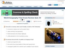
World Geography Final Exam Review Quiz #3
In this world geography instructional activity, students respond to 14 multiple choice questions based on their knowledge of the world's places and features. Students may submit their answers to be scored.
Curated OER
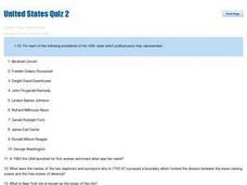
United States Quiz Two
In this United States worksheet, students answer short answer questions about which political party the Presidents belonged to and geography of the country. Students answer 20 short answer questions.
Curated OER
Physical and Human Geography Review Worksheet and Study Guide
In this geography skills worksheet, students respond to 30 short answer questions pertaining to physical and human geography.
Curated OER
Eastern Europe in 1989
Major political shifts occurred in Eastern Europe during the late 1980s. Locate, identify, and label 90 different areas on the provided map. A list of cities, countries, and water ways is provided.
Curated OER
World Political Map
In this blank outline map worksheet, students note the political boundaries of the nations of the world on a Mercator projection map.
Curated OER
World: Political Map
In this world political outline map worksheet, students examine boundaries of each of the countries in the world. This map not is labeled.
Curated OER
U.S. Political Map
For this political map worksheet, students use the map of the United States and the 7 cities to measure the straight-line distance between the cities. Students add the total number of miles traveled and write their answers in the spaces.
Curated OER
Europe: Political Map
In this Europe political map worksheet, students examine each country's boundaries. The map also highlights each of the nation's capitals with a star.
Curated OER
Africa Political Map
In this blank outline map activity, students explore the political boundaries of the continent of Africa, the countries located there, and label other geographic features.
Curated OER
Americas: Political Map
In this North America and South America outline map worksheet, students examine the political boundaries of the 2 continents.
Curated OER
Regents High School Examination: Global History and Geography, 2009
Get your geographers thinking with this global history and geography standardized practice test. Class members respond to 50 multiple choice questions, 2 essay prompts, and 15 short answer questions that require them to review their...
Curated OER
Tennessee Map
In this Tennessee outline map, learners examine the political boundaries of the state. Students mark the state capital, major cities, and other state attractions.
Curated OER
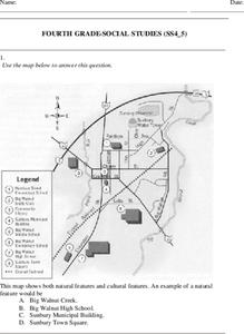
Fourth Grade Social Studies
In this social studies worksheet, 4th graders answer multiple choice questions on state maps, city maps, road maps, political maps, and more. Students complete 25 multiple choice questions.
Curated OER
South America Map
In this South American political map learning exercise, students examine both national boundaries and national capitals.
Curated OER
South America Map
In this South America political map worksheet, students examine the country boundaries. The map also labels each of the countries and their capitals.
Curated OER
Europe Labeled Map
In this Europe political map worksheet, students examine the national boundaries. The map also highlights each of the nation's capitals with a star. The countries and capital cities in this map are labeled.
Curated OER
European Country Map
In this Europe political map worksheet, students examine the national boundaries. The country names are labeled on the map.
Curated OER
Australia Map
In this Australia outline map worksheet, students make note of the political divisions of the 5 provinces and territories of the nation.
Curated OER
Australia Map: Labeled
In this Australia outline map worksheet, students make note of the political divisions of the 5 provinces and territories of the nation. This map is labeled.
Curated OER
World: Continents
For this blank outline map worksheet, students note the political boundaries of the continents of the world on a Robinson projection map.
Curated OER
World: Continents Map
In this outline map worksheet, students note the political boundaries of the continents of the world. The map is labeled with the names of the 7 continents.
Curated OER
World: Continents Map
In this World outline map worksheet, students note the political boundaries of the continents of the world on this Robinson projection map.


