Curated OER
Family Life Among the Ashanti of West Africa
Learners examine the way of life of the Ashanti who live in West Africa. After locating the countries on a map, they are shown slides of artifacts to determine their uses. In groups, they compare and contrast the Ashanti's view of...
Curated OER
Where Life Is Too Short
Pupils predict how a pandemic would affect aspects of South Africa's society. In this world issues and geography lesson, students read a letter outlining the problems affecting South Africa. Pupils discuss and analyze how resource...
Curated OER
African Country Report
Sixth graders describe the relationship between the people of Africa and their environment. They examine the climate, economy and inhabitants of this land. Using maps graphic organizers and writing a report, 6th graders demonstrate how...
Facts and Files
The Nile
While it may not be possible to take an entire class to Egypt and explore the ancient wonders, it is possible to engage your young historians in activities that ask them to research these and other antiquities and place them on their...
August House
Anansi and the Pot of Beans
Anansi is a tricky character, but can he realize he's wrong and write an apology letter? Learners use Anansi and the Pot of Beans to practice writing, art, and figurative language. A series of activities are engaging for both advanced...
Curated OER
The African Slave Trade: From West Africa to South Carolina and Beyond
Eighth graders explore the African slave trade. They identify the principal figures practicing the African slave trades at three locations. Students draw the physical routes of the slave trade on a map and they list the reasons for the...
Curated OER
Exploring Maps: Lesson 2 Guide: Navigation
Students explore and examine how maps have been used in navigation. They research how travelers collected observations to keep track of their positions and plotted information on maps. Each student then makes a Mercator projection...
Curated OER
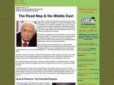
The Road Map & the Middle East
Will walls help? Read to learn how Prime Minister Ariel Sharon proposes to build walls around Isreal in hopes of isolation from Palestine. Complete an online Webquest, analyze maps, listen to audio clips, answer discussion questions, and...
Howard Hughes Medical Institute
Measuring Biodiversity in Gorongosa
Take your biology class' understanding of biodiversity to a whole new level! Ecology scholars use data to calculate three different diversity indices based on the organisms in the Gorongosa National Park. The four-part activity uses an...
Curated OER
African Art is Alive: Drum, Dance, Storytelling....
Students investigate and experience African culture through various art forms. Students explore the physical and political geographies of Africa through mapping activities. Students, in groups, prepare presentations about different...
August House
The Clever Monkey Rides Again
Use a West African folktale to practice several different skills in your first grade classroom. Learners read The Clever Monkey Rides Again and focus on rhyming words, reading comprehension, measurement, art, movement, and word order.
Curated OER
Cyberspace Safari
Middle schoolers go on an information gathering hunt on the Internet to study West African empires. They work in teams; meteorologists, bankers, writers, and archaeologists. They collect data on all sorts of topics related to West...
Curated OER
Mapping and Personifying Nations
Eleventh graders analyze the geography, actions, and relationships of countries involved in World War II. They create a map of Europe, Northern Africa, and the Pacific, and analyze and evaluate their self-made map of Europe and the...
Curated OER
Timeline of Ancient Africa
In this ancient Africa worksheet, students complete a timeline and respond to 4 short answer questions about the civilizations of Egypt, Ghana, Kush and Mali.
Curated OER
Mapping Population Changes In The United States
Students create a choropleth map to illustrate the population growth rate of the United States. They explore how to construct a choropleth map, and discuss the impact of population changes for the future.
Curated OER
Solutions or Impossibilities? HIV Prevention for African Children
Students analyze maps for clues as to why students and mothers in both urban and rural areas of Africa may not fight HIV the same way as those in wealthier countries. They write an essay outlining solutions to the AIDS epidemic.
Curated OER
Day-to-Day Life in a Small African Village
Students experience just a bit of what it's like living in a village in Tanzania-from language to geography to health and hygiene issues. They compare aspects of school and home life in the United States with those in Tanzania and...
Curated OER
Desertification
Learners investigate the process of desertification in the Sahel region of Africa. They discuss photos from a National Geographic magazine, analyze the physical/political map of the Sahara, identify the causes and effects of...
Curated OER
Water: The Flow of Women's Work
Students view photographs, read, and reflect on their own environments to gather information about gender roles in Lesotho and the United States. Students role-play gender role related scenarios and write about their reflections on the...
Curated OER
Exploring an Atlas
Students explore global geography by participating in an atlas activity. In this countries of the world lesson, students collaborate in small groups and analyze an atlas while researching continents, countries and demographics. Students...
Curated OER
Gullah People of the Sea Islands
Students examine the history and culture of the Gullah people. They study the geography, impact of industrialization and effects of tourism on the people of Gullah. They view films, use a large map of West Africa,. Students will listen...
World Maps Online
Introduction to the World Map
Students identify the differences between maps and globes. In this map skills instructional activity, students are shown a globe and a map and recognize the differences. Students use post-it notes to locate several locations on the world...
Curated OER
Cacao Tree Geography
Learners use a map to learn about where chocolate comes from. In this lesson on the cacao tree, students locate various regions where the cacao tree grows. They will discuss why the cacao tree grows more favorably in particular climates...
Curated OER
Saudi Arabia -- Future city
Seventh graders summarize an article on Masdar. In this summarizing instructional activity students clearly explain three of the four points provided in an outline of the article. The students write an essay and identify six physical...


