Curated OER
Climate Change in My City
Students investigate the climate changes occurring locally, regionally and globally over the last one hundred years. They brainstorm and predict whether the current year's weather was warmer or colder than last year then check the...
Texas State University
Earth: Deposition and Lithification
Geology geniuses analyze sediment samples with a hand lens and sort according to physical characteristics. They also learn about the processes of cementation, compaction, and lithification within the rock cycle. The lesson plan is...
Curated OER
The Path of the Black Death
Students analyze maps, firsthand accounts, and archival documents to trace the path and aftermath of the Black Death. Connections between the plague and changes adopted by the ruling class are explored in this lesson plan.
Curated OER
NIGHT AND DAY: DAILY CYCLES IN SOLAR RADIATION
Students examine how Earth's rotation causes daily cycles in solar energy using a microset of satellite data to investigate the Earth's daily radiation budget and locating map locations using latitude and longitude coordinates.
Curated OER
Tracking the Salt Front
Using the Hudson River as the focus, learners discuss the difference between salt water and fresh water environments, analyze maps and graphs, and complete addition and subtraction problems. This lesson comes with a wealth of...
Polar Trec
What Can We Learn from Sediments?
Varve: a deposit of cyclical sediments that help scientists determine historical climates. Individuals analyze the topography of a region and then study varve datasets from the same area. Using this information, they determine the...
Curated OER
Cold, Clouds, and Snowflakes
Students explore satellite data and graphing. In this weather data analysis math and science lesson, students analyze NASA satellite data to draw conclusions about geographical areas where precipitation might have happened. Students...
Montana State University
Who’s on Top?
What's it like to climb Mount Everest? An educational resource encourages an in-depth knowledge of Mount Everest's scientific missions through a variety of activities, including an analysis of maps, a KWL chart, videos, a simulation, and...
Curated OER
A Thoreau Look at Our Environment
Sixth graders write journal entries o school site at least once during each season, including sketched and written observations of present environment. They can use sample topographical maps and student's own maps. Students can use...
Curated OER
What is Climate?
Students explore the differences between climate and weather. For this introductory lesson of a climate unit, students discuss the vocabulary and concepts associated with weather and climate. They build their information base for the...
Curated OER
Geology and the Battle of Gettysburg
High schoolers create geologic maps of the Gettysburg battlefield. For this geologic skills lesson, students consider the variations of Earth's surfaces and explore strategies employed by the North and South in the Battle of Gettysburg...
Curated OER
Hurricanes and Climate
Students investigate maps and data to learn about the connections between hurricanes and climate. In this exploratory lesson students describe and graph the 6 regions where hurricanes happen and discuss how hurricanes have changed over...
Curated OER
Weather and its Effect on the Environment and Settlement
Students, after choosing two diverse cities, collect data on weather for a month and construct a graph on temperature and precipitation. After collecting population data of said cities, and graphing it, they plot population on a large...
Curated OER
Analyzing Journey North Maps
Students analyze what's happening and interpret why it's happening as the season progresses.
Curated OER
Tracking Weather Over Time
Young scholars gather, analyze and interpret data. They explain scientific inquiry. They plot points on a map and report information from a spatial perspective.
Curated OER
Quilt? What Quilt? I Don't See a Quilt!
Students analyze maps and cultures of major cities in the state of Arizona and designate different regions within the state according to geography and economy.
Curated OER
March of the Polar Bears: Global Change, Sea Ice, and Wildlife Migration
Students study global change and how these changes impact wildlife. In this polar bears lesson plan students analyze maps and data to understand climate change.
Curated OER
Why Here? Why Not There?
Middle schoolers analyze a map and graph information on eleven countries. Using the characteristics of the countries, they determine if they should host the summer or winter Olympic games. After viewing a video, they locate the...
Curated OER
Reading Satellite Images
Learners analyze satellite images. In this astronomy lesson, students examine 3 satellite images in order to understand how satellite images are taken and what they can teach scientists.
Curated OER
High Mountain Retreat
Students explore and analyze atmospheric conditions for a high mountain retreat. They examine the relationship between altitude, atmospheric pressure, temperature and humidity at a particular location. In addition, they write reports...
Curated OER
The Path of the Black Death
Students are able to show on a map how the Black Death moved through Europe. They summarize the direct effects of the Black Death in Europe. Students cite evidence from firsthand accounts in developing an argument that connections can,...
Curated OER
El Nino
Young scholars explain what El Nino is, where it is located and how it is created. They describe the weather changes caused by El Nino. They draw the patterns of El Nino on a world map. They predict economic effects El Nino has on the...
Curated OER
Microclimates of Our School
Students read the story "Weslandia" by Paul Fleischman, define the term microclimate, gather and record data in various places on school grounds to establish the presence of difference microclimates, analyze and compare microclimates,...
Curated OER
California Crops
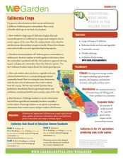
Young scholars explore agriculture by researching the native food crops of California. Students define a list of agriculture vocabulary terms and analyze maps of California which explain which foods come from which area. Young scholars...


