Curated OER
Dangerous Road: A Letter of Complaint
Engage your English learners with this resource. To begin, learners describe a map to a partner. After a vocabulary exercise and a jumbled letter activity, pupils are asked to write their own letter. The letter reading and writing...
Curated OER
Mapping The Ocean Floor
Young scholars explore and analyze the bottom structure of underwater habitats. They describe and explain what can't see through the collection and correlation of accurate data. Learners assess that technology is utilized as a tool for...
Curated OER
OPEC and the Energy Crisis
Learners color the Middle East Nations of OPEC on outline maps. They discuss and watch a video about the United States reliance on oil producing nations of the Middle East. They participate in a discussion of the problems of the gas...
Curated OER
The East Fork Project
Students identify possible sources of health risks, types of exposures, routes of exposure, and populations that could be affected after discussing water pollution and environmental health hazards. After discussion, students conduct a...
Curated OER
Finding Their New World
First graders place stickers on maps indicating their understanding of the cardinal directions. They locate Jamestown, England, the Atlantic, and Virginia.
Curated OER
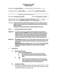
Compass Rose: Dance and Quilt
Fourth graders identify the cardinal directions by listening to a song entitled, "Stand," and by reviewing the lyrics to that song. They notice the cardinal directions that are posted around the classroom. They perform the motions as...
Curated OER
Theatre Lesson Plan: Finding Your Way
Second graders identify story elements in familiar stories from their lives. In this story elements lesson, 2nd graders act out familiar activities by following directions. Students read a story and discuss the story elements....
Curated OER
Natural Features as a Resource
Students investigate how land and water can meet basic needs. In this natural resources lesson, students locate water features on a Landscape Picture Map and describe how water is used to meet their needs.
Curated OER
Going to the Zoo
Students choose a map and follow directions to get to the zoo. In this physical education and map skill lesson, students follow a color map to get to the zoo. Students walk, jump or use other movement skills to reach the zoo.
Curated OER
Filigree Jewelry
Young scholars describe physical and human characteristics of North Africa and the Middle East, plot on a map areas populated by nomadic people in those areas, explain importance of filigree jewelry in Arab culture, and create their own...
Curated OER
Tortoise and Hare Races
Students listen to the fable, The Tortoise and the Hare, and participate in various map skill activities. They manipulate magnetic tortoises and hares on metal cookie sheets to practice direction, and construct racing tortoises out of...
Curated OER
Following Plans
Students learn to follow a specific plan in order to do something or get somewhere. In this following directions activity, students explore key vocabulary related to following plans, complete fun activities that require attention to...
Curated OER
U.S. Geography- The Northeast
Students investigate the geography of the Northeast states. In this map skills lesson, students are shown a map of the Northeast states and identify the state names and borders. Students construct individual maps of the Northeast using...
Curated OER
Latitude and Longitude
Pupils find latitude and longitude on a map or atlas. They create maps with a cruise route. They practice plotting locations given latitiude and longitude.
Curated OER
Quarters from the Coast
Learners discuss Fifty State Quarters Program, compare and contrast location of land and water on map of United States, while also becoming aware of physical shape of nation and home state, and explore coastal areas in United States.
Curated OER
The Amazing PE Race
Students utilize map reading skills, perform locomotor movements, and practice skills as they make their way through the Amazing PE Race. They use a map of school grounds to collect clues around the building.
Curated OER
Where Am I?
Pupils apply map reading skills by locating places through the use of latitude and longitude.
Curated OER
Going, Going, Ghost
Third graders research ghost towns. In this geography lesson, 3rd graders locate ghost towns on a map and choose one location to research. Students construct a research paper and present it to the class.
Curated OER
European Agriculture
Students make inferences on how physical geography affected the development of early civilizations and come up with solutions to global issues. In this physical geography lesson plan, students compare maps of the past to maps of today to...
Curated OER
Using Map Skills
Third graders study maps. In this U.S. geography lesson, 3rd graders explore directions on a compass rose and use a map scale to determine distances between two points on a map. They listen to a lecture and use their own maps to practice...
Code.org
The Need for DNS
That's one complicated address book! To understand the need for a system that keeps track of addresses, pupils trying to find the IP address of their classmates. Then individuals change their IP addresses, which leads to research...
Curated OER
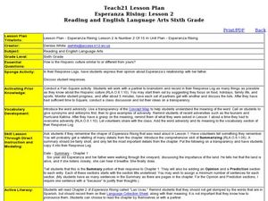
Esperanza Rising: Lesson 2
Sixth graders explore adversity. In this summarizing lesson students compare their culture to the Hispanic culture. Students reflect on a time they were met with adversity. Students summarize Chapter 1 of Esperanza Rising.
K12 Reader
Pronouns as Indirect Objects
Pronouns used as indirect objects are the focus of this short worksheet that asks learners to fill in the correct pronoun.
Curated OER
Neighborhood Map Machine
Second graders study building placements in a neighborhood. They discuss businesses, roads, houses, rivers, police/fire stations, and use Neighborhood Map Machine to create a new map. They complete an exploratory map and community of...


