Curated OER
In Great Demand
Focusing on supply and demand, learners discuss economic principles in this lesson related to Wisconsin. After discussing supply and demand, learners answer questions related to a pizza parlor. They talk about profit, as well as other...
EngageNY
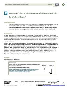
What Are Similarity Transformations, and Why Do We Need Them?
It's time for your young artists to shine! Learners examine images to determine possible similarity transformations. They then provide a sequence of transformations that map one image to the next, or give an explanation why it is...
Curated OER
ESOL Government and Commmunity Resources
Students study vocabulary words associated with community services. They label each community service on an index card and match a phrase with the service. They identify community service buildings in the area on a local map.
Curated OER
A Thoreau Look at Our Environment
Sixth graders write journal entries o school site at least once during each season, including sketched and written observations of present environment. They can use sample topographical maps and student's own maps. Students can use...
Curated OER
A Place Called Fairfax
Students use maps to locate Virginia, its surrounding states and Fairfax County. Individually, they describe the absolute and relative location of the county and why it is important to know both. As a class, they brainstorm the...
Curated OER
A Place Called Fairfax
Pupils are introduced to the various types of maps of Fairfax County, Virginia. Using the maps, they explain the relative and absolute locations of the county and discuss the importance of both. They also discover how the county is...
Curated OER
Beyond the Tap
Learners explain the basic properties of a watershed including how water flows from higher to lower elevations and how watersheds are interconnected. They comprehend how the placement of buildings, roads, and parking lots can be...
Curated OER
Tracing Our Own Family Pilgrimages
Pupils observe a world map and are introduced to vocabulary like: cities, continents, rivers, lakes, and oceans. They discuss the names of the cities they live in and locate them on the map; then using a colored pushpin indicate: the...
Curated OER
What is Biology?
For this human needs worksheet, students review a graphic organizer explaining the basic human needs. Then students complete 1 true or false and 2 short answer questions.
Curated OER
Cartography
Students follow directions to draw a map of an island. They complete the island map adding their own details using symbols and a legend.
Curated OER
Voyage to the New World
Third graders investigate the history of North America by creating a map. In this world geography lesson, 3rd graders analyze the voyage Christopher Columbus took to arrive at the new world by creating a map of his...
Curated OER
Cross Section and Slope
Students draw cross sections of given contour maps. In this math instructional activity, students interpret the different symbols used in the map. They determine slope and steepness through direct measurement.
Curated OER
Comparing Distances
Students practice estimating distances by analyzing a map. In this length measurement lesson, students view a map with a distance key and use their measurement skills to estimate the distance between two cities. Students utilize an...
Curated OER
Mother's Day Flowers
Students complete a circle map describing why they love their mom and use a flower template to type the ways. Then they insert a digital picture into the center of the flower. The flowers are then printed out and given to their mothers...
Curated OER
Cows That Type Friendly Letters
Students engage in a lesson that introduces the parts of a letter. The lesson is taught using a powerpoint presentation with the purpose of integrating technology into instruction. Students create a letter and thinking map to challenge...
Curated OER
Touring the Regions of the United States
Fifth graders explore the regions of the United States. In this geography skills lesson, 5th graders examine the landforms, climates, and economies of the regions of the United States. Students conduct Internet research in order to...
Curated OER
Catch Me If You Can: Over and Under
Students read a story. In this vocabulary skills lesson plan, students read The Gingerbread Man, use flannel cut outs to re-enact the gingerbread man running over and under.
Curated OER
Spherical Geometry: A Global Perspective
Students investigate spherical geometry using a globe and an apple. In this spherical geometry lesson plan, students translate Euclidean geometry terms to spherical geometry terms using a globe. They answer 3 questions about spherical...
Curated OER
African Country Study and PowerPoint Presentation
Students investigate the geography of Africa. In this African culture lesson, students research the lifestyles of African residents and create a PowerPoint presentation based on a single African country. Students share their...
Curated OER
Using Maps To Make Public Health Decisions Case Study: Wildfires in Mexico 2000
Students study environmental health. Using actual NOAA satellite imagery, students investigate the basic concepts of mapping. They explore the relationship between monitoring satellite images and public health decision making.
Curated OER
Mapping With MapPoint
The class is engaged through a discussion of mapping. They determine what they believe makes a good map and what the essential elements of a map are. Students work independently to complete a worksheet on mapping. They follow clear...
Curated OER
Where in the World War? Mapping WWII in the Pacific
Students study the geography of the Pacific theater of World War II. They study maps to examine the geography and features of the land.
Curated OER
ESOL Necessary Skills
Students view flash cards with basic vocabulary pictures on them and match them to the vocabulary words. They cut the pictures apart and glue the words on the back. They play concentration with a partner matching the word with the...
Curated OER
The Lincoln-Douglas Debates of 1858: Interactive Map Activity
Students utilize an interactive map to explore the 1858 Senate campaign in Illinois. They examine how factors such as population, transportation, and party strongholds can affect campaign strategies. Students write an essay discussing...
Other popular searches
- Basic Map Skills Worksheets
- Basic Map Skills Boston
- Basic Map Skills Vosstown
- Hiking Basic Map Skills

