Curated OER
Learning About the Basin
Learners use watershed maps to explore the Lake Pontchartrain Basin in Louisiana. In this geography lesson, students identify important features such as elevation, vegetation, cultural, historical and land use on a map of Lake...
Curated OER
Thematic Unit on Cats
Students discover in which climates the cats of the world live in. They review the different climates of the world and use maps and globes to help them locate continents.
Curated OER
The Queen of Sheba
Students discuss various versions of the myth of The Queen of Sheba and the basic characteristics of myths. They research how different cultures interpret the story and include it in their religious beliefs. They create projects about...
Curated OER
Science: Draining the Land - the Mississippi River
Students use topographic maps to identify parts of rivers. In addition, they discover gradient and predict changes in the channels caused by variations in water flow. Other activities include sketching a river model with a new channel...
Curated OER
My Neighborhood:
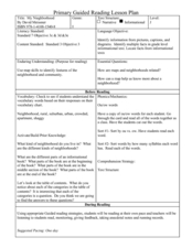
Students act as tour guides for their communities after conducting research about their neighborhoods. After conducting research, students write stories and create maps of their communities to share with classmates and community members.
Curated OER
How 9/11 Shaped U.S. Foreign Policy
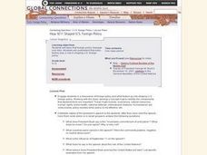
Students discuss the U.S. foreign policy and the components they consider important. They read and discuss President George W. Bush's speech of November 10, 2001. Students locate and mark countries President Bush identified in his speech...
Curated OER
Sending Messages, Then and Now
Students analyze how patriots created ways to communicate during the Revolutionary War. After reading about and discussing ways patriots communicated, students create a chart analyzing the way messages are sent today with the way...
Curated OER
Stitching Truth Lesson Two: The Arpilleristas in Pinochet's Chile
High schoolers analyze arpilleras. In this Chilean history instructional activity, students examine social justice issues as they read and interpret arpilleras. High schoolers study the tapestries to learn about Augusto Pinochet and his...
Curated OER
The Geography of the Philippines
High schoolers examine the geographic features and population distribution of the Philippines. They analyze maps, take a quiz, define monsoon, and discuss how the people in the Philippines have adapted to their environment.
Curated OER
"Pass the Potatoes" (But, where did they come from?)
Eighth graders explore various cultures around the world. For this cultural lesson, 8th graders prepare foods that belong to different cultures. Students examine the climate in the places of origin of their foods using a...
Curated OER
From Above
Students use maps and other geographic representations, tools, and technologies to acquire and report information from a spacial perspective.
Curated OER
Journey to Japan: An Elementary Geography Standards-Based Unit on Japan
Second graders compare and contrast Japanese customs and culture to those of Americans through research in this year long study. They determine the basic needs of all people in spite of cultural differences.
Curated OER
Wacky Web Tales
Students study the parts of speech and then review them. They identify each part of speech and place them on a tree map. Then they visit a website to create a "Wacky Web Tale" using information from the tree map. They print their tales...
Curated OER
Friends in the Community
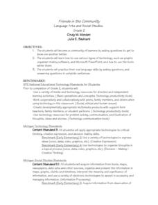
Second graders build a classroom community by getting to know each other better. They ask classmates various questions and use graphic organizer software and Microsoft PowerPoint. Students practice their oral language skills while asking...
Curated OER
Who Dropped What into the Melting Pot?
Learners show the movement of people to the United States from other countries on maps. They study the geographic cultural roots of foods that contribute to the melting pot of food in America. They research where an ingredient comes from...
Curated OER
Friends, Romans, Countrymen...
Young scholars research an important person or place from Ancient Roame and communicate their findings in a report that includes a map and illustration. Students may publish their reports online.
Curated OER
The Working of Scientists
Students define and explain the basic concepts of experimental design. In this scientific method lesson students complete a hands on activity, develop and present proposals to test their explanations.
Curated OER
Synonymous Sharks
Students locate and read an Internet article on sharks. They write a summary of the article, and complete a Concept of Definition Map using information from the article.
Curated OER
Geography of the Hill
Middle schoolers explore the basic functions of Canadian government, who is responsible for each function and where the officials associated with each function work.
Curated OER
Deciphering Community
Middle schoolers explore the concept of a community. They identify and group various kinds of communities. Students create a concept map exemplifying their membership in different communities. They write a narrative describing their...
Curated OER
Introduction to World Religions - Christianity
Sixth graders explore Christianity. In this world religions lesson plan, 6th graders listen to a lecture about the attributes of the religion and then listen to and then conduct independent research on Christianity. Students also...
Curated OER
Five Themes of Geography and Current Events
Basically, pupils look for a current world event from a reputable source and identify the five themes of geography within it. Throughout the school year, they keep a notebook of these current events. A grading guideline is outlined, and...
Curated OER
Lesson on Superlatives
Students practice basic Internet navigation skills, find and summarize information on a Web site, and explore tenement life in the 19th and early 20th Century.
Curated OER
Earthquakes And Volcanoes
Students investigate the concept of plate tectonics through focusing a research study upon the occurrence of earthquakes and volcanic eruptions. They find information that is used for class discussion. Students complete a mapping of...
Other popular searches
- Basic Map Skills Worksheets
- Basic Map Skills Boston
- Basic Map Skills Vosstown
- Hiking Basic Map Skills


