Curated OER
Where in the World Is Mexico?
Learners practice map-reading skills as they locate Mexico and its cities on a world map. By creating a puzzle out of a map of Mexico, students engage in a meaningful hands-on activity to help them explore that country's geography.
NASA
Outline Maps
Don't miss this gold mine of blank maps for your next geography lesson! Regions include traditional continents such as Asia, Europe, and Africa, as well as other major world areas such as the Pacific Rim and the Middle East.
Curated OER
Geograophy of Mexico And Central America
Students create a chart comparing the terrain, climate, economy, environmental issues and natural disasters for Mexico and the Central American countries. They view and discuss a video on the region then compile research on the internet.
Curated OER
Mexico Map
In this blank outline map worksheet, students study the political boundaries of the North American country of Mexico. This map may be used in a variety of classroom activities.
Curated OER
Mexico Map
In this blank outline map worksheet, students study the political boundaries of the North American country of Mexico. The capital cities of each state are denoted with stars.
Curated OER
Mexico Outline Map 2
In this outline map worksheet, students discover and investigate the North American country of Mexico. This blank outline map may be used for a variety of classroom activities.
Curated OER
Mexico and Central America Map
In this blank outline map activity, students study the political boundaries of Mexico and Central America. Each of the counties is labeled and the capital cities are starred.
Curated OER
Mapping Mexico
In this Mexico map activity, students label features and places on a blank map of Mexico. A reference web site is given for additional activities.
Curated OER
Do You Know Your 50 States?
Learners use the names and abbreviations of the 50 states to label a blank map of the United States.
Curated OER
Reading a Map
Third graders become familiar with the vocabulary and skills related to mapping. In this guided reading instructional activity, 3rd graders find proper nouns on from the map. Students read Goldilocks. ...
Curated OER
Mexico History Worksheet
In this Mexico history worksheet, students examine a map of the states in Mexico and a blank timeline from 3000BC to the future. There are primary lines provided to write on, but no student directions.
Curated OER
Identifying Border States of the U.S.
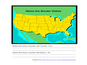
For this identifying border states of the U.S. worksheet, 3rd graders visually identify then write the names of the states that border Canada and Mexico; page 1 is a lesson, page 2 is the worksheet.
Curated OER
State to State Scavenger Hunt
In this states activity, students utilize the Internet to access one specific website to locate the answers to five fill in the blank statements about the states found on a United States map.
Bismarck Public Schools
Chapter 9 Review WKST
Here is a traditional multiple-choice, true/false, and fill-in-the-blank assessment on the presidency of James Monroe in the United States. It was designed to supplement a particular textbook chapter, but could be used to assess learning...
Curated OER
The First North Americans
Students identify and interpret the different North American Indian groups, by region, and the type and impact of their interaction with Europeans.
Then they complete an overview of one main Native American group during the age of...
Curated OER
Predicting the Route of the Monarch's Spring Migration
Pupils consider the habits of the monarch butterfly and predict the path it take as it migrates in the spring.
Curated OER
Worksheet 7: Prepositions of Place
In this vocabulary skills worksheet, students read 8 sentences and fill in the blanks in each of the sentences with the appropriate prepositions listed as possible answers.
Curated OER
Gray Whales on the Move
Middle schoolers study whale migration and their natural history. In this migration instructional activity students plot whale migration on a map and describe their ecosystems.
Curated OER
Old Man River
Learners place the four reservoirs of the Kansas-Lower Republican Basin correctly on a map adding creeks and rivers flowing into them. Students explain uses for the reservoirs.
Scholastic
Perfect Postcards: California
It's time to hear about some adventures in travel! The Transcontinental Railroad changed life and travel in the United States during the 1800s. Practicing online research skills, pupils discover the features they would like to visit on...
Curated OER
The Mesoamerican Mystique
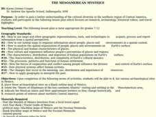
Students gain a better understanding of the cultural diversity in the northern region of Central America. They engage in a lesson which focuses on research, archaeology, historical videos, and travel highlights.
Curated OER
THE MESOAMERICAN MYSTIQUE
Students research, archeology, historical videos, and travel highlights in the northern region of Central America. They identify the various archaeological / historical sites along with a date of probable existence and the title of the...
Curated OER
Worksheet 7: Prepositions of Place
ESL learners answer 8 multiple choice questions by choosing the correct preposition of place to describe the corresponding picture. This worksheet could be used as practice following a lesson on prepositions of place.
Curated OER
Talking About Our Native Countries
Twelfth graders give oral presentations about their native countries. They compile lists of questions to ask fellow students about their native countries. They respond to the questions during their presentations.


