Curated OER
"Label Me" Texas Map
For this Texas map worksheet, students research, label and discuss the top ten major cities in Texas on a map, label the physical attributes and identify the surrounding states around Texas.
Curated OER
State to State Scavenger Hunt
In this states activity, students utilize the Internet to access one specific website to locate the answers to five fill in the blank statements about the states found on a United States map.
Curated OER
Latitude and Longitude- Online Interactive
In this maps worksheet, students learn about longitude and latitude by reading a two paragraph text and studying two maps. Students answer 9 fill in the blank questions. This is an online interactive worksheet.
Curated OER
Globe Skills Lesson 5
In this map skills worksheet, students read a text selection about locations during the American Revolution and then respond to 8 fill in the blank questions.
Curated OER
Working with Contour Maps
In this contour maps worksheet, high schoolers use contour maps to determine the slope and steepness of different land masses. This worksheet has 16 fill in the blank questions.
Curated OER
Backyard Map- Measuring with Centimeters
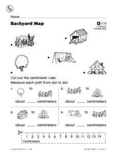
In this backyard map centimeter measurement worksheet, 1st graders cut out a centimeter ruler from the bottom of the page. They use the ruler to measure the path between objects which are pictures in the backyard map at the top of the...
Curated OER
Past Tense Verbs- Fill In the Blank
In this past tense verbs worksheet, students fill the blank lines with the correct form of the verb which is given in parentheses at the end of the sentence. They complete 30 examples.
Curated OER
M Is For Map
In this printing letter M worksheet, students trace dotted examples of upper and lower case Zaner-Bloser letter Mm. Students then use the blank primary lines to practice forming their own letters.
Curated OER
Continent of Africa
In this geography worksheet, learners examine a map of Africa and read about the characteristics of the continent. They use the map and information to answer 10 online fill in the blank questions.
Bismarck Public Schools
Chapter 9 Review WKST
Here is a traditional multiple-choice, true/false, and fill-in-the-blank assessment on the presidency of James Monroe in the United States. It was designed to supplement a particular textbook chapter, but could be used to assess learning...
Curated OER
The War of 1812
You won't find a better worksheet than this! Here is a fabulous, comprehensive test on the War of 1812. Learners complete 50 questions of a wide variety; true or false, matching, fill-in-the-blank, multiple choice, and essays. They must...
Curated OER
Barton Lake
In this lake depth worksheet, learners use a topographic map to determine the depth of the Barton Lake at various points. This worksheet has 8 fill in the blank questions.
Curated OER
World: Continents
In this blank outline map worksheet, students note the political boundaries of the continents of the world on a Robinson projection map.
Devine Educational Consultancy Services
Geography Student Workbook, Australia
Your youngsters will be experts on the geography of Australia after working with these activities and worksheets, which review the continent's weather, major landforms, dimensions, history, and climate.
Curated OER
Rivers Run Through It
In this mapping practice worksheet, 5th graders read an informational paragraph and answer 7 questions about the parts of a map along with places shown on a given map.
Curated OER
Exploring BC Through Mapping
For this mapping worksheet, students use an atlas or map to locate and label the rivers, mountains, lakes, and cities in British Columbia.
Curated OER
What´s the Weather Like in Andalusia?
In this Andalusia activity, students look at the weather map of Andalusia and fill in the blanks to sentences about the weather. Students complete 8 sentences.
Curated OER
Viewing Earth and Sky
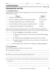
In this earth and sky worksheet, learners review terms associated with map reading. Students also review topographic maps and how contour lines represent elevation. This worksheet has 5 matching, 5 true or false, 5 fill in the blank, and...
Curated OER
Sign a Map
In this geography worksheet, learners think and identify the different features and landforms that an explorer would come across the continent of Antarctica. They use body gestures to communicate their list of items to a partner and...
Curated OER
Canada: Name The Territory or Province
In this geography worksheet, 4th graders examine an outline map of Canada. They write the names of the 13 territories and provinces on the blank lines below the map.
Curated OER
Google Earth
In this Google Earth learning exercise, students access the Google Earth website and find the latitude, longitude, and elevation for their house and school. Then they do the same for a variety of world locations. This learning exercise...
Curated OER
Story Grammar Recording Worksheet
In this story grammar recording worksheet, student fill in the blanks with the title, author, setting, main characters, conflicts, and events of a story in order. They write a paragraph describing the conclusion.
Curated OER
Renaissance and Reformation Chapter Test
This is a traditional textbook chapter test on the Renaissance and Reformation, complete with eight multiple choice questions, six fill-in-the-blank, and a 10-question matching section identifying key individuals and terms from the...
Curated OER
High Frequency and Spelling Words: 6
Your can use this spelling and high frequency word daily activity worksheet as part of your regular morning schedule. Learners ay the name of the pictures, write sentences, fill in the blanks, and read a story. There are 4 activities to...
Other popular searches
- Blank Maps of Europe
- Middle East Maps Blank
- Blank Maps of World
- European Cities Blank Maps
- Blank Outline Maps Americas
- Blank Outline Maps China
- Blank Maps of Canada
- Blank Outline Maps Europe
- Blank Maps of Eurasia
- Ww Ii Blank Maps
- Ohio Blank Outline Maps
- Blank Maps of Europerating=3


