Curated OER
Populations in the Path of Natural Hazards
Students read "Geographical Mobility: 1995-2000." They examine the maps in the handouts and compare them with maps from an atlas. In the second part of this lesson, students read "In Harm's Way." They receive three more handouts, one a...
Curated OER
Settling the Plymouth Colony
Students label blank maps with the names of the New England Colonies. They explain the difficulties that the Pilgrims had and how hard they worked to survive in Plymouth.
Curated OER
Mapping the Middle East
Students examine how the countries of the Middle East were created. They explore the influence of various political and geographic factors in their creation. They list the things they should consider in deciding how to draw new borders...
Curated OER
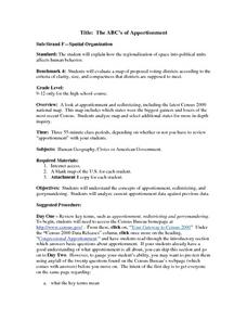
The ABC's of Apportionment
Students are introduced to the terms of apportionment and redistricting. Using a Census map, they identify the states that had the highest and lowest numbers of change during the past ten years. They examine a map of voting districts and...
Curated OER
Baseball in Korea
Seventh graders explore the origins of baseball. In this Geography lesson, 7th graders compare Korean baseball teams with other countries. Students create a map of all the baseball teams around the world.
Curated OER
The African Slave Trade: From West Africa to South Carolina and Beyond
Eighth graders explore the African slave trade. They identify the principal figures practicing the African slave trades at three locations. Students draw the physical routes of the slave trade on a map and they list the reasons for the...
Curated OER
Culture Regions of the U.S.
Students identify the location of different cultural groups within the United States (agricultural, retirement, urban, etc.) They map these areas and analyze the correlation between the landscape of a given region and the type of...
Curated OER
Mapping Martin Luther King Jr.
Young scholars examine geographic locations that were important in Martin Luther King Jr.'s life. They research Martin Luther King Jr., and create U.S. maps that show the locations important to him.
Curated OER
Combining Geography and Literature by Mapping a Story
Learners listen to or read a story on their own. Using the text, they describe the relative locations of the main events. In groups, they develop two and three dimensional maps of the story. They create a key and a title for their map.
Curated OER
Mapas Bailados: Creating Visual Representations of Dances Using Maps
Third graders listen to "Frank the Monster..." and discuss the dance map on the inside cover of the book. They create their own dance map using sentence strips to record the types of movement.
Curated OER
Media Center Map Skills
Student demonstrates the ability to locate, retrieve, and handle media and equipment by utilizing the library media center floor plan, symbols, and guides. They then use systems of classification to identify, locate, and retrieve materials.
Federal Reserve Bank
Messy Bessey's Holidays
Teach your class some fairly complex terms—factors of production, human resources, capital resources, natural resources, and intermediate goods—with a storybook (Messy Bessey's Holidays), plenty of visuals and handouts, and related...
Curated OER
World Cities of 5 Million or More
Students consult online resources to identify and map the world's largest cities and metropolitan areas. They analyze birth rates, settlement patterns and other demographic data and make predictions for the future. They write essays...
Curated OER
Weather Reporting
Students locate a weather map on the internet and explain or predict the weather for the following day. Students interpret the information on the weather map and pick the correct clothing to wear for that day. Students chart and graph...
Curated OER
Volcano Contour Models Activity and Tracing the Highs and Lows in San Francisco
Pupils investigate how to draw topographic contours and read topographic maps.They examine the topography of San Francisco and contrast the elevation of different points within San Francisco.
Curated OER
U.S. History: de Soto's Alternate Route
Eighth graders examine various maps associated with Hernando de Soto's expedition. By comparing their textbook maps with newer maps, they answer a battery of focus questions. Using Microsoft Word, 8th graders answer the questions...
Curated OER
Gift of the Magi
While reading O Henry's "The Gift of the Magi," your class will define and identify situational irony and allusion. Use a study guide (not included, but easy to produce) to record and discuss examples of allusion as you read. Map the...
Curated OER
European Integration: Who and Why?
This French IV-V lesson addresses European integration into the European Union. French language learners research, discuss, and present in the target language. Online research, discussion, and presentations will take approximately 5-7...
Curated OER
League of Nations
Ninth graders examine the purposes and mandate system of the League of Nations. They watch a PowerPoint presentation on the mandate system and complete a fill-in-the-blank worksheet, and participate in a "pick your side" activity.
Curated OER
Hemispheres & Continents
Students learn in cooperative learning groups to determine how the equator and the Prime Meridian divide the earth into hemispheres and use Venn diagrams. Students will locate and label the hemispheres, continents, and oceans.
Curated OER
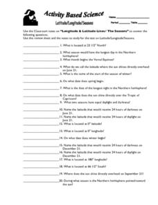
Latitude, Longitude, Seasons
In this latitude and longitude worksheet, students use their classroom notes on both longitude and latitude lines as well as seasons to complete 20 fill in the blank questions.
Curated OER
Physical Geography of Africa
Fifth graders investigate the topography of Africa. In this physical geography lesson, 5th graders research the six regions of Africa and complete a physical map. Students locate various landforms in Africa. Students...
Curated OER
Great Cities of the Middle East
Students explore the cities of Cairo, Istanbul, Jerusalem, Mecca and Tehran. For this Middle East lesson plan, students complete a map, research one of the five the cities and prepare a presentation that includes details about the...
Curated OER
Around the World in 5 Days
Learners explore continents, draw map, discuss cultures, use research to learn geography, and investigate cultures.


