Curated OER
Mapping China
Students identify cities in China on a map. In this map skills instructional activity, students locate the continent of Asia and the country of China. Students use a blank map to label China and bordering countries.
Curated OER
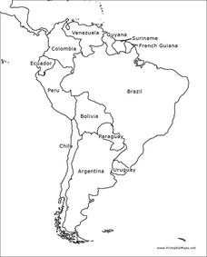
South America Map
In this South America learning exercise, students view a blank map of South America that they can color or label. Students do this for all the countries in South America.
Super Teacher Worksheets
United States of America
Here is the perfect assessment to test your young learners on labeling the 50 states! Each state is given a number on a blank map of the United States, and a second page lists the numbers in order for learners to identify.
Curated OER
Map Memory
Fifth graders, working in a whole class setting, label a United States map with the names of all the states that they know. They transfer the names of the states to an individual map and color it. Next, they receive directions on how to...
Curated OER
The Roman Empire-Map Activity
In this Roman Empire worksheet, students complete a map activity in which they label and color civilizations, countries and physical features as instructed. There are no maps included.
Curated OER
Mapping Your State's Role in the Vietnam War
Learners recognize reasons to celebrate Memorial Day. Students create a map of victims of the VIetnam War. Using the internet, learners research information about soldiers from their state who were killd in action in Vietnam. Students...
Curated OER
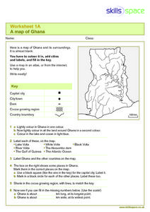
A Map of Ghana
In this Map of Ghana worksheet, students are given a blank map and key. They are told to label major features and color according to directions.
Curated OER
Blank US Map
In this blank outline map worksheet, students study the physical boundaries of the 50 states that make the United States. This outline map may be used for a variety of geographic activities.
Curated OER
United States Map
Students describe cities they are familiar with. In this United States Map instructional activity, students understand how cities are listed on a map. Students become aware of a map legend and the information in it.
Curated OER
United States Map- State Capitals
Students explore map skills. In this state capital lesson, students view a United States Political Map and identify and use post-it notes to label the state capitals.
Curated OER
Denmark Outline Map
In this blank outline map worksheet, learners explore the political boundaries of Denmark located in Europe. This map may be used in a variety of classroom activities.
Curated OER
Spain Outline Map
In this blank outline map worksheet, students explore the political boundaries of Spain located in Europe. This map may be used in a variety of classroom activities.
Curated OER
Map of Germany
In this map worksheet, pupils can color and label a blank map of Germany. This map show Germany and it's surrounding neighbors.
Curated OER
Learn the States and Postal Abbreviations
If you are preparing to cover the 50 states with your class, you don't want to miss this resource. It includes an excellent set of worksheets through which learners practice identifying states from their abbreviations and placing those...
Curated OER
Blank Europe Outline Map
In this blank outline map learning exercise, students explore the political boundaries of the continent of Europe and those of the countries located there. This map may be used in a variety of classroom activities.
Curated OER
Blank Europe Outline Map 2
In this blank outline map worksheet, students explore the political boundaries of the continent of Europe and those of the countries located there. This map may be used in a variety of classroom activities.
Curated OER
Africa Map
For this blank Africa map worksheet, students investigate the continent of Africa and it's political boundaries. No country borders are denoted.
Curated OER
Map Keys
Third graders examine maps and map keys. In this locating map features lesson, 3rd graders use crayons, markers and colored pencils to label maps. Students work in partners to read map keys and locate given places and things.
Curated OER
Canada Outline Map: Labeled
In this blank outline map worksheet, students study the political boundaries of the North American country of Canada as well as those of the provinces located there. This map is labeled.
Curated OER
Mexico Map
In this blank outline map worksheet, students study the political boundaries of the North American country of Mexico. This map may be used in a variety of classroom activities.
Curated OER
Mexico Outline Map 2
In this outline map worksheet, students discover and investigate the North American country of Mexico. This blank outline map may be used for a variety of classroom activities.
Curated OER
South America Outline Map
In this blank outline map worksheet, students explore the political boundaries of South America and the nations there. This map may be used in a variety of classroom activities. The map is labeled with the country names.
Curated OER
South America Outline Map
In this blank outline map learning exercise, students explore the political boundaries of South America and the nations there. This map may be used in a variety of classroom activities. The location of the capital cities are...
Curated OER
New York: Agricultural Products Maps
In this agricultural products worksheet, 4th graders use the information on four maps of New York Agriculture to make a comprehensive map of all products and answer four questions.


