Curated OER
On the Street Where You Live: Online Mapping
Students access the Internet and use Google Maps to pinpoint their home address and get directions to and from school. they write the directions in paragraph format.
Curated OER
The Global Grapefruit - Representing a 3-Dimensional Globe on a 2-Dimensional Map
Students compare and contrast world maps and globes. They convert a 3-dimensional globe to a 2-dimensional map. They are introduced to the Mercator map projection. They observe map distortions of shape, area, distance, directions and angle.
Curated OER
Geography: Mapping Newspaper Coverage
Learners examine the locations of stories appearing in newspapers and determine where to assign reporters. Using various maps, they connect the stories to the correct maps and create charts of the story locations. Students explain their...
Curated OER
Your Galactic Address
Students discover their place in the universe. In this astronomy lesson, students identify their location on various maps that have increasingly larger scales. In the end, the students write their address in terms of their...
Curated OER
Schoolyard Geology
Discover that maps show information about an area and that they have common features like scales and legends. View an aerial map of your school and find features on the map such as the playground, roads, and trees. Trace the outline of...
Curated OER
School Neighborhood Walking Tour
Young scholars list specific boundaries in their school neighborhood and explain their possible purpose. They examine a neighborhood and see what connects us and what divides us. They, in groups, make maps of various neighborhoods and...
Curated OER
Saudi Arabia -- Future city
Seventh graders summarize an article on Masdar. For this summarizing lesson students clearly explain three of the four points provided in an outline of the article. The students write an essay and identify six physical features of the...
Curated OER
Geographic Regions of Arkansas
Students examine maps that illustrate the various regions in Arkansas. They label the individual regions on a blank map that is divided into the regions and color each region a different color. Groups research a region and create a...
Curated OER
The Early History of Haiti
Seventh graders make list of places Columbus explored on his first journey to Americas, locate island of Hispaniola on map, examine groups of people who have inhabited island, complete blank map and key of Hispaniola, and research early...
Curated OER
Coordinate Seating: Using a Coordinate System
Fourth graders discover coordinate systems. In this mapping lesson, 4th graders create a coordinate system for theater seating. Students observe a video based on a theater's seating map.
Curated OER
Majority Rules
Students color code a map of the United States and label the amount of Electoral votes each state has. In this Electoral College lesson plan, students conduct a vote of their own.
Curated OER
Philosophy of Social Studies Education
Learn how to distinguish between curriculum and instruction. Utilize concept mapping strategies to organize a philosophy of elementary social studies education. Your class will be able to explain the process they underwent to organize...
California Academy of Science
Pollution in Our Watershed
The concept of a how pesticides and other chemicals pass through a watershed can be difficult for younger learners to grasp without a concrete example. In the activity here, some blank paper, markers, and a spray bottle are all you need...
Global Oneness Project
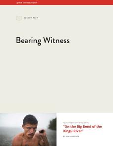
Bearing Witness
A controversial construction project in South America, the Belo Monte dam, is endangering local cultures, ecosystems, and communities. High schoolers create a concept map based on an online article they read before engaging in...
Curated OER
Move Around the Map
Fourth graders, while working with a partner, label and identify on a tarp map six major cities and five major rivers in Indiana. They traverse along the rivers utilizing a different locomotor skill (hop, skip, walk, run, leap, gallop,...
Curated OER
Zones of Conflict
Students read maps and identify specific countries involved in conflict. They classify countries in cultural realms. They relate maps to what they know about world conflict.
Curated OER
The History of the Pencil
Students research and write about the pencil. They organize the research using concept maps and write an essay using the writing process.
Curated OER
Where In the World Are You?
Fourth graders fill in blank copies of the United States Map and then the World Map.
Curated OER
Growing a Literature Tree
Third graders use prior knowledge of fairy tales and fables to create a literature tree map. They categorize literature as fiction or nonfiction and use bubble maps to show features.
Curated OER
Continents and Oceans on the Move
Students create an awareness of the vast percentage of water covering the earth. They relate similarities/differences between topographical maps and other maps of various time periods. Students examine how to use a topographical map.
Curated OER
Let's Play Geography Twister
Pupils practice geography skills by playing a game based on Twister. Students manipulate their position on a map by placing their arms and legs on the appropriate state or country called out by the teacher.
Curated OER
Watershed
Students study watersheds and use topo maps to help explore where they are located. In this watershed lesson students delineate their watershed on their own.
Curated OER
Treasure Hunt!
Learners follow directions on a worksheet to follow directions on a map of the United States and Territories of the United States. In this directions worksheet, students use a compass rose and learn the directions.
Curated OER
Where Should We Put a Store?
Students analyze population data. They convert population data into simple density maps to help make decisions about their world. They select the best location for a school store based on population density. They present their maps...


