Curated OER
Culture Regions of the U.S.
Students identify the location of different cultural groups within the United States (agricultural, retirement, urban, etc.) They map these areas and analyze the correlation between the landscape of a given region and the type of...
Curated OER
Mapping Martin Luther King Jr.
Young scholars examine geographic locations that were important in Martin Luther King Jr.'s life. They research Martin Luther King Jr., and create U.S. maps that show the locations important to him.
Curated OER
Combining Geography and Literature by Mapping a Story
Learners listen to or read a story on their own. Using the text, they describe the relative locations of the main events. In groups, they develop two and three dimensional maps of the story. They create a key and a title for their map.
Curated OER
Sign a Map
For this geography worksheet, students think and identify the different features and landforms that an explorer would come across the continent of Antarctica. They use body gestures to communicate their list of items to a partner and...
Curated OER
Canada: Name The Territory or Province
In this geography worksheet, 4th graders examine an outline map of Canada. They write the names of the 13 territories and provinces on the blank lines below the map.
Curated OER
Media Center Map Skills
Student demonstrates the ability to locate, retrieve, and handle media and equipment by utilizing the library media center floor plan, symbols, and guides. They then use systems of classification to identify, locate, and retrieve materials.
Federal Reserve Bank
Messy Bessey's Holidays
Teach your class some fairly complex terms—factors of production, human resources, capital resources, natural resources, and intermediate goods—with a storybook (Messy Bessey's Holidays), plenty of visuals and handouts, and related...
Curated OER
World Cities of 5 Million or More
Students consult online resources to identify and map the world's largest cities and metropolitan areas. They analyze birth rates, settlement patterns and other demographic data and make predictions for the future. They write essays...
Curated OER
Renaissance and Reformation Chapter Test
This is a traditional textbook chapter test on the Renaissance and Reformation, complete with eight multiple choice questions, six fill-in-the-blank, and a 10-question matching section identifying key individuals and terms from the...
Curated OER
U.S. History: de Soto's Alternate Route
Eighth graders examine various maps associated with Hernando de Soto's expedition. By comparing their textbook maps with newer maps, they answer a battery of focus questions. Using Microsoft Word, 8th graders answer the questions...
Curated OER
League of Nations
Ninth graders examine the purposes and mandate system of the League of Nations. They watch a PowerPoint presentation on the mandate system and complete a fill-in-the-blank worksheet, and participate in a "pick your side" activity.
Curated OER
Hemispheres & Continents
Students learn in cooperative learning groups to determine how the equator and the Prime Meridian divide the earth into hemispheres and use Venn diagrams. Students will locate and label the hemispheres, continents, and oceans.
Curated OER
Physical Geography of Africa
Fifth graders investigate the topography of Africa. In this physical geography lesson, 5th graders research the six regions of Africa and complete a physical map. Students locate various landforms in Africa. Students...
Curated OER
Great Cities of the Middle East
Students explore the cities of Cairo, Istanbul, Jerusalem, Mecca and Tehran. For this Middle East lesson plan, students complete a map, research one of the five the cities and prepare a presentation that includes details about the...
Curated OER
Around the World in 5 Days
Learners explore continents, draw map, discuss cultures, use research to learn geography, and investigate cultures.
Curated OER
The Return of the Taliban
Students view a news program from Frontline. They discover who the Taliban are and identify their locations on maps. They compare and contrast the changes in Pakistan from 2004 to 2006.
Curated OER
Seven Daughters and Seven Sons: the Middle East Through
Sixth graders read "Seven Daughters and Seven Sons" and examine aspects of Middle East culture and geography. They define vocabulary from the book and map locations described in the book.
Curated OER
Michigan Food: From Farm to You
Young scholars recognize Michigan on a map and understand how its climate is affected by the Great Lakes. In this Michigan food lesson, students play a trivia game to identify the produce of Michigan. Young scholars relate the climate in...
Curated OER
Africa Unite!
Students work in pairs to research assigned African countries. They compile their research to label a continent map of Africa, present their research to the class and design a game of trivia using their findings.
Curated OER
The 50 States and its Holidays
Though the format of this ELL lesson is confusing (the standards listed are for plate tectonics, yet the objectives are for American geography and holidays), a teacher could glean some ideas from the main idea. Here, pupils complete a...
Curated OER
Help! I Am Lost at Fox Chapel
Sixth graders create a map to locate places on campus and share the map with another student. The other students use the map to locate certain places and validate for accuracy via a checklist. The parents use the completed map at open...
Curated OER
Find the Way
Fourth graders, after discussing different places to visit and being given a map of Indiana, draw the route to his/her destination within Indiana. They tell the directions in their own words and formulate pertinent questions to ask along...
Curated OER
Lesson: Journey of a Tree
Third graders explore the operation of a Christmas farm and how trees are shipped. After taking a tour of a Christmas tree farm and researching transportation, location and cost issues, 3rd graders create a map to show the distribution...
Curated OER
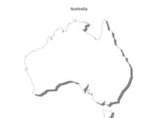
Australia
In this Australia map, students research and locate the main regions, states and important landmarks found on the map and discuss them with their classmates.


