Curated OER
The Countries of Slave Trade
Students create graphs, routes, and write an essay based on their research of the slave trade. In this slave trade lesson plan, students research the Middle Passage and how slave trade happened in the United States.
Curated OER
Mapping Martin Luther King Jr.
Young scholars examine geographic locations that were important in Martin Luther King Jr.'s life. They research Martin Luther King Jr., and create U.S. maps that show the locations important to him.
Curated OER
Unite These States
Students explore the historical events and people associated with the 13 colonies. The geographic locations of the 13 colonies and ultimately, of all 50 states are investigated.
Curated OER
Location, Location, Location!
Twelfth graders locate cities, states and countries on maps. They use the cardinal directions to locate places on maps. They describe where they were born by giving clues without naming the exact state. They trade papers and try to guess...
Curated OER
Journey of Discovery and Rivers
Learners investigate the rivers encountered and mapped by the Corps of Discovery. They analyze maps, outline and label rivers on a blank map, complete a chart, and answer discussion questions while watching a National Geographic video,...
Curated OER
Indianapolis Government
Learners read about a girl who takes a trip during the time of the State Capital moving to Indianapolis and then write their own essay about a trip that they took. In this Indianapolis Government lesson plan, students use maps and...
Curated OER
Immigration Push and Pull Factors
Eighth graders examine significant ideas, beliefs, and themes; organize patterns and events; and analyze how individuals and societies have changed over time in Maryland, the United States, and the world.
Curated OER
On the Street Where You Live: Online Mapping
Students access the Internet and use Google Maps to pinpoint their home address and get directions to and from school. they write the directions in paragraph format.
Curated OER
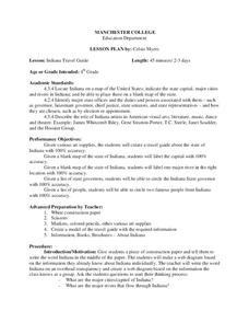
Indiana Travel Guide
Fourth graders, after exploring and researching the state of Indiana, create a travel guide about the state of Indiana including its capital, major rivers, governors and two famous people from the state. They utilize a variety of art...
Curated OER
We Found It!
First graders identify and describe landforms. They demonstrate an understanding of the compass rose and a map key using the trail of Lewis and Clark and the Corps of Discovery. They generate a map key.
Curated OER
The Original 13 Colonies and 3 Regions
Seventh graders review the content of American History and focus upon the original thirteen colonies. They also study the geography of the region. It is recommended that students have other lessons delivered on the topic prior to this one.
Curated OER
TORNADOES!
Third graders compare the parts of a real tornado with the parts of a tornado created in a demonstration, label "Tornado Alley" on their maps, and label the locations of famous tornado disasters on their maps.
Curated OER
This Land is Your Land? This Land is My Land!
Students research the various territory acquisitions in United States history and create an annotated map that tells the history of U.S. expansion. Working in small groups, students outline the land acquisitions and purchases made by...
Curated OER
Apple Logic and Problem Solving
Young scholars examine apple production in the United States. In this interdisciplinary lesson, students use problem solving strategies introduced to solve math problems associated with apple production in the United States. Student...
Curated OER
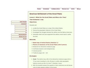
American Settlement of the Great Plains
Seventh graders examine the Great Plains. In this American settlement lesson plan, 7th graders create a map of the settled areas in the United States. Students discuss the struggle between settlers and the Native Americans.
Curated OER
People On The Move
Students describe patterns of internal migration in the United States, past and present and evaluate implications of internal migration. They examine population movement at the state and local levels.
Curated OER
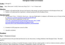
European Union Governance
Students explore the government functions of the European Union and how legislation is passed. As a class, students define the European Union and their interests in economic, political and social issues. Using the internet, students...
Curated OER
Place Names
Students investigate the meaning of various Native American names. In this Native American language lesson, students locate state names that come from Native American descriptions and mark them on a map. Students then suggest a name for...
Curated OER
Let's Play Geography Twister
Pupils practice geography skills by playing a game based on Twister. Students manipulate their position on a map by placing their arms and legs on the appropriate state or country called out by the teacher.
Curated OER
Imperialism and Expansion: Part 1
Young scholars explore the era of imperialism and expansion of the United States. In this American history lesson plan, students play a game regarding the U.S. attempts to expand the nation in the late 1800s and early 1900s.
Curated OER
God's Creation
Second graders explore religion by analyzing the state of the country. In this American creation lesson, 2nd graders read that God created the world and therefore the United States and all of the beautiful things within the country....
Curated OER
Just The Facts
Students investigate a state of choice. They conduct research looking at various important aspects of the state. The information is organized into a presentation for the class. The additional reading of target books should help students...
Curated OER
Move Around the Map
Fourth graders, while working with a partner, label and identify on a tarp map six major cities and five major rivers in Indiana. They traverse along the rivers utilizing a different locomotor skill (hop, skip, walk, run, leap, gallop,...
Curated OER
"A Pig is Big"
Students explore the concept of big, bigger, and biggest. They examine and classify items by size, listen to and discuss the book "A Pig is Big," complete a fill in the blank activity, and create a tri-fold that illustrates two items...


