Curated OER
U.S. Geography for Children
In this U.S. map activity worksheet, students observe maps of the continental United States, Hawaii, and Alaska, locate and label landforms and bodies of water, and create symbols for natural resources and places of interest. Students...
Curated OER
African Lakes, Rivers, Bays, and Seas Map Quiz
In this online interactive geography quiz worksheet, students examine the map that includes 25 African lakes, river, bays, and seas. Students match the names of the bodies of water and waterways to the...
Curated OER
Europe Seas Map Quiz
In this online interactive geography quiz worksheet, learners examine the map that includes 14 European seas. Students match the names of the bodies of water to the appropriate locations on the...
Curated OER
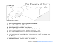
The Country of Kenya
In this map completion worksheet, learners observe a map and map scale of Kenya to find and label bodies of water, cities, countries, and the equator. Students answer 11 questions.
Curated OER
The Country of Venezuela
In this map skills of Venezuela worksheet, students use an outline map to find an label important cities landforms, and bodies of water. Students label and color code 10 answers.
Curated OER
Map of India
In this map of India activity, students label the capital city, the bodies of water and the compass points, then color the surrounding colors according to directions.
It's About Time
Energy Flow in Ecosystems
Emerging biochemists more fully understand the flow of energy in ecosystems as they explore the laws of thermodynamics and relate them to energy transfer in food chains. They also investigate heat loss from the human body and how...
Curated OER
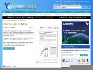
Animals Must Fit In
A instructional activity on tadpoles is here for your young biologists. Learners read a short paragraph on tadpoles, then answer three questions regarding how parts of their bodies help the tadpole to survive in the pond. There is a good...
Curated OER
Reproduction and Development
Have a sense of humor when discussing human anatomy with your class! Through puzzles and riddles, learners become comfortable with words relating to reproduction and development. They combine mixed up words from the "vocabulary gene...
Curated OER
Sponges, Cnidarians, Flatworms, and Roundworms
In this simple animals worksheet, students compare and contrast the body plans of sponges, cnidarians, flatworms, and roundworms. This worksheet has 4 short answer questions.
Curated OER
Amphibians Crossword Puzzle
In this biology worksheet, learners complete a crossword puzzle with 24 questions about different types of amphibians and functions of their body parts.
Curated OER
Europe Puzzle
For this geography worksheet, students complete a crossword puzzle in reference to the geography of Europe. They identify the capital cities of various countries and the bodies of water which surround specific countries of Europe.
Curated OER
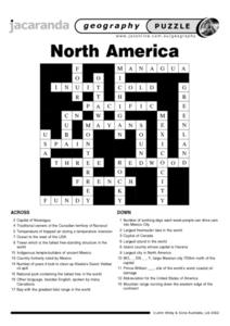
North America Puzzle Answer Sheet
In this geography worksheet, students name the capitals of various countries found in North America. They also identify the various weather patterns across the continent and specific bodies of water. There are 21 descriptions and 21...
Curated OER
Eurasia Physical Map
In this Eurasia physical map worksheet, students make note of the major landforms and bodies of water located in this world region.
Curated OER
Australia and Oceania: Physical Map
In this Australia and Oceania physical map worksheet, students make note of the major landforms and bodies of water located within this region.
Curated OER
South America: Physical Map
In this South American physical map worksheet, students make note of the major landforms and bodies of water located on the continent.
Curated OER
Europe Physical Map
In this Europe physical map worksheet, students make note of the major landforms and bodies of water located on the continent.
Curated OER
USA: Physical Map
In this United States physical map worksheet, students investigate the major landforms and bodies of water located throughout the country.
Curated OER
Americas: Physical Map
In this Americas physical map worksheet, students make note of the major landforms and bodies of water located on the North American and South American continents.
Curated OER
Southeast Asia and the South Pacific: Political
In this Southeast Asia and the South Pacific political map worksheet, students examine boundaries of each of the countries and the placement of the capital cities. The major bodies of water are labeled.
Curated OER
Africa & Asia: Physical Map
In this African and Asian physical map worksheet, learners investigate the major landforms and bodies of water located on the African and Asian continents.
Curated OER
Asia and the South Pacific : Political Map
In this Asia and the South Pacific map worksheet, students examine the boundaries of the nations in this region of the world. Students also note the location of capital cities as they are denoted by stars. Major bodies of water are labeled.
Curated OER
Map of Africa
In this Africa worksheet, students analyze a labeled map of Africa. The map shows all the countries and regions as well as the bodies of water. There are no questions to answer.
Curated OER
World Map Labels
In this geography skills worksheet, students identify the countries and bodies of water labelled on the maps of the world, Africa, Asia, Canada, Europe, the Caribbean, the Middle East, North America, Australia, and South America.
Other popular searches
- Landforms and Bodies of Water
- Major Bodies of Water
- Bodies of Water/rivers
- Bodies of Water Lesson
- Identifying Bodies of Water
- Different Bodies of Water
- Bodies of Water 101
- Water Bodies
- Bodies of Water Word Scramble
- Landforms and Water Bodies
- Earth's Bodies of Water
- Healthy Bodies Water


