White Pine Pictures
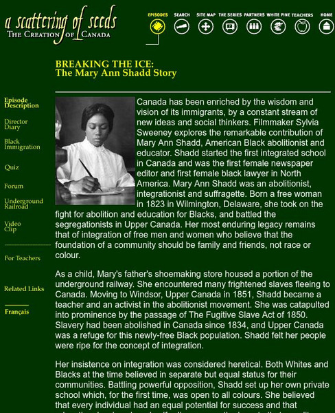
White Pine Pictures: Breaking the Ice: The Mary Ann Shadd Story
Mary Ann Shadd was born in Wilmington, Delaware in 1823. She emigrated to Windsor, Upper Canada and was a leader in advocating for integrated schools at a time when most Canadians believed segregated schools should predominate. This web...
Nature Canada
Nature Canada: Great Blue Heron
The great blue heron ranges all over North America and into the Caribbean and northern South America. Its population is healthy at this time.
Nature Canada
Nature Canada: Red Necked Phalarope
The red-necked phalarope is a shorebird that spends summers in the Arctic and northern Canada, and winters mainly south of the equator. They are found mostly in coastal waters but can also be seen in some inland waters. Facts about the...
Nature Canada
Nature Canada: Species Spotlight: Woodland Caribou
Woodland caribou are found all over Canada, except for the Maritimes where the population has disappeared. It is an endangered species in several areas of Canada. Detailed information about this species and the efforts being made to...
Nature Canada
Nature Canada: Species Spotlight: Porbeagle Shark
A fact sheet giving information about the endangered porbeagle shark, which inhabits the northwest Atlantic Ocean, in the St. Lawrence Seaway and the waters off Newfoundland. The conservation efforts being made to revive the population...
Alberta Online Encyclopedia
Alberta Online Encyclopedia: Competitive Fur Trade (1850 1900)
This encyclopedia article explains that competition in the fur trade did not end after the 1821 merger of the North West Company and Hudson's Bay Company. The Metis and other private traders were active with American trade companies....
Nature Canada
Northern Icon in Peril: Global Warming Threatens the World's Polar Bears
Did you know that Canada lists the polar bear as a, 'species of special concern.' This page provides a glimpse at how climate change is effecting polar bears in the Canadian Arctic. You will also find some basic polar bear facts: size,...
Other
Bird Studies Canada: Monitoring Short Eared Owls
The short-eared owl is a species at risk in Canada due to loss of its habitat and the resulting reduction in population. Information about this owl and the threats it faces are outlined.
Curated OER
Photograph: Hudson's Bay Company Post, Dog Head Point, Lake Winnipeg, 1884
This entry from the National Library of Canada's presentation on Canadian Confederation, looks at the 1870 inclusion of Manitoba. Built from the North-Western Territory, the province was founded by Metis, Francophones from Lower Canada,...
Curated OER
Educational Technology Clearinghouse: Maps Etc: Newfoundland, 1903
A map from 1903 of the Canadian province of Newfoundland, showing cities, towns and ports, railways, lakes, rivers, and coastal features, as well as the coastal districts of White Bay, Bonne Bay, Bay of Exploits, Bonavista Bay, St....
Curated OER
Educational Technology Clearinghouse: Maps Etc: Settled Ontario, 1920
A map from 1920 showing the most populous portions of the Canadian provinces of Ontario and Quebec along the Great Lakes and St. Lawrence River. The map shows major cities and towns, railways, lakes, and rivers in the area.
Curated OER
Etc: Maps Etc: Distribution of Ethnicities in the United States, 1900
A map from 1907 of the United States showing concentrations and distribution of various European ethnic groups in 1900. The map is color-coded to show foreign populations where 8 percent or more of the inhabitants are Scandinavian,...
Curated OER
Etc: Maps Etc: Distribution of European Races in the United States, 1900
A map from 1920 of the United States showing concentrations and distribution of various European ethnic groups in 1900. The map is color-coded to show foreign populations where 8 percent or more of the inhabitants are Scandinavian,...


