Curated OER
Educational Technology Clearinghouse: Maps Etc: North America, 1897
A map from 1897 of North America, Central America, and the Caribbean showing national boundaries, major cities, terrain and coastal features, including mountain systems, basins, plains, lakes, and rivers.
Curated OER
Educational Technology Clearinghouse: Maps Etc: North America, 1920
A map from 1920 of North America, Central America, and Caribbean showing political boundaries, major cities, railroads, steamship routes with distances between major ports given, rivers, and coastal features.
Curated OER
Educational Technology Clearinghouse: Maps Etc: North America, 1904
A map from 1904 of North America, Central America, Greenland, and the Caribbean showing political boundaries at the time, capitals and major cities, mountain systems, lakes, rivers, and coastal features of the region.
Curated OER
Educational Technology Clearinghouse: Maps Etc: North America, 1916
A map from 1916 of North America, Central America, Greenland, and the Caribbean to Puerto Rico showing the political borders at the time, capitals and major cities, existing and proposed railroads, rivers, and coastal features.
Curated OER
Educational Technology Clearinghouse: Maps Etc: North America, 1912
A map from 1912 of North America, Central America, Greenland, and the Caribbean showing political boundaries at the time, capitals and major cities, railroads, mountain systems, lakes, rivers, and coastal features of the region.
Curated OER
Educational Technology Clearinghouse: Maps Etc: North America, 1885
A map from 1885 of North America, Central America, Greenland, and the Caribbean showing political boundaries at the time, major cities, mountain systems, lakes, rivers, and coastal features of the region. Ship routes from San Francisco...
Curated OER
Educational Technology Clearinghouse: Maps Etc: Relief of North America, 1872
A base relief map from 1872 of North America, Central America, Greenland, and the Caribbean to Puerto Rico showing the general mountain systems, highlands, and plains of the region. Major river systems are shown.
Curated OER
Educational Technology Clearinghouse: Maps Etc: Relief of North America, 1909
A base relief map from 1909 of North America, Central America, Greenland, and the Caribbean to Puerto Rico showing the general mountain systems, highlands, and plains of the region. Major river systems are shown.
Curated OER
Etc: Maps Etc: North American Vegetation Regions, 1901
A map from 1901 of North America, Central America, Greenland, and the Caribbean to Puerto Rico showing the general vegetation regions. The map shows areas of deserts, tundras, and ice fields, areas of grassy lands, areas of open forests,...
Curated OER
Etc: Maps Etc: North American Population Density, 1910
A map from 1910 of North America, Central America, Greenland and the Caribbean showing population density distribution in the region at the time. The map is coded to show areas of population densities ranging from less than 1 inhabitant...
Curated OER
Educational Technology Clearinghouse: Maps Etc: North America, 1915
North America including Canada, the United States, Mexico, Caribbean islands, Central America and a portion of South America, showing physical features.
Curated OER
Educational Technology Clearinghouse: Maps Etc: North America, 1909
North America, with Central America included.
Curated OER
Educational Technology Clearinghouse: Maps Etc: Cuba and Mexico, 1903
A map from 1903 of Cuba, Isle of Pines and Jamaica, showing the provinces at the time, province capitals, major cities, towns and ports, railroads, mountains, rivers, coastal features, and smaller neighboring islands. An inset map...
Curated OER
Educational Technology Clearinghouse: Maps Etc: Vegetation Regions, 1898
A base map from 1898 of North America, Central America, Greenland, and the Caribbean to Puerto Rico showing the general distribution of vegetation types in the region, including areas of deserts, tundras, and ice fields, areas of grassy...
Curated OER
Educational Technology Clearinghouse: Maps Etc: West Indies, 1910
A relief map from 1910 of the West Indies and Central America showing the land relief of the islands and isthmus, the extent of the submerged Florida, Bahamian, and Yucatan platforms, the basins of the Gulf of Mexico and Caribbean Sea,...
Climate Zone
Climate of Panama
Offers climate information for the Central American country of Panama. Broken down by average monthly temperature, rain days, and snow days. Also featured is a country map.
Climate Zone
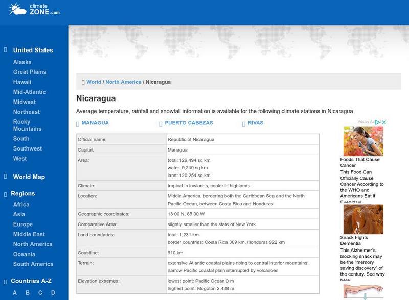
Climate Zone: Climate of Nicaragua
A guide to information about the weather of Nicaragua displayed in tables featuring average monthly temperature, rainfall, and snow days. Also included is a detailed map.
Maps of Mexico
Virtual Picture Travel Map of Arizona
Travel to Arizona and take a virtual tour of Phoenix and the Grand Canyon. While in Phoenix visit places of interest such as the Roosevelt Dam, Goldfield Ghost Town and the State Capital Museum.
Maps of Mexico
Virtual Picture Travel Map of Arizona
Travel to Arizona and take a virtual tour of Phoenix and the Grand Canyon. While in Phoenix visit places of interest such as the Roosevelt Dam, Goldfield Ghost Town and the State Capital Museum.
AllRefer
All Refer: Reference: Costa Rica: Introduction & Country Profile
Significant source for information about the Central American country of Costa Rica. Facts are included about geography, economy, history, government, and the people. Take a look at the map and the flag.
AllRefer
All Refer Reference: El Salvador: Introduction & Country Profile
Profiled here is the Central American country of El Salvador. Basic facts are furnished for topics that include: geography, economy, government, people, military, history, a map, and a flag.
AllRefer
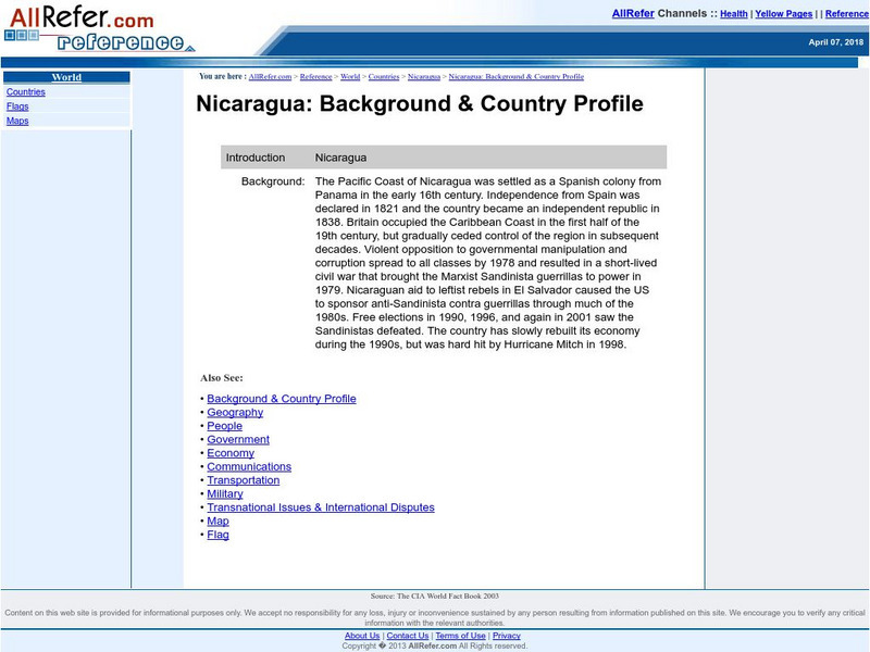
All Refer Reference: Nicaragua: Introduction & Country Profile
Presented is a guide to meaningful information about the economy, geography, people, government, and military of Nicaragua. There is also a map and a picture of the flag of this Central American country.
AllRefer
All Refer: Reference: Panama: Introduction & Country Profile
Good resource for studying about the Central American country of Panama. Learn significant facts about its geography, culture, economy, government, and more. You can even view a map and a flag.
National Geographic Kids
National Geographic Kids: Guatemala
Click-through facts-and-photo file about Guatemala's geography, nature, history, people and culture, and government. Includes a map of the country that pinpoints its Central American location and a video of a bat falcon, a resident...


