Hi, what do you want to do?
Curated OER
Coldest US Cities Quiz
For this online interactive geography quiz worksheet, students respond to 20 identification questions about the coldest cities in the United States. Students have 4 minutes to complete the quiz.
Curated OER
Classrooms: Then and Now
Students look at schoolhouses from the past. In this comparative analysis lesson, students visit a one room school house and look at the tools used for learning. Students then compare the schoolhouse of the past to the schoolhouse of today.
Curated OER
Jamestown Scavenger Hunt
Students identify and share Primary Sources in Early American History by Janey Levy. Then they discuss the usefulness of using primary sources in uncovering the past. Students also research original documents from Jamestown to complete...
Curated OER
Investigation 8 - Weather Forecasts
Fourth graders examine how to predict and evaluate weather forecasts. Discuss with students why weather predictions are important to us. Ask them what people do after they hear a forecast. They brainstorm reasons forecasts are important...
Curated OER
Structure of the Earth
Eighth graders examine the forces that are constantly acting on the Earth. They describe the theory of tectonic plates and demonstrate the two kinds of earthquake waves. They also examine the role of volcanoes in the structure of the...
Curated OER
The Secret Garden
Students research the culture and geography of India and England while reading "The Secret Garden". Using this information, they write at least three predictions about what they believe might happen in the story. Using the Internet,...
Curated OER
Lesson Design Archaeology
Students participate in their own excavation and measure and record as they go. For this archaeology lesson students divide into groups and solve the mystery of what they uncovered in their dig box.
Curated OER
Temperate Forests vs. Wetlands
Students compare and contrast the temperate forest and wetlands by researching them in groups. In this forest lesson plan, students identify the economic, ecological, and social benefits of each.
Curated OER
Colonies Word Scramble
In this American colonies worksheet, students examine 13 sets of letters and unscramble them to correctly spell the names of the 13 colonies.
Curated OER
The Pony Express
Fourth graders reasearch the history of the Pony Express on the internet or they can use books from the school or public library. They write a one-page story which incorporates their research. They share their stories with the class by...
Curated OER
Political Geography of Europe
Fifth graders listen to a lecture that traces the political geography of Europe from 814 through 1997. They incorporate these themes into a research project on Western Europe.
Curated OER
"Professional" Settlement of Arkansas
Eighth graders examine the physical geography of Arkansas played and instrumental role in the settlement of the state.
Curated OER
Ordering Objects By Length
Pupils compare and describe objects of differing lengths that are presented in a Mathkeys software compare mat. Working in pairs, one student is the chooser who sets up the objects while the other student is the sizer who puts the...
Curated OER
Mussel Movements
Students consider the impact of invasive species on local environments. In this ecology lesson, watch the video, Arizona Wildlife Views, which focuses on invasive species. Students develop vocabulary, relate to meaningful comprehension...
Curated OER
The Student Newspaper on World War I
Young scholars explore WW I through the publication of a completely student-compiled newspaper.
Curated OER
Where Do We Go From Here?
Pretending to be freed people, high schoolers explore the reasons why US citizens might emigrate from the USA to new lands. Within this lesson, they will prepare proposals discussing both the pros and cons for emigration. The lesson will...
Curated OER
Return South Migration Lesson Plan
Students study the reasons so many immigrants returned to the South following the Civil Rights Movement. They examine how the former slaves influenced the cultural life in the Northern cities.
CommonLit
Common Lit: Themes: America: How Has America Changed Over Time?
This is a collection of Grade-Leveled texts (3-12) to address the question, "How has America changed over time? Select a grade level and a collection of on grade-level reading passages on the topic comes up. [Free account registration...
Other
Bscs: Earth's Changing Surface Lesson 3: Grand Canyon Explorers
Students will learn that landforms can change over time in this lesson. Included are a minute-by-minute lesson plan, activities, and teacher discussion points and questions.
Other
Bringing History Home: Children Long Ago
This Kindergarten unit introduces students to the concept of change over time by examining the historic counterparts of objects in children's daily lives, e.g., toys, food, cars, music, telephones, and toothbrushes. This develops an...
Stanford University
Sheg: Document Based History: Reading Like a Historian: Mapping the New World
[Free Registration/Login Required] Young scholars read primary source documents to solve a problem surrounding a historical question. This document-based inquiry activity allows students study two 17th-century maps of Virginia and think...
National Geographic
National Geographic: European Borders Through History
Lesson in which students use maps to explore how European political borders have changed over time. Maps after WWI, WWII and European Union provided for comparison.
American Geosciences Institute
American Geosciences Institute: Earth Science Week: Exploring Color Maps
An activity where young scholars study the Ozone Hole poster used that brings together colorful images of over 30 years of satellite observations of the ozone hole. Students interpret the color on the globes to see how the ozone hole has...
Curated OER
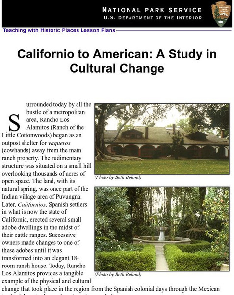
National Park Service: Californio to American: A Study in Cultural Change
This site has a lesson about the ranching industry, creation of California towns and the changes over time. Contains information, inquiry question, historical context, maps, readings, and images.


